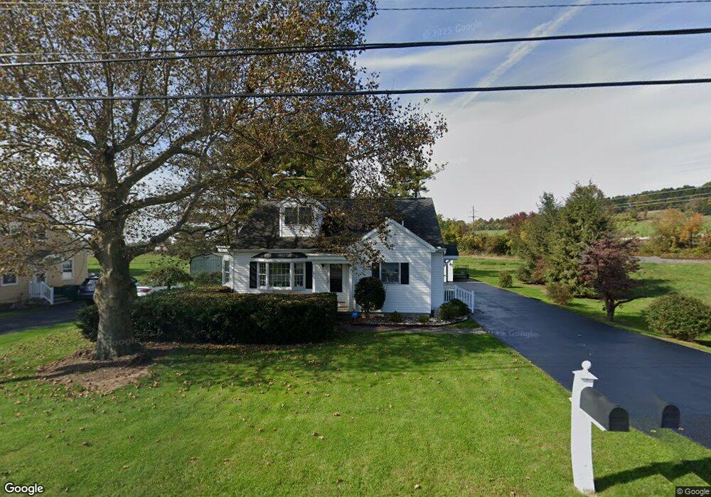
39 Laudermilch Rd Hershey, PA 17033
Estimated Value: $294,322 - $419,000
2
Beds
1
Bath
1,497
Sq Ft
$231/Sq Ft
Est. Value
About This Home
This home is located at 39 Laudermilch Rd, Hershey, PA 17033 and is currently estimated at $345,581, approximately $230 per square foot. 39 Laudermilch Rd is a home located in Dauphin County with nearby schools including Hershey Elementary School, Hershey Primary Elementary School, and Hershey Middle School.
Ownership History
Date
Name
Owned For
Owner Type
Purchase Details
Closed on
Jun 8, 2018
Sold by
Huebsch Kenneth R and Huebsch Leslye L
Bought by
Commonwealth Of Pennsylvania Department
Current Estimated Value
Purchase Details
Closed on
Mar 30, 2005
Sold by
Kochel Rick
Bought by
Huebsch Kenneth
Home Financials for this Owner
Home Financials are based on the most recent Mortgage that was taken out on this home.
Original Mortgage
$138,000
Interest Rate
5.61%
Mortgage Type
New Conventional
Create a Home Valuation Report for This Property
The Home Valuation Report is an in-depth analysis detailing your home's value as well as a comparison with similar homes in the area
Home Values in the Area
Average Home Value in this Area
Purchase History
| Date | Buyer | Sale Price | Title Company |
|---|---|---|---|
| Commonwealth Of Pennsylvania Department | -- | None Available | |
| Huebsch Kenneth | $138,000 | -- |
Source: Public Records
Mortgage History
| Date | Status | Borrower | Loan Amount |
|---|---|---|---|
| Previous Owner | Huebsch Kenneth | $138,000 |
Source: Public Records
Tax History
| Year | Tax Paid | Tax Assessment Tax Assessment Total Assessment is a certain percentage of the fair market value that is determined by local assessors to be the total taxable value of land and additions on the property. | Land | Improvement |
|---|---|---|---|---|
| 2025 | $3,335 | $106,700 | $17,400 | $89,300 |
| 2024 | $3,134 | $106,700 | $17,400 | $89,300 |
| 2023 | $3,078 | $106,700 | $17,400 | $89,300 |
| 2022 | $3,010 | $106,700 | $17,400 | $89,300 |
| 2021 | $3,010 | $106,700 | $17,400 | $89,300 |
| 2020 | $3,010 | $106,700 | $17,400 | $89,300 |
| 2019 | $2,956 | $106,700 | $17,400 | $89,300 |
| 2018 | $2,877 | $106,700 | $17,400 | $89,300 |
| 2017 | $2,877 | $106,700 | $17,400 | $89,300 |
| 2016 | $0 | $106,700 | $17,400 | $89,300 |
| 2015 | -- | $106,700 | $17,400 | $89,300 |
| 2014 | -- | $106,700 | $17,400 | $89,300 |
Source: Public Records
Map
Nearby Homes
- 348 E Derry Rd
- 308 E Derry Rd
- 804 E Chocolate Ave
- 125 N Roosevelt
- 229 Cocoa Ave
- 118 Elm Ave
- 147 Elm Ave
- 251 Maple Ave
- 319 Cedar Ave
- 419 W Areba Ave
- 420 Cedar Ave
- 15 W Governor Rd
- 212 E Canal St
- 1821 Wexford Rd
- 519 Cedar Ave
- 46 W Governor Rd
- 1937 Wexford Rd
- 358 S Lingle Ave
- 708 W Cherry St
- 29 Almond Dr
- 31 Laudermilch Rd
- 23 Laudermilch Rd
- 15 Laudermilch Rd
- 585 E Derry Rd
- 583 E Derry Rd
- 0 E Derry Rd
- 553 E Derry Rd
- Lot #1 E Derry Rd Unit HAWTHORNE PLAN
- 545 E Derry Rd
- 539 E Derry Rd
- 531 E Derry Rd
- 635 E Derry Rd
- 635 E Derry Rd Unit SEBASTIAN PLAN
- 564 Olde Course Rd
- 647 E Derry Rd
- 610 Olde Course Rd
- 560 Olde Course Rd
- 525 E Derry Rd
- 614 Olde Course Rd
- 661 E Derry Rd
Your Personal Tour Guide
Ask me questions while you tour the home.