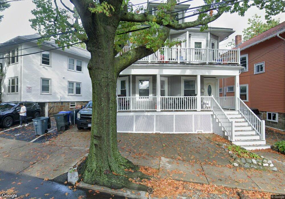
39 Long Ave Unit 2D Allston, MA 02134
Commonwealth NeighborhoodEstimated Value: $1,283,000 - $1,674,000
5
Beds
2
Baths
2,000
Sq Ft
$736/Sq Ft
Est. Value
About This Home
This home is located at 39 Long Ave Unit 2D, Allston, MA 02134 and is currently estimated at $1,472,559, approximately $736 per square foot. 39 Long Ave Unit 2D is a home located in Suffolk County with nearby schools including Boston Green Academy Horace Mann Charter School, German International School Boston, and St Joseph Preparatory High School.
Ownership History
Date
Name
Owned For
Owner Type
Purchase Details
Closed on
Apr 8, 2008
Sold by
Lee Gen W and Lee Kam Y
Bought by
Lee Gen W and Lee Kam Y
Current Estimated Value
Home Financials for this Owner
Home Financials are based on the most recent Mortgage that was taken out on this home.
Original Mortgage
$250,000
Outstanding Balance
$159,107
Interest Rate
6.06%
Mortgage Type
Purchase Money Mortgage
Estimated Equity
$1,313,452
Purchase Details
Closed on
Dec 2, 1996
Sold by
Aulenbeck F J Est
Bought by
Lee Gen W and Lee Kam Y
Home Financials for this Owner
Home Financials are based on the most recent Mortgage that was taken out on this home.
Original Mortgage
$150,000
Interest Rate
7.82%
Mortgage Type
Purchase Money Mortgage
Create a Home Valuation Report for This Property
The Home Valuation Report is an in-depth analysis detailing your home's value as well as a comparison with similar homes in the area
Home Values in the Area
Average Home Value in this Area
Purchase History
| Date | Buyer | Sale Price | Title Company |
|---|---|---|---|
| Lee Gen W | -- | -- | |
| Lee Gen W | -- | -- | |
| Lee Gen W | $230,000 | -- |
Source: Public Records
Mortgage History
| Date | Status | Borrower | Loan Amount |
|---|---|---|---|
| Open | Lee Gen W | $250,000 | |
| Closed | Lee Gen W | $250,000 | |
| Previous Owner | Lee Gen W | $150,000 | |
| Previous Owner | Lee Gen W | $40,000 | |
| Previous Owner | Lee Gen W | $41,750 |
Source: Public Records
Tax History
| Year | Tax Paid | Tax Assessment Tax Assessment Total Assessment is a certain percentage of the fair market value that is determined by local assessors to be the total taxable value of land and additions on the property. | Land | Improvement |
|---|---|---|---|---|
| 2025 | $14,576 | $1,258,700 | $520,200 | $738,500 |
| 2024 | $13,224 | $1,213,200 | $400,500 | $812,700 |
| 2023 | $13,030 | $1,213,200 | $400,500 | $812,700 |
| 2022 | $12,000 | $1,102,900 | $364,100 | $738,800 |
| 2021 | $11,768 | $1,102,900 | $364,100 | $738,800 |
| 2020 | $11,130 | $1,054,000 | $318,500 | $735,500 |
| 2019 | $10,787 | $1,023,400 | $243,700 | $779,700 |
| 2018 | $10,116 | $965,300 | $243,700 | $721,600 |
| 2017 | $9,736 | $919,400 | $243,700 | $675,700 |
| 2016 | $8,872 | $806,500 | $243,700 | $562,800 |
| 2015 | $8,992 | $742,500 | $166,600 | $575,900 |
| 2014 | $7,957 | $632,500 | $166,600 | $465,900 |
Source: Public Records
Map
Nearby Homes
- 83 Glenville Ave
- 130 Glenville Ave
- 1304 Commonwealth Ave Unit 5
- 43 Glenville Ave Unit 11
- 30 Glenville Ave Unit 1
- 85 Brainerd Rd Unit 302
- 10 Scottfield Rd Unit 2
- 1263 Commonwealth Ave Unit 4
- 18 Glenville Ave Unit 3A
- 33 Brainerd Rd Unit 311
- 88 Gordon St Unit 304
- 88 Gordon St Unit 305
- 147 Kelton St Unit 305
- 147 Kelton St Unit 609
- 239 Kelton St Unit 41
- 239 Kelton St Unit 11
- 198 Allston St Unit 3
- 56 Park Vale Ave Unit 4
- 39 Verndale St Unit 39
- 36 Gordon St
- 39 Long Ave
- 39 Long Ave Unit 4
- 39 Long Ave Unit 3
- 39 Long Ave Unit 2
- 39 Long Ave Unit B1
- 39 Long Ave
- 37 Long Ave
- 37 Long Ave
- 37 Long Ave Unit 1
- 37 Long Ave Unit 2
- 41 Long Ave Unit B11
- 41 Long Ave Unit 41
- 41 Long Ave
- 41 Long Ave Unit 2
- 41 Long Ave Unit 3
- 41 Long Ave Unit 4
- 41 Long Ave
- 41 Long Ave Unit 1
- 41 Long Ave Unit 1A
- 35 Long Ave
Your Personal Tour Guide
Ask me questions while you tour the home.