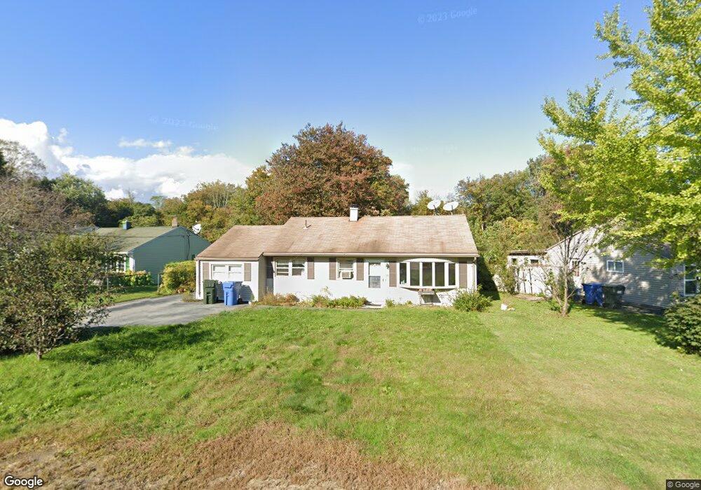
39 Maple Dr Groton, CT 06340
Long Hill NeighborhoodEstimated Value: $276,624 - $325,000
3
Beds
1
Bath
1,238
Sq Ft
$241/Sq Ft
Est. Value
About This Home
This home is located at 39 Maple Dr, Groton, CT 06340 and is currently estimated at $298,906, approximately $241 per square foot. 39 Maple Dr is a home located in New London County with nearby schools including Claude Chester School, Groton Middle School, and Robert E. Fitch High School.
Ownership History
Date
Name
Owned For
Owner Type
Purchase Details
Closed on
Apr 7, 1994
Sold by
Gackseher Douglas and Gackseher Marylynne L
Bought by
Burke Michael A and Burke Brenda
Current Estimated Value
Home Financials for this Owner
Home Financials are based on the most recent Mortgage that was taken out on this home.
Original Mortgage
$76,000
Interest Rate
7.27%
Mortgage Type
Unknown
Create a Home Valuation Report for This Property
The Home Valuation Report is an in-depth analysis detailing your home's value as well as a comparison with similar homes in the area
Home Values in the Area
Average Home Value in this Area
Purchase History
| Date | Buyer | Sale Price | Title Company |
|---|---|---|---|
| Burke Michael A | $80,000 | -- |
Source: Public Records
Mortgage History
| Date | Status | Borrower | Loan Amount |
|---|---|---|---|
| Closed | Burke Michael A | $50,000 | |
| Closed | Burke Michael A | $100,500 | |
| Closed | Burke Michael A | $76,000 | |
| Previous Owner | Burke Michael A | $10,075 |
Source: Public Records
Tax History
| Year | Tax Paid | Tax Assessment Tax Assessment Total Assessment is a certain percentage of the fair market value that is determined by local assessors to be the total taxable value of land and additions on the property. | Land | Improvement |
|---|---|---|---|---|
| 2025 | $3,863 | $130,900 | $57,890 | $73,010 |
| 2024 | $3,636 | $130,900 | $57,890 | $73,010 |
| 2023 | $3,564 | $130,900 | $26,600 | $104,300 |
| 2022 | $3,482 | $130,900 | $26,600 | $104,300 |
| 2021 | $2,691 | $82,880 | $29,260 | $53,620 |
| 2020 | $2,621 | $82,880 | $29,260 | $53,620 |
| 2019 | $2,524 | $82,880 | $29,260 | $53,620 |
| 2018 | $2,498 | $82,880 | $29,260 | $53,620 |
| 2017 | $2,433 | $82,880 | $29,260 | $53,620 |
| 2016 | $2,699 | $96,110 | $45,850 | $50,260 |
| 2015 | $2,595 | $96,110 | $45,850 | $50,260 |
| 2014 | $2,526 | $96,110 | $45,850 | $50,260 |
Source: Public Records
Map
Nearby Homes
- 0 Bonnie Cir
- 99 Pamela Ave
- 205 Winding Hollow Rd
- 374 Meridian Street Extension Unit 68
- 85 Crown Knoll Ct Unit 110
- 74 Crown Knoll Ct Unit 162
- 90 Crown Knoll Ct Unit 136
- 279 Bridge St Unit 10
- 130 Meridian St Unit 301
- 22 Toll Gate Rd
- 517-571 Gold Star Hwy
- 41 Riverview Ave
- 783 Buddington Rd
- 136 Blueberry Hill Rd
- 301 Buddington Rd Unit LOT 24
- 50 School St
- 132 Thames St Unit R
- 108 Thames St
- 85 Baker Ave
- 141 Starr Hill Rd
Your Personal Tour Guide
Ask me questions while you tour the home.