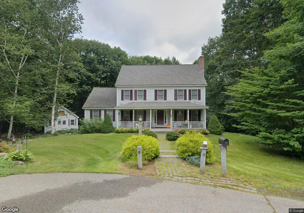
39 Nantucket Place Greenland, NH 03840
Estimated Value: $919,000 - $1,188,000
3
Beds
4
Baths
2,512
Sq Ft
$401/Sq Ft
Est. Value
About This Home
This home is located at 39 Nantucket Place, Greenland, NH 03840 and is currently estimated at $1,008,457, approximately $401 per square foot. 39 Nantucket Place is a home with nearby schools including Greenland Central School, The Cornerstone School, and Cornerstone Christian Academy.
Ownership History
Date
Name
Owned For
Owner Type
Purchase Details
Closed on
May 27, 1997
Sold by
D D Cook Bldrs Inc
Bought by
Cummings Charles H and Cummings Lizbeth K
Current Estimated Value
Home Financials for this Owner
Home Financials are based on the most recent Mortgage that was taken out on this home.
Original Mortgage
$110,000
Outstanding Balance
$15,877
Interest Rate
8.08%
Estimated Equity
$992,580
Create a Home Valuation Report for This Property
The Home Valuation Report is an in-depth analysis detailing your home's value as well as a comparison with similar homes in the area
Home Values in the Area
Average Home Value in this Area
Purchase History
| Date | Buyer | Sale Price | Title Company |
|---|---|---|---|
| Cummings Charles H | $260,000 | -- |
Source: Public Records
Mortgage History
| Date | Status | Borrower | Loan Amount |
|---|---|---|---|
| Open | Cummings Charles H | $55,255 | |
| Open | Cummings Charles H | $110,000 |
Source: Public Records
Tax History Compared to Growth
Tax History
| Year | Tax Paid | Tax Assessment Tax Assessment Total Assessment is a certain percentage of the fair market value that is determined by local assessors to be the total taxable value of land and additions on the property. | Land | Improvement |
|---|---|---|---|---|
| 2024 | $10,254 | $789,400 | $437,400 | $352,000 |
| 2023 | $9,686 | $789,400 | $437,400 | $352,000 |
| 2022 | $8,725 | $482,300 | $244,600 | $237,700 |
| 2021 | $9,029 | $482,300 | $244,600 | $237,700 |
| 2020 | $7,997 | $482,300 | $244,600 | $237,700 |
| 2019 | $7,929 | $483,500 | $244,600 | $238,900 |
| 2018 | $7,634 | $483,500 | $244,600 | $238,900 |
| 2017 | $7,388 | $444,000 | $196,000 | $248,000 |
| 2016 | $7,393 | $444,000 | $196,000 | $248,000 |
| 2015 | $7,508 | $444,000 | $196,000 | $248,000 |
| 2014 | $7,037 | $442,000 | $196,000 | $246,000 |
| 2013 | $6,851 | $442,000 | $196,000 | $246,000 |
Source: Public Records
Map
Nearby Homes
- 14 Balmoral Dr
- 13 Dearborn Rd
- 00 Lovell Rd Unit 22
- Unit 26 Summerwind Place Unit 26
- 24 Great Bay Rd
- 141 Dearborn Rd
- 44 High St
- 64 Boxwood Path Unit 64
- 00 Scamman Rd
- 12 Founders Square Unit A
- 39 Glengarry Dr
- 36 Downs Ave
- 177 Winnicutt Rd
- 18 Treat Farm Rd
- 638 Post Rd
- 227 Portsmouth Ave
- 217 Portsmouth Ave
- Unit 25 Summerwind Place Unit 25
- Unit 1 Summerwind Place Unit 1
- Unit 3 Summerwind Place Unit 3
- 47 Nantucket Place
- 33 Nantucket Place
- 46 Nantucket Place
- 38 Nantucket Place
- 30 Nantucket Place
- 25 Nantucket Place
- 22 Nantucket Place
- 17 Nantucket Place
- 1 Van Etten Dr
- 1 van Etten Drive (A K A Lot 1)
- 14 Nantucket Place
- 57 Alderwood Dr
- 7 Alderwood Dr
- 40 Nantucket Place
- 11 Van Etten Dr Unit 5)
- 11 Van Etten Dr
- 13 Willowbrook Ave Unit 1
- 15 Willowbrook Ave Unit 2
- 17 Willowbrook Ave Unit 3
- 9 Van Etten Dr