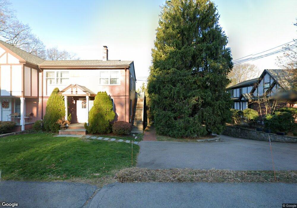
39 Oak St Unit A Wellesley, MA 02482
Wellesley Square NeighborhoodEstimated Value: $1,684,000 - $2,369,000
3
Beds
4
Baths
2,748
Sq Ft
$742/Sq Ft
Est. Value
About This Home
This home is located at 39 Oak St Unit A, Wellesley, MA 02482 and is currently estimated at $2,039,267, approximately $742 per square foot. 39 Oak St Unit A is a home located in Norfolk County with nearby schools including Sprague Elementary School, Wellesley Middle School, and Wellesley Sr High School.
Ownership History
Date
Name
Owned For
Owner Type
Purchase Details
Closed on
May 20, 2008
Sold by
Wier Francesca V and Wier Peter A
Bought by
Korpi Alan R and Korpi Ellen L
Current Estimated Value
Purchase Details
Closed on
Oct 30, 2006
Sold by
Wier Peter A and Wier Francesca V
Bought by
Brennan Anne R
Purchase Details
Closed on
Dec 27, 2004
Sold by
Villa Esther E and Wier Francesca V
Bought by
Wier Francesca and Wier Peter A
Home Financials for this Owner
Home Financials are based on the most recent Mortgage that was taken out on this home.
Original Mortgage
$400,000
Interest Rate
5.74%
Mortgage Type
Purchase Money Mortgage
Create a Home Valuation Report for This Property
The Home Valuation Report is an in-depth analysis detailing your home's value as well as a comparison with similar homes in the area
Home Values in the Area
Average Home Value in this Area
Purchase History
| Date | Buyer | Sale Price | Title Company |
|---|---|---|---|
| Korpi Alan R | $1,020,000 | -- | |
| Weir Francesca | -- | -- | |
| Brennan Anne R | $1,185,000 | -- | |
| Wier Francesca | $560,000 | -- |
Source: Public Records
Mortgage History
| Date | Status | Borrower | Loan Amount |
|---|---|---|---|
| Previous Owner | Wier Francesca | $400,000 |
Source: Public Records
Tax History Compared to Growth
Tax History
| Year | Tax Paid | Tax Assessment Tax Assessment Total Assessment is a certain percentage of the fair market value that is determined by local assessors to be the total taxable value of land and additions on the property. | Land | Improvement |
|---|---|---|---|---|
| 2025 | $16,273 | $1,583,000 | $0 | $1,583,000 |
| 2024 | $16,167 | $1,553,000 | $0 | $1,553,000 |
| 2023 | $17,885 | $1,562,000 | $0 | $1,562,000 |
| 2022 | $13,958 | $1,195,000 | $0 | $1,195,000 |
| 2021 | $14,041 | $1,195,000 | $0 | $1,195,000 |
| 2020 | $13,814 | $1,195,000 | $0 | $1,195,000 |
| 2019 | $13,444 | $1,162,000 | $0 | $1,162,000 |
| 2018 | $13,492 | $1,129,000 | $0 | $1,129,000 |
| 2017 | $13,228 | $1,122,000 | $0 | $1,122,000 |
| 2016 | $11,440 | $967,000 | $0 | $967,000 |
| 2015 | $11,190 | $968,000 | $0 | $968,000 |
Source: Public Records
Map
Nearby Homes
- 11 Oak St Unit 62
- 16 Oak St
- 63 Oak St Unit B
- 26B Pleasant St Unit B
- 32 Donizetti St
- 16 Stearns Rd Unit 101
- 16 Stearns Rd Unit 302
- 16 Stearns Rd Unit 207
- 16 Stearns Rd Unit 301
- 16 Stearns Rd Unit 103
- 16 Stearns Rd Unit 202
- 16 Stearns Rd Unit 304
- 16 Stearns Rd Unit 104
- 16 Stearns Rd Unit 108
- 42 Calvin Rd
- 100 Linden St Unit 111
- 32 Kingsbury St Unit A
- 68 Linden St Unit 68
- 63 Linden St Unit 1
- 36 Oakridge Rd
- 39B Oak St
- 39 Oak St Unit C
- 39 Oak St Unit B
- 37 Oak St Unit C
- 37 Oak St Unit B
- 37 Oak St Unit A
- 33 Oak St Unit 33A
- 33 Oak St
- 33 A Oak St Unit 33A
- 39A Oak St Unit A
- 39B Oak St Unit B
- 33 A Oak St Unit A
- 37 A Oak St Unit A
- 33 Oak St Unit 1
- 37 Oak St Unit 37B
- 37 Oak St
- 33 Oak St Unit A
- 31B Oak St
- 31B Oak St Unit SF
- 41A Oak St