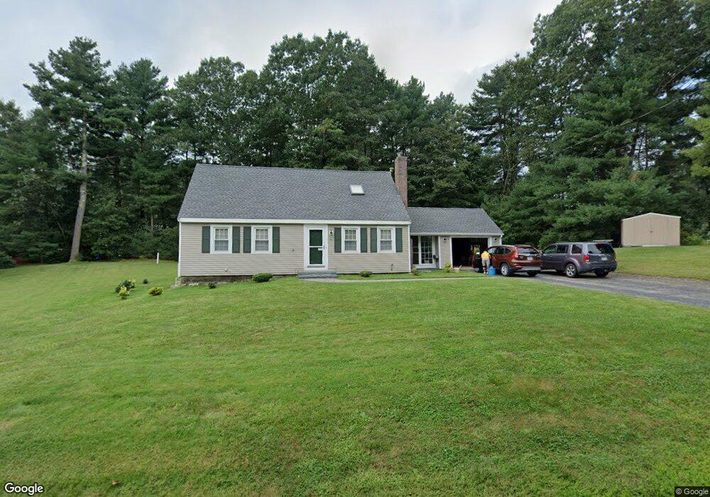
39 Phillips Ln Wrentham, MA 02093
Estimated Value: $451,000 - $899,000
3
Beds
2
Baths
1,368
Sq Ft
$464/Sq Ft
Est. Value
About This Home
This home is located at 39 Phillips Ln, Wrentham, MA 02093 and is currently estimated at $634,765, approximately $464 per square foot. 39 Phillips Ln is a home located in Norfolk County with nearby schools including Delaney Elementary School and Charles E Roderick.
Ownership History
Date
Name
Owned For
Owner Type
Purchase Details
Closed on
Jun 1, 1988
Sold by
Kortros Christo G
Bought by
Bilodeau Theodore J
Current Estimated Value
Home Financials for this Owner
Home Financials are based on the most recent Mortgage that was taken out on this home.
Original Mortgage
$130,000
Interest Rate
10.24%
Mortgage Type
Purchase Money Mortgage
Create a Home Valuation Report for This Property
The Home Valuation Report is an in-depth analysis detailing your home's value as well as a comparison with similar homes in the area
Purchase History
| Date | Buyer | Sale Price | Title Company |
|---|---|---|---|
| Bilodeau Theodore J | $181,000 | -- |
Source: Public Records
Mortgage History
| Date | Status | Borrower | Loan Amount |
|---|---|---|---|
| Closed | Bilodeau Theodore J | $120,000 | |
| Closed | Bilodeau Theodore J | $130,000 |
Source: Public Records
Tax History
| Year | Tax Paid | Tax Assessment Tax Assessment Total Assessment is a certain percentage of the fair market value that is determined by local assessors to be the total taxable value of land and additions on the property. | Land | Improvement |
|---|---|---|---|---|
| 2025 | $6,268 | $540,800 | $289,100 | $251,700 |
| 2024 | $6,097 | $508,100 | $289,100 | $219,000 |
| 2023 | $5,871 | $465,200 | $262,900 | $202,300 |
| 2022 | $5,646 | $413,000 | $245,300 | $167,700 |
| 2021 | $5,257 | $373,600 | $214,200 | $159,400 |
| 2020 | $5,265 | $369,500 | $190,500 | $179,000 |
| 2019 | $5,087 | $360,300 | $190,500 | $169,800 |
| 2018 | $4,836 | $339,600 | $190,600 | $149,000 |
| 2017 | $4,589 | $322,000 | $186,900 | $135,100 |
| 2016 | $4,485 | $314,100 | $181,500 | $132,600 |
| 2015 | $4,358 | $290,900 | $174,500 | $116,400 |
| 2014 | $4,308 | $281,400 | $167,800 | $113,600 |
Source: Public Records
Map
Nearby Homes
- 500 Franklin St
- 287 Park St
- 10 Nature View Dr
- 15 Nature View Dr
- 246 Forest Grove Ave
- 50 Reed Fulton Ave Unit Lot 61
- 45 Joshua Rd
- 2 Earle Stewart Ln
- 12 Earle Stewart Ln
- 3 Earle Stewart Ln
- 0 W Birch Rd
- 8 Ridgefield Rd
- 10 Earle Stewart Ln Unit Lot 5
- 11 Weber Farm Rd Unit 11
- 8 Weber Farm Rd Unit 8
- 576 Dedham St
- 30 Weber Farm Rd Unit 30
- 9 Elliot Mills Unit 5
- 8 Elliot Mills Unit 30
- 5 Elliot Mills Unit 3
Your Personal Tour Guide
Ask me questions while you tour the home.