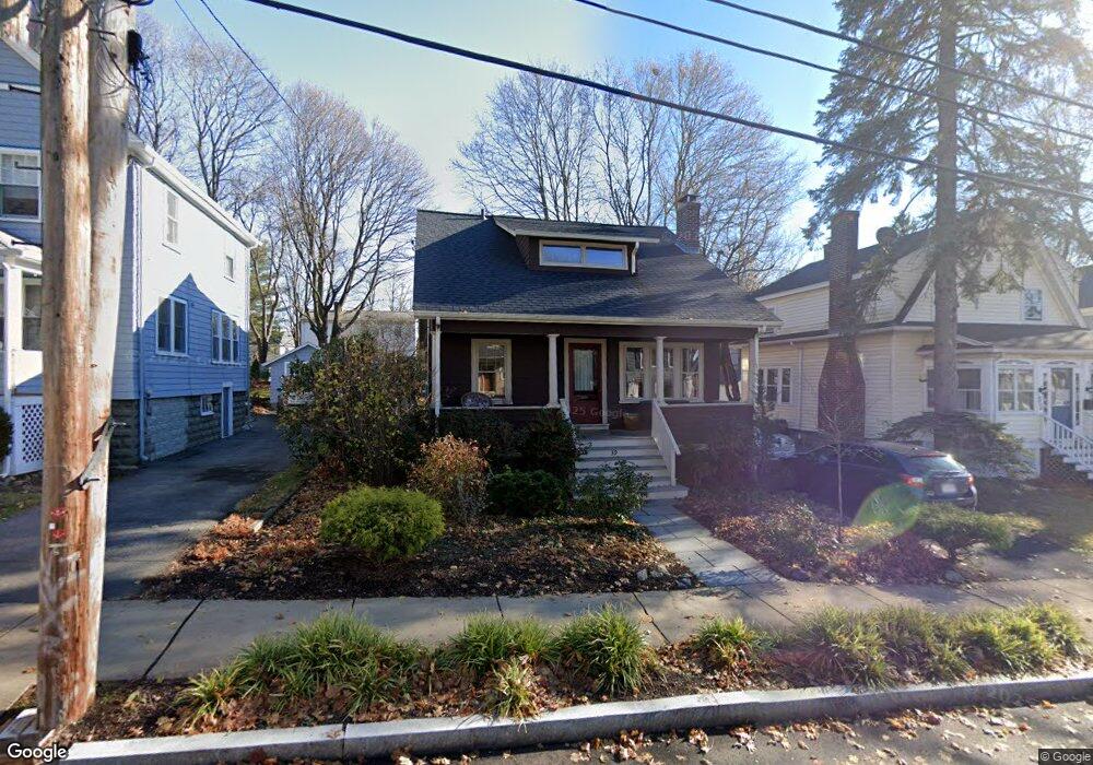
39 Ronald Rd Arlington, MA 02474
Arlington Heights NeighborhoodEstimated Value: $905,000 - $1,076,000
4
Beds
2
Baths
1,642
Sq Ft
$599/Sq Ft
Est. Value
About This Home
This home is located at 39 Ronald Rd, Arlington, MA 02474 and is currently estimated at $984,122, approximately $599 per square foot. 39 Ronald Rd is a home located in Middlesex County with nearby schools including M. Norcross Stratton Elementary School, Ottoson Middle School, and Arlington High School.
Ownership History
Date
Name
Owned For
Owner Type
Purchase Details
Closed on
Nov 1, 2021
Sold by
Swartz Leslie M
Bought by
Leslie M Swartz 2014 Ret and Swartz
Current Estimated Value
Create a Home Valuation Report for This Property
The Home Valuation Report is an in-depth analysis detailing your home's value as well as a comparison with similar homes in the area
Home Values in the Area
Average Home Value in this Area
Purchase History
| Date | Buyer | Sale Price | Title Company |
|---|---|---|---|
| Leslie M Swartz 2014 Ret | -- | None Available |
Source: Public Records
Tax History Compared to Growth
Tax History
| Year | Tax Paid | Tax Assessment Tax Assessment Total Assessment is a certain percentage of the fair market value that is determined by local assessors to be the total taxable value of land and additions on the property. | Land | Improvement |
|---|---|---|---|---|
| 2025 | $9,427 | $875,300 | $478,100 | $397,200 |
| 2024 | $8,841 | $834,800 | $472,300 | $362,500 |
| 2023 | $8,663 | $772,800 | $425,700 | $347,100 |
| 2022 | $8,260 | $723,300 | $408,200 | $315,100 |
| 2021 | $8,101 | $714,400 | $408,200 | $306,200 |
| 2020 | $7,901 | $714,400 | $408,200 | $306,200 |
| 2019 | $7,421 | $659,100 | $414,000 | $245,100 |
| 2018 | $6,684 | $551,000 | $309,000 | $242,000 |
| 2017 | $6,555 | $521,900 | $279,900 | $242,000 |
| 2016 | $6,531 | $510,200 | $268,200 | $242,000 |
| 2015 | $6,186 | $456,500 | $227,400 | $229,100 |
Source: Public Records
Map
Nearby Homes
- 455 Summer St Unit 455
- 4 Beck Rd
- 37 Pine St
- 1205 Massachusetts Ave
- 6 Appleton Place
- 18-20 Brattle St
- 11 Lowell St Unit B
- 15 Higgins St Unit 17
- 1 Watermill Place Unit 308
- 51 Lowell St
- 1025 Massachusetts Ave Unit 204
- 204 Plan at Majestic Mill Brook
- 1025 Massachusetts Ave Unit 404
- 1025 Massachusetts Ave Unit 506
- 1025 Massachusetts Ave Unit 401
- 1025 Massachusetts Ave Unit 210
- 1025 Massachusetts Ave Unit 402
- 1025 Massachusetts Ave Unit 308
- 1025 Massachusetts Ave Unit 411
- 1025 Massachusetts Ave Unit 313