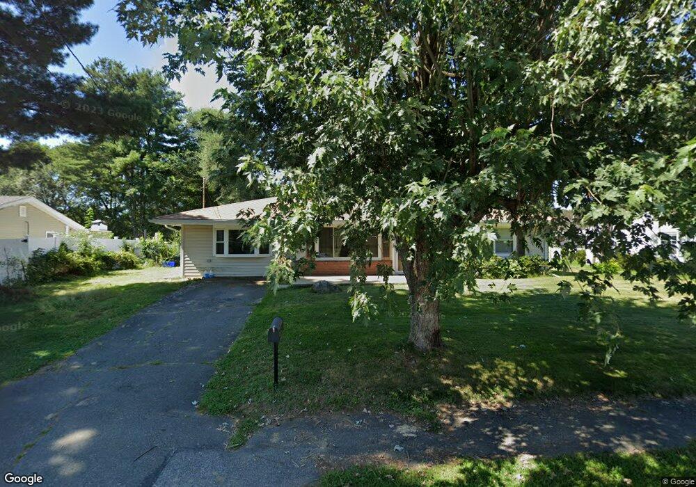
39 Ruthellen Rd Bellingham, MA 02019
Estimated Value: $444,000 - $574,000
2
Beds
1
Bath
1,216
Sq Ft
$408/Sq Ft
Est. Value
About This Home
This home is located at 39 Ruthellen Rd, Bellingham, MA 02019 and is currently estimated at $496,669, approximately $408 per square foot. 39 Ruthellen Rd is a home located in Norfolk County with nearby schools including Stall Brook Elementary School, Bellingham High School, and Bethany Christian Academy.
Ownership History
Date
Name
Owned For
Owner Type
Purchase Details
Closed on
Sep 22, 2009
Sold by
Desousa Gilmar
Bought by
Hays Pamela A
Current Estimated Value
Home Financials for this Owner
Home Financials are based on the most recent Mortgage that was taken out on this home.
Original Mortgage
$215,913
Outstanding Balance
$141,850
Interest Rate
5.28%
Mortgage Type
Purchase Money Mortgage
Estimated Equity
$354,819
Purchase Details
Closed on
Jun 19, 2009
Sold by
Desousa Gilmar and Desousa Audrey
Bought by
Desousa Gilmar
Purchase Details
Closed on
Sep 30, 2003
Sold by
Est Walton Samuel Jr and Howell Heather A
Bought by
Desouza Gilmar and Desouza Audrey
Home Financials for this Owner
Home Financials are based on the most recent Mortgage that was taken out on this home.
Original Mortgage
$242,000
Interest Rate
6.29%
Mortgage Type
Purchase Money Mortgage
Create a Home Valuation Report for This Property
The Home Valuation Report is an in-depth analysis detailing your home's value as well as a comparison with similar homes in the area
Home Values in the Area
Average Home Value in this Area
Purchase History
| Date | Buyer | Sale Price | Title Company |
|---|---|---|---|
| Hays Pamela A | $219,900 | -- | |
| Desousa Gilmar | -- | -- | |
| Desouza Gilmar | $242,000 | -- |
Source: Public Records
Mortgage History
| Date | Status | Borrower | Loan Amount |
|---|---|---|---|
| Open | Hays Pamela A | $215,913 | |
| Previous Owner | Desouza Gilmar | $242,000 | |
| Previous Owner | Desouza Gilmar | $58,700 |
Source: Public Records
Tax History
| Year | Tax Paid | Tax Assessment Tax Assessment Total Assessment is a certain percentage of the fair market value that is determined by local assessors to be the total taxable value of land and additions on the property. | Land | Improvement |
|---|---|---|---|---|
| 2025 | $4,371 | $348,000 | $165,800 | $182,200 |
| 2024 | $4,161 | $323,600 | $151,300 | $172,300 |
| 2023 | $4,014 | $307,600 | $144,100 | $163,500 |
| 2022 | $3,873 | $275,100 | $120,200 | $154,900 |
| 2021 | $3,768 | $261,500 | $120,200 | $141,300 |
| 2020 | $3,531 | $248,300 | $120,200 | $128,100 |
| 2019 | $3,454 | $243,100 | $120,200 | $122,900 |
| 2018 | $3,203 | $222,300 | $115,600 | $106,700 |
| 2017 | $3,125 | $217,900 | $115,600 | $102,300 |
| 2016 | $2,997 | $209,700 | $113,600 | $96,100 |
| 2015 | $2,876 | $201,800 | $109,300 | $92,500 |
| 2014 | $2,879 | $196,400 | $106,700 | $89,700 |
Source: Public Records
Map
Nearby Homes
- 110 Lisa Ann Dr
- 60 Wethersfield Rd
- 0 Hartford Ave
- 23 Bellwood Cir Unit 23
- 123-125 Mendon St
- 133 Grove St
- 34 Bellwood Cir Unit 34
- 370 S Main St
- 1 Evergreen Dr Unit 1
- 17 Pine St
- 267 S Main St
- 67 Blackstone St
- 44 Arapahoe Rd
- 4 Carby Dr
- 48 Black Bear Cir Unit 48
- 46 Black Bear Cir Unit 46
- 214 Conlyn Ave
- 125 Blackstone St
- 43 Black Bear Cir Unit 43
- 7 Black Bear Unit 7