Estimated Value: $356,000 - $418,000
3
Beds
2
Baths
1,428
Sq Ft
$268/Sq Ft
Est. Value
About This Home
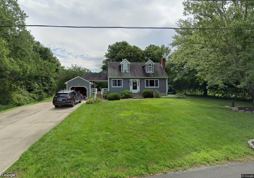
This home is located at 39 Salem Ridge Dr N, Salem, CT 06420 and is currently estimated at $382,659, approximately $267 per square foot. 39 Salem Ridge Dr N is a home located in New London County with nearby schools including Salem Elementary School.
Ownership History
Date
Name
Owned For
Owner Type
Purchase Details
Closed on
Dec 14, 2022
Sold by
Anderson Stacie L and Anderson Scott E
Bought by
Gendron Suzanne
Current Estimated Value
Home Financials for this Owner
Home Financials are based on the most recent Mortgage that was taken out on this home.
Original Mortgage
$250,381
Outstanding Balance
$243,045
Interest Rate
7.08%
Mortgage Type
FHA
Estimated Equity
$139,614
Purchase Details
Closed on
Jun 15, 2004
Sold by
Patterson Vincent and Patterson Karen
Bought by
Anderson Scott and Anderson Stacie
Home Financials for this Owner
Home Financials are based on the most recent Mortgage that was taken out on this home.
Original Mortgage
$242,250
Interest Rate
5.99%
Create a Home Valuation Report for This Property
The Home Valuation Report is an in-depth analysis detailing your home's value as well as a comparison with similar homes in the area
Home Values in the Area
Average Home Value in this Area
Purchase History
| Date | Buyer | Sale Price | Title Company |
|---|---|---|---|
| Gendron Suzanne | $255,000 | None Available | |
| Gendron Suzanne | $255,000 | None Available | |
| Anderson Scott | $255,200 | -- | |
| Anderson Scott | $255,200 | -- |
Source: Public Records
Mortgage History
| Date | Status | Borrower | Loan Amount |
|---|---|---|---|
| Open | Gendron Suzanne | $250,381 | |
| Closed | Gendron Suzanne | $250,381 | |
| Previous Owner | Anderson Scott | $242,250 | |
| Previous Owner | Anderson Scott | $129,150 |
Source: Public Records
Tax History Compared to Growth
Tax History
| Year | Tax Paid | Tax Assessment Tax Assessment Total Assessment is a certain percentage of the fair market value that is determined by local assessors to be the total taxable value of land and additions on the property. | Land | Improvement |
|---|---|---|---|---|
| 2025 | $5,373 | $177,900 | $48,300 | $129,600 |
| 2024 | $5,212 | $177,900 | $48,300 | $129,600 |
| 2023 | $5,124 | $177,900 | $48,300 | $129,600 |
| 2022 | $5,124 | $177,900 | $48,300 | $129,600 |
| 2021 | $4,865 | $151,100 | $46,300 | $104,800 |
| 2020 | $4,865 | $151,100 | $46,300 | $104,800 |
| 2019 | $4,865 | $151,100 | $46,300 | $104,800 |
| 2018 | $4,865 | $151,100 | $46,300 | $104,800 |
| 2017 | $4,865 | $151,100 | $46,300 | $104,800 |
| 2016 | $4,432 | $139,800 | $45,000 | $94,800 |
| 2015 | $4,432 | $139,800 | $45,000 | $94,800 |
| 2014 | $4,348 | $139,800 | $45,000 | $94,800 |
Source: Public Records
Map
Nearby Homes
- 119 Rattlesnake Ledge Rd
- 70 Morgan Rd
- 608 West Rd
- 343 Old Colchester Rd Unit R
- 10 Shingle Mill Rd
- 27 Woodland Dr
- 21 Woodland Dr
- 139 Forsyth Rd
- 3 Forsyth Rd
- 129 Salem Rd
- 79 Mill Lane Rd
- 89 Harris Road Extension
- 376 West Rd
- 306 Old Colchester Rd Unit 197
- 34 Gardner Lake Heights
- 156 Old Colchester Rd
- 73 Lake Shore Dr
- 90 Lake Shore Dr
- 52 Lake View Ave
- 113 Horse Pond Rd Unit B
- 33 Salem Ridge Dr N
- 20 Salem Ridge Dr
- 26 Salem Ridge Dr
- 30 Salem Ridge Dr N
- 34 Salem Ridge Dr
- 360 Hartford Rd
- 27 Salem Ridge Dr N
- 4 Salem Ridge Dr
- 20 Salem Ridge Dr N
- 21 Salem Ridge Dr N
- 19 Salem Ridge Dr
- 40 Salem Ridge Dr
- 11 Salem Ridge Dr
- 25 Salem Ridge Dr
- 3 Salem Ridge Dr
- 376 Hartford Rd
- 12 Salem Ridge Dr N
- 11 Salem Ridge Dr N
- 46 Salem Ridge Dr
- 39 Salem Ridge Dr