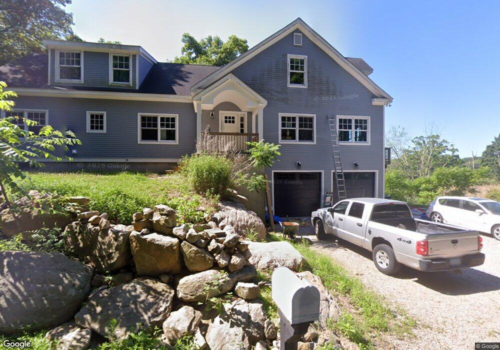
39 Sawmill Rd Branford, CT 06405
Estimated Value: $647,000 - $910,349
3
Beds
2
Baths
2,070
Sq Ft
$391/Sq Ft
Est. Value
About This Home
This home is located at 39 Sawmill Rd, Branford, CT 06405 and is currently estimated at $808,587, approximately $390 per square foot. 39 Sawmill Rd is a home located in New Haven County with nearby schools including Francis Walsh Intermediate School and Branford High School.
Ownership History
Date
Name
Owned For
Owner Type
Purchase Details
Closed on
Feb 16, 2005
Sold by
Est James Carol V and Viglione Virginia K
Bought by
Dalton Heather and Dalton Michael
Current Estimated Value
Home Financials for this Owner
Home Financials are based on the most recent Mortgage that was taken out on this home.
Original Mortgage
$228,000
Interest Rate
5.78%
Create a Home Valuation Report for This Property
The Home Valuation Report is an in-depth analysis detailing your home's value as well as a comparison with similar homes in the area
Home Values in the Area
Average Home Value in this Area
Purchase History
| Date | Buyer | Sale Price | Title Company |
|---|---|---|---|
| Dalton Heather | $260,000 | -- |
Source: Public Records
Mortgage History
| Date | Status | Borrower | Loan Amount |
|---|---|---|---|
| Open | Dalton Heather | $221,250 | |
| Closed | Dalton Heather | $228,000 | |
| Previous Owner | Dalton Heather | $42,000 | |
| Previous Owner | Dalton Heather | $17,173 |
Source: Public Records
Tax History Compared to Growth
Tax History
| Year | Tax Paid | Tax Assessment Tax Assessment Total Assessment is a certain percentage of the fair market value that is determined by local assessors to be the total taxable value of land and additions on the property. | Land | Improvement |
|---|---|---|---|---|
| 2025 | $13,007 | $607,800 | $140,800 | $467,000 |
| 2024 | $11,445 | $375,500 | $103,700 | $271,800 |
| 2023 | $11,224 | $375,500 | $103,700 | $271,800 |
| 2022 | $11,058 | $375,500 | $103,700 | $271,800 |
| 2021 | $11,058 | $375,500 | $103,700 | $271,800 |
| 2020 | $10,859 | $375,500 | $103,700 | $271,800 |
| 2019 | $10,977 | $377,600 | $121,500 | $256,100 |
| 2018 | $10,814 | $377,600 | $121,500 | $256,100 |
| 2017 | $10,750 | $377,600 | $121,500 | $256,100 |
| 2016 | $7,124 | $259,900 | $121,500 | $138,400 |
| 2015 | $5,647 | $209,700 | $121,500 | $88,200 |
| 2014 | $4,760 | $181,400 | $121,500 | $59,900 |
Source: Public Records
Map
Nearby Homes
- 55-69 Sawmill Rd
- 12 Bowhay Hill Rd
- 294 Thimble Island Rd
- 312 Leetes Island Rd
- 48 Andrews Rd
- 55 Harbor View Rd
- 59 Hoadley Creek Cir
- 0 Belden Island Unit 24090225
- 155 Stony Creek Rd
- 575 Leetes Island Rd
- 0 Potato Island Unit 24032744
- 1028 Moose Hill Rd
- 0 Rogers Island
- 0 Rogers Island Unit 122749
- 8 Gaylea Dr
- 33 Thimble Farms Rd
- 0 Beechwood Rd
- 29 Blackstone Ave
- 10 Island View Ave
- 63 Gould Ln
- 51 Sawmill Rd
- 630 Leetes Island Rd Unit 644
- 52 Sawmill Rd
- 616 Leetes Island Rd Unit 626
- 30 Sawmill Rd
- 55 Sawmill Rd Unit 69
- 19 Sawmill Rd
- 28 Sawmill Rd
- 18 Sawmill Rd
- 130 Sawmill Rd
- 100 Sawmill Rd
- 80 Sawmill Rd
- 15 Sawmill Rd
- 150 Sawmill Rd
- 10 Sawmill Rd
- 84 Sawmill Rd
- 8 Sawmill Rd
- 90 Sawmill Rd
- 88 Sawmill Rd
- 694 Leetes Island Rd