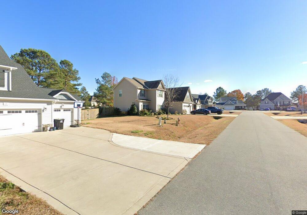
39 Seashore Point Clayton, NC 27520
Cleveland NeighborhoodEstimated Value: $510,375 - $561,000
4
Beds
4
Baths
3,003
Sq Ft
$177/Sq Ft
Est. Value
About This Home
This home is located at 39 Seashore Point, Clayton, NC 27520 and is currently estimated at $530,844, approximately $176 per square foot. 39 Seashore Point is a home located in Johnston County with nearby schools including Polenta Elementary School, Swift Creek Middle, and Cleveland High School.
Ownership History
Date
Name
Owned For
Owner Type
Purchase Details
Closed on
Apr 10, 2018
Sold by
High Michael L and High Emily J
Bought by
Williams Beth A and Williams Jason S
Current Estimated Value
Home Financials for this Owner
Home Financials are based on the most recent Mortgage that was taken out on this home.
Original Mortgage
$301,342
Outstanding Balance
$259,089
Interest Rate
4.43%
Mortgage Type
VA
Estimated Equity
$271,755
Purchase Details
Closed on
Apr 1, 2015
Sold by
Cates Building Inc
Bought by
High Michael L and High Emily J
Home Financials for this Owner
Home Financials are based on the most recent Mortgage that was taken out on this home.
Original Mortgage
$237,985
Interest Rate
3.84%
Mortgage Type
New Conventional
Purchase Details
Closed on
Oct 29, 2014
Sold by
341 Sonny Road Llc
Bought by
Cates Building Inc
Create a Home Valuation Report for This Property
The Home Valuation Report is an in-depth analysis detailing your home's value as well as a comparison with similar homes in the area
Home Values in the Area
Average Home Value in this Area
Purchase History
| Date | Buyer | Sale Price | Title Company |
|---|---|---|---|
| Williams Beth A | $295,000 | None Available | |
| High Michael L | $264,500 | None Available | |
| Cates Building Inc | -- | None Available |
Source: Public Records
Mortgage History
| Date | Status | Borrower | Loan Amount |
|---|---|---|---|
| Open | Williams Beth A | $301,342 | |
| Previous Owner | High Michael L | $237,985 |
Source: Public Records
Tax History Compared to Growth
Tax History
| Year | Tax Paid | Tax Assessment Tax Assessment Total Assessment is a certain percentage of the fair market value that is determined by local assessors to be the total taxable value of land and additions on the property. | Land | Improvement |
|---|---|---|---|---|
| 2025 | $3,036 | $478,130 | $75,000 | $403,130 |
| 2024 | $2,443 | $301,560 | $50,000 | $251,560 |
| 2023 | $2,360 | $301,560 | $50,000 | $251,560 |
| 2022 | $2,480 | $301,560 | $50,000 | $251,560 |
| 2021 | $2,480 | $301,560 | $50,000 | $251,560 |
| 2020 | $2,510 | $301,560 | $50,000 | $251,560 |
| 2019 | $2,510 | $301,560 | $50,000 | $251,560 |
| 2018 | $2,357 | $277,000 | $40,000 | $237,000 |
| 2017 | $2,585 | $277,000 | $40,000 | $237,000 |
| 2016 | $2,361 | $277,000 | $40,000 | $237,000 |
| 2015 | -- | $45,000 | $40,000 | $5,000 |
Source: Public Records
Map
Nearby Homes
- 99 Barton Bay Ln
- 208 Hunting Lodge Rd
- 13 Knotty Pine Ln
- 130 Castaway Ct
- 119 Sommerset Dr
- 330 Ambassador Dr
- 280 Ambassador Dr
- 290 Ambassador Dr
- 305 Ambassador Dr
- 302 Ambassador Dr
- 320 Ambassador Dr
- The Buford II Plan at Wellesley
- The Harrington Plan at Wellesley
- The Caldwell Plan at Wellesley
- The Braselton II Plan at Wellesley
- The Greenbrier II Plan at Wellesley
- The Bradley Plan at Wellesley
- The McGinnis Plan at Wellesley
- 340 Ambassador Dr
- 44 Nassau Ct
- 38 Seashore Point
- 17 Seashore Point
- 57 Seashore Point
- 18 Seashore Point
- 58 Seashore Point
- 71 Seashore Point
- 103 Ocean Dr
- 63 Ocean Dr
- 18 Saltwater Cove
- 41 Ocean Dr
- 77 Seashore Point
- 72 Seashore Point
- 19 Ocean Dr
- 31 Saltwater Cove
- 78 Seashore Point
- 42 Saltwater Cove
- 0 Sonny Rd Unit 1693820
- 0 Sonny Rd Unit 1 TR1693820
- 0 Sonny Rd Unit 1
- 94 Ocean Dr