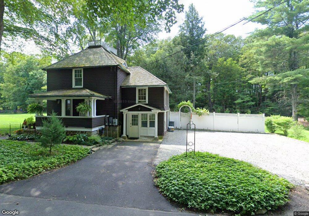
39 Simpaug Turnpike Redding, CT 06896
Estimated Value: $630,000 - $731,384
3
Beds
2
Baths
1,884
Sq Ft
$368/Sq Ft
Est. Value
About This Home
This home is located at 39 Simpaug Turnpike, Redding, CT 06896 and is currently estimated at $693,096, approximately $367 per square foot. 39 Simpaug Turnpike is a home located in Fairfield County with nearby schools including Redding Elementary School, John Read Middle School, and Joel Barlow High School.
Ownership History
Date
Name
Owned For
Owner Type
Purchase Details
Closed on
Jun 26, 2006
Sold by
Barrett Herbert S
Bought by
Lung Richard S
Current Estimated Value
Home Financials for this Owner
Home Financials are based on the most recent Mortgage that was taken out on this home.
Original Mortgage
$350,000
Interest Rate
6.59%
Create a Home Valuation Report for This Property
The Home Valuation Report is an in-depth analysis detailing your home's value as well as a comparison with similar homes in the area
Home Values in the Area
Average Home Value in this Area
Purchase History
| Date | Buyer | Sale Price | Title Company |
|---|---|---|---|
| Lung Richard S | $489,000 | -- | |
| Lung Richard J | $489,000 | -- |
Source: Public Records
Mortgage History
| Date | Status | Borrower | Loan Amount |
|---|---|---|---|
| Open | Lung Richard J | $331,253 | |
| Closed | Lung Richard J | $40,000 | |
| Closed | Lung Richard J | $350,000 |
Source: Public Records
Tax History
| Year | Tax Paid | Tax Assessment Tax Assessment Total Assessment is a certain percentage of the fair market value that is determined by local assessors to be the total taxable value of land and additions on the property. | Land | Improvement |
|---|---|---|---|---|
| 2025 | $11,228 | $380,100 | $129,200 | $250,900 |
| 2024 | $10,916 | $380,100 | $129,200 | $250,900 |
| 2023 | $10,525 | $380,100 | $129,200 | $250,900 |
| 2022 | $10,029 | $300,800 | $141,100 | $159,700 |
| 2021 | $9,878 | $300,800 | $141,100 | $159,700 |
| 2020 | $9,878 | $300,800 | $141,100 | $159,700 |
| 2019 | $9,740 | $296,600 | $141,100 | $155,500 |
| 2018 | $9,408 | $296,600 | $141,100 | $155,500 |
| 2017 | $8,276 | $279,400 | $133,900 | $145,500 |
| 2016 | $8,170 | $279,400 | $133,900 | $145,500 |
| 2015 | $8,077 | $279,400 | $133,900 | $145,500 |
| 2014 | $8,077 | $279,400 | $133,900 | $145,500 |
Source: Public Records
Map
Nearby Homes
- 8 Cornerstone Ct
- 229 Umpawaug Rd
- 15 Laurel Hill Rd
- 176 Picketts Ridge Rd
- 12 Werf Dr
- 40 Hull Place
- 2 Brick School Dr
- 71 Picketts Ridge Rd
- 2 Lemon Ln
- 233 Danbury Rd Unit 209
- 217 Danbury Rd
- 26 Wilridge Rd
- 19 Prospect Ridge Unit 14
- 7 Peaceable St
- 86 Starrs Plain Rd
- 77 Sunset Ln Unit 213
- 77 Sunset Ln Unit 223
- 59 Prospect St Unit C
- 24 Costa Ln
- 25 Eustis Ln
- 34 Simpaug Turnpike
- 23 Simpaug Turnpike
- 30 Simpaug Turnpike
- 42 Simpaug Turnpike
- 21 Simpaug Turnpike
- 12 Bayberry Ln
- 5 Topledge Rd
- 66 Topstone Rd
- 8 Bayberry Ln
- 14 Bayberry Ln
- 3 Topledge Rd
- 9 Topledge Rd
- 6 Bayberry Ln
- 76 Topstone Rd
- 64 Topstone Rd
- 18 Bayberry Ln
- 13 Topledge Rd
- 3 Bayberry Ln
- 5 Topstone Rd
- 11 Topstone Rd
Your Personal Tour Guide
Ask me questions while you tour the home.