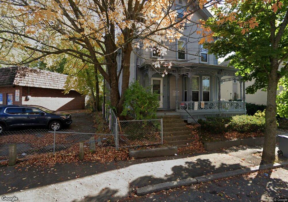
39 Vine St Unit 1 Haverhill, MA 01830
Lower Acres NeighborhoodEstimated Value: $133,000 - $258,000
1
Bed
1
Bath
602
Sq Ft
$364/Sq Ft
Est. Value
About This Home
This home is located at 39 Vine St Unit 1, Haverhill, MA 01830 and is currently estimated at $219,069, approximately $363 per square foot. 39 Vine St Unit 1 is a home located in Essex County with nearby schools including Dr. Paul Nettle Middle School.
Ownership History
Date
Name
Owned For
Owner Type
Purchase Details
Closed on
Nov 4, 2008
Sold by
Lasalle Bk
Bought by
Brunet William J and Brunet Nancy A
Current Estimated Value
Home Financials for this Owner
Home Financials are based on the most recent Mortgage that was taken out on this home.
Original Mortgage
$32,000
Outstanding Balance
$20,744
Interest Rate
5.83%
Mortgage Type
Purchase Money Mortgage
Estimated Equity
$198,325
Purchase Details
Closed on
Jun 8, 2007
Sold by
Rise Leonard A
Bought by
Lasalle Bk
Purchase Details
Closed on
Oct 1, 1999
Sold by
Wheeler Parker C and Wheeler Judith A
Bought by
Rise Leonard A
Purchase Details
Closed on
Mar 1, 1995
Sold by
Fnma
Bought by
Wheeler Parker C and Wheeler Judith
Purchase Details
Closed on
Aug 3, 1994
Sold by
Steele Kim A
Bought by
Federal National Mortgage Association
Create a Home Valuation Report for This Property
The Home Valuation Report is an in-depth analysis detailing your home's value as well as a comparison with similar homes in the area
Home Values in the Area
Average Home Value in this Area
Purchase History
| Date | Buyer | Sale Price | Title Company |
|---|---|---|---|
| Brunet William J | $40,000 | -- | |
| Lasalle Bk | $85,000 | -- | |
| Rise Leonard A | $32,500 | -- | |
| Wheeler Parker C | $8,500 | -- | |
| Federal National Mortgage Association | $57,818 | -- |
Source: Public Records
Mortgage History
| Date | Status | Borrower | Loan Amount |
|---|---|---|---|
| Open | Federal National Mortgage Association | $32,000 | |
| Previous Owner | Federal National Mortgage Association | $97,500 | |
| Previous Owner | Federal National Mortgage Association | $76,000 |
Source: Public Records
Tax History Compared to Growth
Tax History
| Year | Tax Paid | Tax Assessment Tax Assessment Total Assessment is a certain percentage of the fair market value that is determined by local assessors to be the total taxable value of land and additions on the property. | Land | Improvement |
|---|---|---|---|---|
| 2025 | $1,050 | $98,000 | $0 | $98,000 |
| 2024 | $994 | $93,400 | $0 | $93,400 |
| 2023 | $967 | $86,700 | $0 | $86,700 |
| 2022 | $935 | $73,500 | $0 | $73,500 |
| 2021 | $1,106 | $82,300 | $0 | $82,300 |
| 2020 | $1,084 | $79,700 | $0 | $79,700 |
| 2019 | $1,076 | $77,100 | $0 | $77,100 |
| 2018 | $1,062 | $74,500 | $0 | $74,500 |
| 2017 | $938 | $62,600 | $0 | $62,600 |
| 2016 | $962 | $62,600 | $0 | $62,600 |
| 2015 | $961 | $62,600 | $0 | $62,600 |
Source: Public Records
Map
Nearby Homes
- 17 Vine St
- 48 Portland St
- 25 Portland St
- 8 Dustin St
- 13-15 Arlington St
- 17 Arlington St
- 23 Arlington St
- 4 Michael Anthony Rd
- 2 Michael Anthony Rd
- 8 Bartlett Ave Unit 5
- 5 Kimball St
- 7 Clinton St Unit 4
- 25-27 Dover St
- 151 Franklin St
- 20 Ashland St
- 27 Webster St
- 11 York St Unit 11
- 9 York St Unit 9
- 23 Lewis St
- 192 Franklin St
- 39 Vine St Unit 4
- 39 Vine St Unit 3
- 39 Vine St Unit 2
- 39 Vine St Unit 3,39
- 35 Vine St
- 105 White St
- 91 White St
- 36 Vine St
- 59 Pentucket St
- 5 Pentucket St
- 5-9 Pentucket St
- 111 White St
- 111 White St
- 34 Vine St
- 31 Vine St
- 38 Portland St Unit 1
- 38 Portland St Unit 2
- 27 Vine St Unit 11
- 27 Vine St Unit 4
- 27 Vine St Unit 6