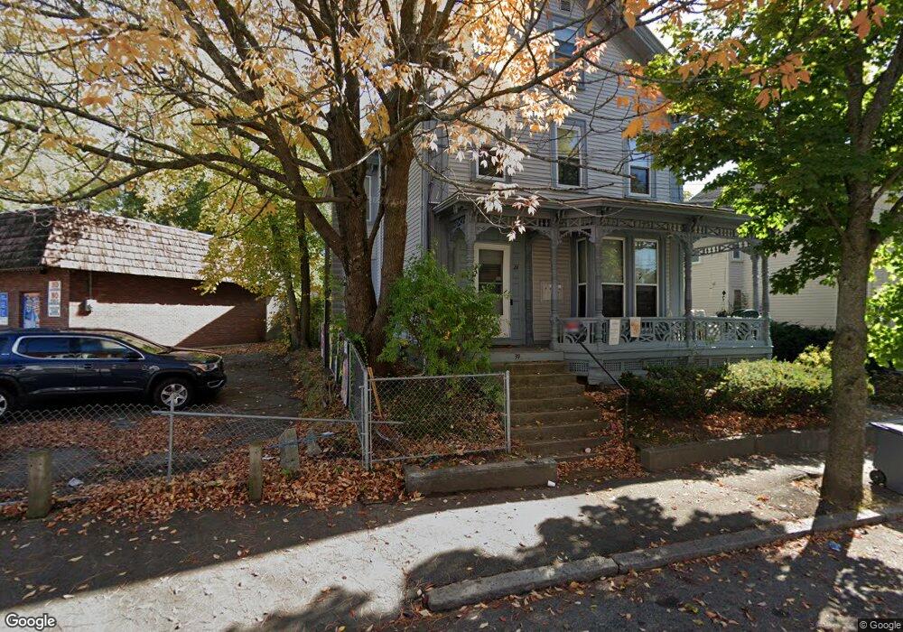
39 Vine St Unit 4 Haverhill, MA 01830
Lower Acres NeighborhoodEstimated Value: $171,000 - $357,000
2
Beds
2
Baths
1,222
Sq Ft
$235/Sq Ft
Est. Value
About This Home
This home is located at 39 Vine St Unit 4, Haverhill, MA 01830 and is currently estimated at $287,478, approximately $235 per square foot. 39 Vine St Unit 4 is a home located in Essex County with nearby schools including Dr. Paul Nettle Middle School.
Ownership History
Date
Name
Owned For
Owner Type
Purchase Details
Closed on
Mar 6, 2009
Sold by
Us Bank Na
Bought by
Mann Stephanie E
Current Estimated Value
Purchase Details
Closed on
Jan 16, 2009
Sold by
Kelly Amani M
Bought by
Us Bk
Purchase Details
Closed on
Oct 6, 2003
Sold by
Morrow Sarah E
Bought by
Kelly Aman
Purchase Details
Closed on
Mar 31, 1999
Sold by
Mcgillivray Valerie R and Gomes Kevin J
Bought by
Morrow Sarah E
Purchase Details
Closed on
Jul 24, 1998
Sold by
Crosby Mark A
Bought by
Mcgillivray Valerie R and Gomes Kevin J
Purchase Details
Closed on
Jul 22, 1988
Sold by
Bradley Timothy J
Bought by
Crosby Mark A
Create a Home Valuation Report for This Property
The Home Valuation Report is an in-depth analysis detailing your home's value as well as a comparison with similar homes in the area
Home Values in the Area
Average Home Value in this Area
Purchase History
| Date | Buyer | Sale Price | Title Company |
|---|---|---|---|
| Mann Stephanie E | $35,000 | -- | |
| Us Bk | $63,540 | -- | |
| Kelly Aman | $127,000 | -- | |
| Morrow Sarah E | $75,000 | -- | |
| Mcgillivray Valerie R | $25,000 | -- | |
| Crosby Mark A | $94,900 | -- |
Source: Public Records
Mortgage History
| Date | Status | Borrower | Loan Amount |
|---|---|---|---|
| Previous Owner | Crosby Mark A | $199,500 | |
| Previous Owner | Crosby Mark A | $35,700 |
Source: Public Records
Tax History Compared to Growth
Tax History
| Year | Tax Paid | Tax Assessment Tax Assessment Total Assessment is a certain percentage of the fair market value that is determined by local assessors to be the total taxable value of land and additions on the property. | Land | Improvement |
|---|---|---|---|---|
| 2025 | $1,521 | $142,000 | $0 | $142,000 |
| 2024 | $1,435 | $134,900 | $0 | $134,900 |
| 2023 | $1,390 | $124,700 | $0 | $124,700 |
| 2022 | $1,334 | $104,900 | $0 | $104,900 |
| 2021 | $1,585 | $117,900 | $0 | $117,900 |
| 2020 | $1,549 | $113,900 | $0 | $113,900 |
| 2019 | $1,479 | $106,000 | $0 | $106,000 |
| 2018 | $1,456 | $102,100 | $0 | $102,100 |
| 2017 | $1,282 | $85,500 | $0 | $85,500 |
| 2016 | $1,313 | $85,500 | $0 | $85,500 |
| 2015 | $1,312 | $85,500 | $0 | $85,500 |
Source: Public Records
Map
Nearby Homes
- 17 Vine St
- 48 Portland St
- 25 Portland St
- 8 Dustin St
- 13-15 Arlington St
- 17 Arlington St
- 23 Arlington St
- 4 Michael Anthony Rd
- 2 Michael Anthony Rd
- 8 Bartlett Ave Unit 5
- 5 Kimball St
- 7 Clinton St Unit 4
- 25-27 Dover St
- 151 Franklin St
- 20 Ashland St
- 27 Webster St
- 11 York St Unit 11
- 9 York St Unit 9
- 23 Lewis St
- 192 Franklin St
- 39 Vine St Unit 3
- 39 Vine St Unit 2
- 39 Vine St Unit 1
- 39 Vine St Unit 3,39
- 35 Vine St
- 105 White St
- 91 White St
- 36 Vine St
- 59 Pentucket St
- 5 Pentucket St
- 5-9 Pentucket St
- 111 White St
- 111 White St
- 34 Vine St
- 31 Vine St
- 38 Portland St Unit 1
- 38 Portland St Unit 2
- 27 Vine St Unit 11
- 27 Vine St Unit 4
- 27 Vine St Unit 6