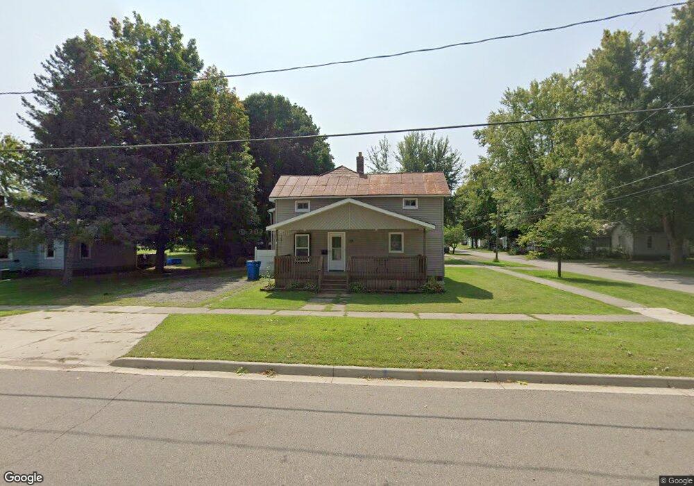
39 W Jefferson St Quincy, MI 49082
Estimated Value: $136,279 - $172,000
3
Beds
2
Baths
2,356
Sq Ft
$68/Sq Ft
Est. Value
About This Home
This home is located at 39 W Jefferson St, Quincy, MI 49082 and is currently estimated at $160,820, approximately $68 per square foot. 39 W Jefferson St is a home located in Branch County with nearby schools including Jennings Elementary School, Quincy Middle School, and Quincy High School.
Ownership History
Date
Name
Owned For
Owner Type
Purchase Details
Closed on
Apr 21, 2016
Sold by
Laney Jason A
Bought by
Gillette Michael C
Current Estimated Value
Home Financials for this Owner
Home Financials are based on the most recent Mortgage that was taken out on this home.
Original Mortgage
$51,300
Outstanding Balance
$40,821
Interest Rate
3.73%
Mortgage Type
New Conventional
Estimated Equity
$119,999
Purchase Details
Closed on
Jul 19, 2001
Sold by
Janice Laney C and Janice Ann
Bought by
Laney, C Wayne & Janica A Trust
Create a Home Valuation Report for This Property
The Home Valuation Report is an in-depth analysis detailing your home's value as well as a comparison with similar homes in the area
Home Values in the Area
Average Home Value in this Area
Purchase History
| Date | Buyer | Sale Price | Title Company |
|---|---|---|---|
| Gillette Michael C | $57,000 | Attorney | |
| Laney, C Wayne & Janica A Trust | -- | -- |
Source: Public Records
Mortgage History
| Date | Status | Borrower | Loan Amount |
|---|---|---|---|
| Open | Gillette Michael C | $51,300 |
Source: Public Records
Tax History Compared to Growth
Tax History
| Year | Tax Paid | Tax Assessment Tax Assessment Total Assessment is a certain percentage of the fair market value that is determined by local assessors to be the total taxable value of land and additions on the property. | Land | Improvement |
|---|---|---|---|---|
| 2025 | $1,382 | $71,254 | $0 | $0 |
| 2024 | $1,200 | $71,741 | $0 | $0 |
| 2023 | $1,109 | $69,053 | $0 | $0 |
| 2022 | $1,109 | $58,452 | $0 | $0 |
| 2021 | -- | $55,523 | $0 | $0 |
| 2020 | -- | $53,733 | $0 | $0 |
| 2019 | -- | $44,094 | $0 | $0 |
| 2018 | -- | $40,505 | $0 | $0 |
| 2017 | -- | $37,908 | $0 | $0 |
| 2016 | -- | $43,325 | $0 | $0 |
| 2015 | -- | $41,015 | $0 | $0 |
| 2014 | -- | $38,816 | $0 | $0 |
| 2013 | -- | $34,831 | $0 | $0 |
Source: Public Records
Map
Nearby Homes
- 34 W Liberty St
- 46 W Chicago St
- 42 W Chicago St
- 78 Taylor St
- 44 Berry St
- 34 Park St
- 9 Cole St
- 14 Cole St
- 69 N Main St
- 1014 Aguadero Pkwy
- 912 Beckwith Shore
- 1085 E Chicago Rd Unit B
- 1085 E Chicago Rd Unit A
- 1085 E Chicago Rd
- 988 Williams Dr
- 216 Sandalwood Dr
- 0 Wildwood Rd
- 732 Cambridge Dr
- 808 Rolling Meadows Dr
- 117 Ridge Rd
- 35 W Jefferson St
- 6 Bennett St
- 41 W Jefferson St
- 38 W Jefferson St
- 40 W Jefferson St
- 36 W Jefferson St
- 31 W Jefferson St
- 3 Bennett St
- 3855 Bennett St
- 42 W Jefferson St
- 8 Bennett St
- 0 Jefferson Unit 2848711
- 0 Jefferson Unit 2906041
- 7 Bennett St
- 29 W Jefferson St
- 44 W Jefferson St
- 45 W Jefferson St
- 30 W Jefferson St
- 45 W Chicago St
- 11 Bennett St