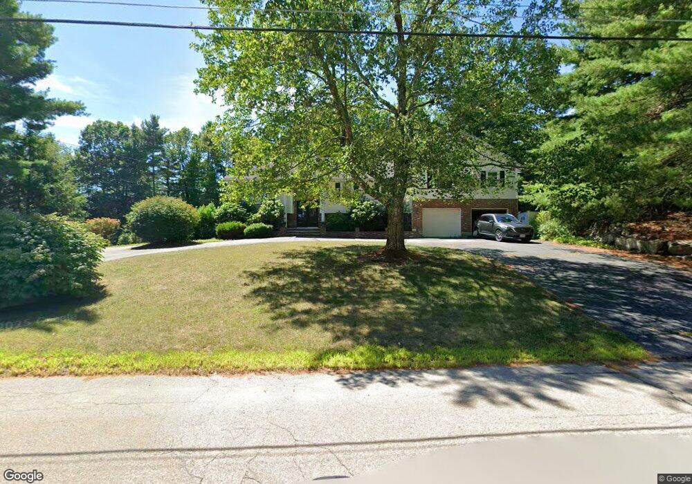
390 Bennett St Wrentham, MA 02093
Estimated Value: $845,000 - $1,039,000
6
Beds
3
Baths
3,528
Sq Ft
$259/Sq Ft
Est. Value
About This Home
This home is located at 390 Bennett St, Wrentham, MA 02093 and is currently estimated at $913,854, approximately $259 per square foot. 390 Bennett St is a home located in Norfolk County with nearby schools including Delaney Elementary School, Charles E Roderick, and Mercymount Country Day School.
Ownership History
Date
Name
Owned For
Owner Type
Purchase Details
Closed on
May 21, 1984
Bought by
Black Thomas and Black Rita Frances
Current Estimated Value
Create a Home Valuation Report for This Property
The Home Valuation Report is an in-depth analysis detailing your home's value as well as a comparison with similar homes in the area
Purchase History
| Date | Buyer | Sale Price | Title Company |
|---|---|---|---|
| Black Thomas | -- | -- |
Source: Public Records
Mortgage History
| Date | Status | Borrower | Loan Amount |
|---|---|---|---|
| Open | Black Thomas | $200,000 | |
| Closed | Black Thomas | $96,000 | |
| Closed | Black Thomas | $20,000 |
Source: Public Records
Tax History Compared to Growth
Tax History
| Year | Tax Paid | Tax Assessment Tax Assessment Total Assessment is a certain percentage of the fair market value that is determined by local assessors to be the total taxable value of land and additions on the property. | Land | Improvement |
|---|---|---|---|---|
| 2025 | $8,336 | $719,200 | $302,100 | $417,100 |
| 2024 | $7,920 | $660,000 | $302,100 | $357,900 |
| 2023 | $7,770 | $615,700 | $274,500 | $341,200 |
| 2022 | $7,502 | $548,800 | $256,000 | $292,800 |
| 2021 | $6,240 | $443,500 | $223,400 | $220,100 |
| 2020 | $7,025 | $493,000 | $198,600 | $294,400 |
| 2019 | $6,706 | $474,900 | $198,600 | $276,300 |
| 2018 | $6,857 | $481,500 | $169,000 | $312,500 |
| 2017 | $6,698 | $470,000 | $165,800 | $304,200 |
| 2016 | $6,559 | $459,300 | $161,000 | $298,300 |
| 2015 | $6,444 | $430,200 | $154,700 | $275,500 |
| 2014 | $6,338 | $414,000 | $148,800 | $265,200 |
Source: Public Records
Map
Nearby Homes
- 613 West St
- 80 Carriage House Ln
- 440 Chestnut St
- 1222 South St
- Lot 1 - Blueberry 2 Car Plan at King Philip Estates
- Lot 8 - Blueberry 2 Car Plan at King Philip Estates
- Lot 5 - Hughes 2 car Plan at King Philip Estates
- Lot 6 - Blueberry 3 Car Plan at King Philip Estates
- 10 Earle Stewart Ln Unit Lot 5
- Lot 2 - Camden 2 Car Plan at King Philip Estates
- Lot 7 - Cedar Plan at King Philip Estates
- Lot 4 - Hemingway 2 Car Plan at King Philip Estates
- 14 Earle Stewart Ln
- Lot 3 - Blueberry 2 Car Plan at King Philip Estates
- 955 Summer St
- 11 Earle Stewart Ln
- 20 Field Cir
- 19 Chestnut Lot 0
- 131 Creek St Unit 7
- 18 Huntington Ave