Estimated Value: $469,000 - $673,000
--
Bed
--
Bath
1
Sq Ft
$581,920/Sq Ft
Est. Value
About This Home
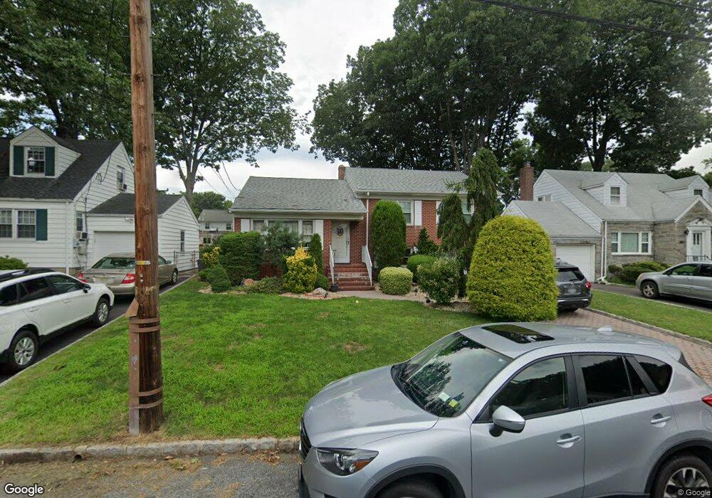
This home is located at 390 Martin Rd, Union, NJ 07083 and is currently estimated at $581,920, approximately $581,920 per square foot. 390 Martin Rd is a home located in Union County with nearby schools including Washington Elementary School and Union High School.
Ownership History
Date
Name
Owned For
Owner Type
Purchase Details
Closed on
Mar 31, 2005
Sold by
Mcdonough Joanne M
Bought by
Santos Lillian and Silvers John
Current Estimated Value
Home Financials for this Owner
Home Financials are based on the most recent Mortgage that was taken out on this home.
Original Mortgage
$312,000
Outstanding Balance
$160,168
Interest Rate
5.7%
Mortgage Type
Future Advance Clause Open End Mortgage
Estimated Equity
$421,752
Purchase Details
Closed on
Jul 27, 2000
Sold by
Mcdonough Thomas P and Mcdonough Joanne M
Bought by
Mcdonough Joanne M
Create a Home Valuation Report for This Property
The Home Valuation Report is an in-depth analysis detailing your home's value as well as a comparison with similar homes in the area
Home Values in the Area
Average Home Value in this Area
Purchase History
| Date | Buyer | Sale Price | Title Company |
|---|---|---|---|
| Santos Lillian | $390,000 | -- | |
| Mcdonough Joanne M | -- | -- |
Source: Public Records
Mortgage History
| Date | Status | Borrower | Loan Amount |
|---|---|---|---|
| Open | Santos Lillian | $312,000 | |
| Closed | Santos Lillian | $390,000 |
Source: Public Records
Tax History Compared to Growth
Tax History
| Year | Tax Paid | Tax Assessment Tax Assessment Total Assessment is a certain percentage of the fair market value that is determined by local assessors to be the total taxable value of land and additions on the property. | Land | Improvement |
|---|---|---|---|---|
| 2025 | $13,478 | $60,300 | $20,400 | $39,900 |
| 2024 | $13,066 | $60,300 | $20,400 | $39,900 |
| 2023 | $13,066 | $60,300 | $20,400 | $39,900 |
| 2022 | $12,612 | $60,300 | $20,400 | $39,900 |
| 2021 | $12,307 | $60,300 | $20,400 | $39,900 |
| 2020 | $12,061 | $60,300 | $20,400 | $39,900 |
| 2019 | $11,899 | $60,300 | $20,400 | $39,900 |
| 2018 | $11,696 | $60,300 | $20,400 | $39,900 |
| 2017 | $11,523 | $60,300 | $20,400 | $39,900 |
| 2016 | $11,242 | $60,300 | $20,400 | $39,900 |
| 2015 | $11,056 | $60,300 | $20,400 | $39,900 |
| 2014 | $10,808 | $60,300 | $20,400 | $39,900 |
Source: Public Records
Map
Nearby Homes
- 394 Martin Rd
- 403 Foxwood Rd
- 321 Salem Rd
- 536 Lehigh Ave
- 819 Greenwich Ln
- 341 Trotting Rd
- 578 Winchester Ave
- 277 Newark Ave
- 686 Gates Terrace
- 233 Monticello St
- 619 Spruce St
- 201 E Lincoln Ave
- 255 Tucker Ave Unit 233
- 255 Tucker Ave Unit 204
- 275 Clermont Terrace
- 214 Washington Ave
- 494 Whitewood Rd
- 1134-1138 Kipling Rd
- 45 E Webster Ave
- 825 Elm St
- 386 Martin Rd
- 393 Huntington Rd
- 400 Martin Rd
- 382 Martin Rd
- 387 Huntington Rd
- 395 Huntington Rd
- 383 Huntington Rd
- 399 Huntington Rd
- 393 Martin Rd
- 389 Martin Rd
- 404 Martin Rd
- 372 Martin Rd
- 399 Martin Rd
- 383 Martin Rd
- 403 Huntington Rd
- 377 Huntington Rd
- 401 Martin Rd
- 408 Martin Rd
- 370 Martin Rd
- 379 Martin Rd