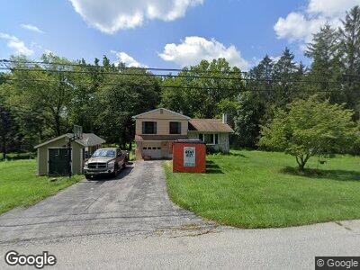
390 Misty Patch Rd Coatesville, PA 19320
East Fallowfield NeighborhoodEstimated Value: $256,000 - $389,000
3
Beds
1
Bath
1,059
Sq Ft
$308/Sq Ft
Est. Value
About This Home
This home is located at 390 Misty Patch Rd, Coatesville, PA 19320 and is currently estimated at $326,466, approximately $308 per square foot. 390 Misty Patch Rd is a home located in Chester County with nearby schools including Caln Elementary School, Coatesville Intermediate High School, and Coatesville Area Senior High School.
Ownership History
Date
Name
Owned For
Owner Type
Purchase Details
Closed on
Oct 27, 2005
Sold by
Kiernan Christopher A and Kiernan Lori A
Bought by
Paquette Michael and Crawford Alice
Current Estimated Value
Home Financials for this Owner
Home Financials are based on the most recent Mortgage that was taken out on this home.
Original Mortgage
$196,000
Interest Rate
7.62%
Mortgage Type
Stand Alone First
Create a Home Valuation Report for This Property
The Home Valuation Report is an in-depth analysis detailing your home's value as well as a comparison with similar homes in the area
Home Values in the Area
Average Home Value in this Area
Purchase History
| Date | Buyer | Sale Price | Title Company |
|---|---|---|---|
| Paquette Michael | $245,000 | None Available |
Source: Public Records
Mortgage History
| Date | Status | Borrower | Loan Amount |
|---|---|---|---|
| Open | Paquette Michael | $247,061 | |
| Closed | Paquette Michael | $257,122 | |
| Closed | Paquette Michael | $196,000 | |
| Previous Owner | Kierman Lori A | $158,000 |
Source: Public Records
Tax History Compared to Growth
Tax History
| Year | Tax Paid | Tax Assessment Tax Assessment Total Assessment is a certain percentage of the fair market value that is determined by local assessors to be the total taxable value of land and additions on the property. | Land | Improvement |
|---|---|---|---|---|
| 2024 | $3,820 | $76,210 | $28,350 | $47,860 |
| 2023 | $3,717 | $76,210 | $28,350 | $47,860 |
| 2022 | $3,600 | $76,210 | $28,350 | $47,860 |
| 2021 | $3,487 | $76,210 | $28,350 | $47,860 |
| 2020 | $3,375 | $74,060 | $28,350 | $45,710 |
| 2019 | $3,268 | $74,060 | $28,350 | $45,710 |
| 2018 | $3,131 | $74,060 | $28,350 | $45,710 |
| 2017 | $2,894 | $74,060 | $28,350 | $45,710 |
| 2016 | $2,230 | $74,060 | $28,350 | $45,710 |
| 2015 | $2,230 | $74,060 | $28,350 | $45,710 |
| 2014 | $2,230 | $74,060 | $28,350 | $45,710 |
Source: Public Records
Map
Nearby Homes
- 35 Maple Ln
- 61 S Brandywine Ave
- 8 Wakefield Dr
- 1318 Brownsville Rd
- 71 Narragansett Ln
- 130 Bridle Path Ln
- 10 Vinebury Ln
- 1437 Oakwood Rd
- 1509 W Chester Rd
- 1504 Cardinal Dr
- 1412 Cardinal Dr
- 1508 Robin Rd
- 2190 Strasburg Rd
- 1651 Reed St
- 2 Belmar St
- 30 Lukens Mill Dr Unit 124
- 320 Andrew Cir
- 214 Andrew Rd
- 1326 Walnut St
- 1806 Crest Dr
- 390 Misty Patch Rd
- 400 Misty Patch Rd
- 384 Misty Patch Rd
- 420 Misty Patch Rd
- 108 Haven Cir
- 106 Haven Cir
- 385 Misty Patch Rd
- 370 Misty Patch Rd
- 375 Misty Patch Rd
- 104 Haven Cir
- 107 Haven Cir
- 395 Misty Patch Rd
- 105 Haven Cir
- 405 Misty Patch Rd
- 103 Haven Cir
- 34 Haven Cir
- 102 Haven Cir
- 113 Haven Cir
- 190 Eagle Glen Dr
- 208 Eagle Glen Dr