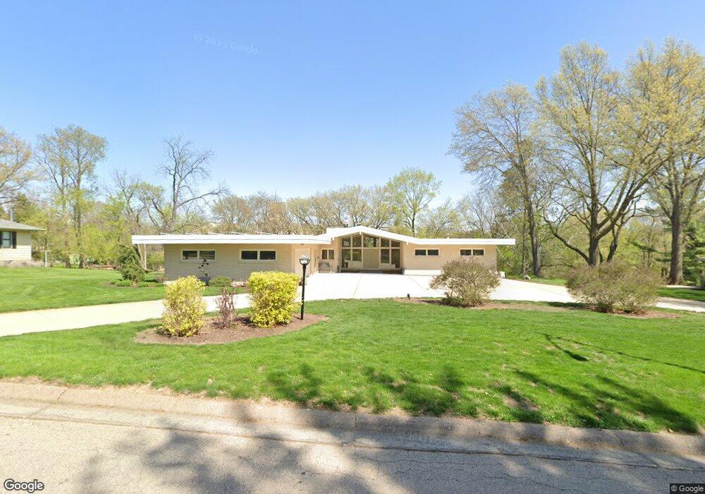
390 Moore Heights Dubuque, IA 52003
Estimated Value: $469,492 - $532,000
5
Beds
3
Baths
3,929
Sq Ft
$129/Sq Ft
Est. Value
About This Home
This home is located at 390 Moore Heights, Dubuque, IA 52003 and is currently estimated at $508,623, approximately $129 per square foot. 390 Moore Heights is a home located in Dubuque County with nearby schools including Bryant Elementary School, George Washington Middle School, and Dubuque Senior High School.
Ownership History
Date
Name
Owned For
Owner Type
Purchase Details
Closed on
Aug 26, 2011
Sold by
Loy Eric S and Loy Patricia J
Bought by
Stierman Kurt J and Stierman Rena A
Current Estimated Value
Home Financials for this Owner
Home Financials are based on the most recent Mortgage that was taken out on this home.
Original Mortgage
$264,000
Outstanding Balance
$182,960
Interest Rate
4.59%
Mortgage Type
New Conventional
Estimated Equity
$325,663
Create a Home Valuation Report for This Property
The Home Valuation Report is an in-depth analysis detailing your home's value as well as a comparison with similar homes in the area
Home Values in the Area
Average Home Value in this Area
Purchase History
| Date | Buyer | Sale Price | Title Company |
|---|---|---|---|
| Stierman Kurt J | $294,000 | None Available |
Source: Public Records
Mortgage History
| Date | Status | Borrower | Loan Amount |
|---|---|---|---|
| Open | Stierman Kurt J | $264,000 |
Source: Public Records
Tax History Compared to Growth
Tax History
| Year | Tax Paid | Tax Assessment Tax Assessment Total Assessment is a certain percentage of the fair market value that is determined by local assessors to be the total taxable value of land and additions on the property. | Land | Improvement |
|---|---|---|---|---|
| 2025 | $6,654 | $513,800 | $76,600 | $437,200 |
| 2024 | $6,654 | $472,900 | $72,900 | $400,000 |
| 2023 | $6,456 | $472,900 | $72,900 | $400,000 |
| 2022 | $6,002 | $371,860 | $61,980 | $309,880 |
| 2021 | $6,002 | $371,860 | $61,980 | $309,880 |
| 2020 | $6,010 | $346,720 | $61,980 | $284,740 |
| 2019 | $5,918 | $346,720 | $61,980 | $284,740 |
| 2018 | $5,824 | $326,810 | $51,040 | $275,770 |
| 2017 | $5,932 | $326,810 | $51,040 | $275,770 |
| 2016 | $5,808 | $315,670 | $51,040 | $264,630 |
| 2015 | $5,808 | $315,670 | $51,040 | $264,630 |
| 2014 | $5,418 | $303,070 | $51,040 | $252,030 |
Source: Public Records
Map
Nearby Homes
- 1985 Marion St
- 17 Jenni St
- 190 Bradley St
- 222 S Grandview Ave
- 224 S Grandview Ave
- 130 Devon Dr
- 1993 Hale St
- 2620 Knob Hill Dr
- 1760 Plymouth Ct
- 670 Duggan Dr
- 1727 Overview Ct
- 615 S Grandview Ave
- 135 State St
- 760 S Grandview Ave
- 722 June Dr
- 2625 New Haven St
- 172 Bryant St
- 229 N Booth St
- 991 June Dr
- 1051 Barbaralee Dr
- 396 Moore Heights
- 370 Moore Heights
- 385 Fremont Ave
- 400 Moore Heights
- 381 Fremont Ave
- 395 Moore Heights
- 381 Moore Heights
- 2140 Simpson St
- 399 Moore Heights
- 2120 Simpson St
- 410 Moore Heights
- 2090 Simpson St
- 379 Fremont Ave
- 2190 Simpson St
- 405 Moore Heights
- 2086 Simpson St
- 2206 Simpson St
- 2222 Simpson St
- 2300 Simpson St
- 0 Simpson St Unit 126379