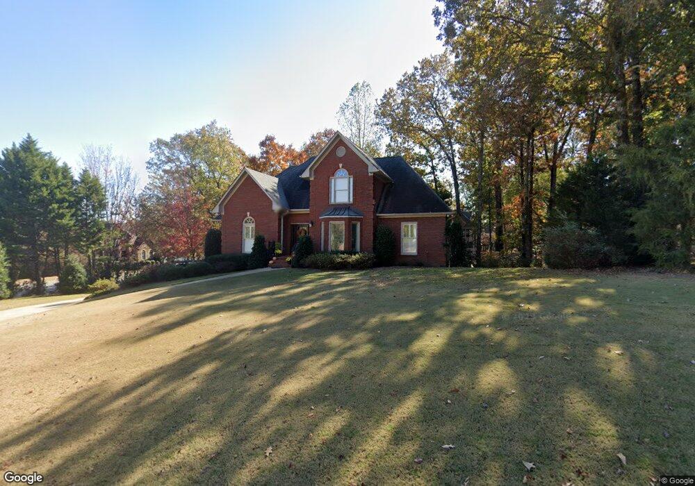
3900 Cannock Dr Birmingham, AL 35242
Estimated Value: $575,467 - $678,000
--
Bed
3
Baths
2,844
Sq Ft
$218/Sq Ft
Est. Value
About This Home
This home is located at 3900 Cannock Dr, Birmingham, AL 35242 and is currently estimated at $620,367, approximately $218 per square foot. 3900 Cannock Dr is a home located in Shelby County with nearby schools including Inverness Elementary School, Oak Mountain Intermediate School, and Oak Mt. Middle School.
Ownership History
Date
Name
Owned For
Owner Type
Purchase Details
Closed on
Jan 6, 2023
Sold by
Mancha Construction Partners Llc
Bought by
Starlin Calvin C and Starlin Sharon P
Current Estimated Value
Purchase Details
Closed on
Sep 25, 2017
Sold by
Paulin Gavan Edward and Parker Gary
Bought by
Parker Gray
Purchase Details
Closed on
Mar 2, 2000
Sold by
Metropolitan Insurance Company
Bought by
Vulcan Properties Llc
Home Financials for this Owner
Home Financials are based on the most recent Mortgage that was taken out on this home.
Original Mortgage
$9,350,000
Interest Rate
8.29%
Mortgage Type
Construction
Purchase Details
Closed on
Oct 21, 1998
Sold by
Cage William S and Cage Susan H
Bought by
Parker Thea Gray and Parker Ame S
Home Financials for this Owner
Home Financials are based on the most recent Mortgage that was taken out on this home.
Original Mortgage
$204,800
Interest Rate
6.79%
Create a Home Valuation Report for This Property
The Home Valuation Report is an in-depth analysis detailing your home's value as well as a comparison with similar homes in the area
Home Values in the Area
Average Home Value in this Area
Purchase History
| Date | Buyer | Sale Price | Title Company |
|---|---|---|---|
| Starlin Calvin C | $931,340 | -- | |
| Parker Gray | -- | None Available | |
| Vulcan Properties Llc | $1,293,732 | -- | |
| Parker Thea Gray | $256,000 | -- |
Source: Public Records
Mortgage History
| Date | Status | Borrower | Loan Amount |
|---|---|---|---|
| Previous Owner | Vulcan Properties Llc | $9,350,000 | |
| Previous Owner | Parker Thea Gray | $204,800 |
Source: Public Records
Tax History Compared to Growth
Tax History
| Year | Tax Paid | Tax Assessment Tax Assessment Total Assessment is a certain percentage of the fair market value that is determined by local assessors to be the total taxable value of land and additions on the property. | Land | Improvement |
|---|---|---|---|---|
| 2024 | $2,103 | $47,800 | $0 | $0 |
| 2023 | $1,896 | $44,020 | $0 | $0 |
| 2022 | $1,787 | $41,540 | $0 | $0 |
| 2021 | $1,612 | $37,560 | $0 | $0 |
| 2020 | $1,501 | $35,040 | $0 | $0 |
| 2019 | $1,535 | $35,820 | $0 | $0 |
| 2017 | $1,487 | $34,720 | $0 | $0 |
| 2015 | $1,419 | $33,180 | $0 | $0 |
| 2014 | $1,376 | $32,200 | $0 | $0 |
Source: Public Records
Map
Nearby Homes
- 4227 Ashington Dr
- 1010 Warrington Cir
- 1645 Wingfield Dr
- 1616 Wingfield Trace
- 225 Courtside Dr
- 243 Courtside Dr Unit 45
- 2096 Brook Highland Ridge
- 2080 Brook Highland Ridge
- 2076 Brook Highland Ridge
- 121 Palmer Cove
- 3212 Brook Highland Trace
- 3213 Brook Highland Trace
- 3071 Somerset Trace
- 3100 Somerset Trace
- 2552 Magnolia Place
- 5330 Meadowlark Ln
- 1257 Greystone Parc Dr
- 1033 Linkside Dr
- 145 Brook Highland Cove
- 5320 Greystone Way
- 3121 Brook Highland Dr
- 3904 Cannock Dr
- 3901 Cannock Dr
- 3125 Brook Highland Dr
- 4200 Ashington Dr
- 1600 Wingfield Dr
- 4104 Ashington Dr
- 1601 Wingfield Dr
- 3109 Brook Highland Dr
- 3120 Brook Highland Dr
- 3129 Brook Highland Dr
- 3124 Brook Highland Dr
- 4204 Ashington Dr
- 4108 Ashington Dr
- 4101 Ashington Dr
- 3108 Brook Highland Dr
- 3909 Cannock Dr
- 1605 Wingfield Dr
- 3128 Brook Highland Dr
- 3133 Brook Highland Dr