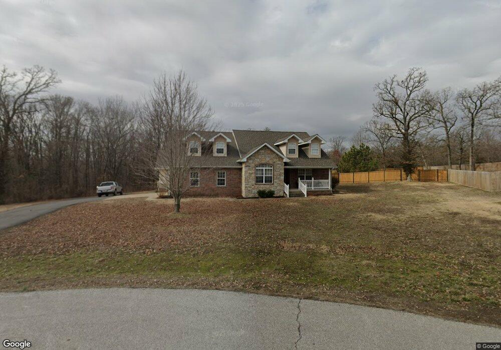
3900 County Lane 272 Joplin, MO 64801
Estimated Value: $345,000 - $398,644
--
Bed
1
Bath
3,681
Sq Ft
$101/Sq Ft
Est. Value
About This Home
This home is located at 3900 County Lane 272, Joplin, MO 64801 and is currently estimated at $371,822, approximately $101 per square foot. 3900 County Lane 272 is a home with nearby schools including Carl Junction Primary School (K-1), Carl Junction Intermediate School, and Carl Junction Primary School (2-3).
Ownership History
Date
Name
Owned For
Owner Type
Purchase Details
Closed on
Aug 3, 2017
Sold by
King Curtis D and King Karen L
Bought by
The Curtis And Karen King Revocable Trus
Current Estimated Value
Purchase Details
Closed on
Sep 29, 2009
Sold by
Overman Ruth
Bought by
King Curtis D and King Karen L
Home Financials for this Owner
Home Financials are based on the most recent Mortgage that was taken out on this home.
Original Mortgage
$240,000
Interest Rate
5.12%
Mortgage Type
New Conventional
Create a Home Valuation Report for This Property
The Home Valuation Report is an in-depth analysis detailing your home's value as well as a comparison with similar homes in the area
Home Values in the Area
Average Home Value in this Area
Purchase History
| Date | Buyer | Sale Price | Title Company |
|---|---|---|---|
| The Curtis And Karen King Revocable Trus | -- | None Available | |
| King Curtis D | -- | Jct |
Source: Public Records
Mortgage History
| Date | Status | Borrower | Loan Amount |
|---|---|---|---|
| Previous Owner | King Curtis D | $240,000 |
Source: Public Records
Tax History Compared to Growth
Tax History
| Year | Tax Paid | Tax Assessment Tax Assessment Total Assessment is a certain percentage of the fair market value that is determined by local assessors to be the total taxable value of land and additions on the property. | Land | Improvement |
|---|---|---|---|---|
| 2024 | $2,477 | $49,620 | $3,830 | $45,790 |
| 2023 | $2,477 | $49,620 | $3,830 | $45,790 |
| 2022 | $2,572 | $51,190 | $3,830 | $47,360 |
| 2021 | $2,557 | $51,190 | $3,830 | $47,360 |
| 2020 | $2,394 | $47,160 | $3,830 | $43,330 |
| 2019 | $2,271 | $47,160 | $3,830 | $43,330 |
| 2018 | $2,179 | $45,390 | $0 | $0 |
| 2017 | $2,185 | $45,390 | $0 | $0 |
| 2016 | $2,215 | $46,440 | $0 | $0 |
| 2015 | $2,167 | $46,440 | $0 | $0 |
| 2014 | $2,167 | $46,440 | $0 | $0 |
Source: Public Records
Map
Nearby Homes
- 5045 County Lane 273
- 1842 Mountain Ash Dr
- XXX Mountain Ash Dr Unit 2
- XXX Mountain Ash Dr Unit 1
- 1713 White Oak Dr
- 1839 W Elm Dr
- 1507 White Oak Dr
- 1806 Mountain Ash Dr
- XXX W Elm Dr
- 4750 N Black Cat Rd
- 4570 N Black Cat Rd
- 1706 Redbud Dr
- Lot 3 N Willow Rd
- Lot 2 N Willow Rd
- Lot 1 N Willow Rd
- 2.78 N Willow Rd
- TBD W Fountain Rd
- 1706 W Marigold Dr
- 2198 W Zora St
- 908 Aberdeen Ave
- 3920 N County Lane 272
- 3901 County Lane 272
- 3940 County Lane 272
- 3939 N County Lane 272
- 3974 County Lane 272
- 3708 N Marin Ln
- 3975 County Lane 272
- 3948 N Peace Church Ave
- 3948 N Peace Church Ave Unit 1
- 3838 N Marin Ln
- 3167 W Euclid
- 3946 N Peace Church Ave
- 3858 N Peace Church Ave
- 3675 N Marin Ln
- 3664 N Peace Church Ave
- 5239 County Lane 273
- 3635 N Peace Church Ave
- 5273 County Lane 273
- 3421 W Fountain Rd
- 3421 W Fountain Rd Unit 1