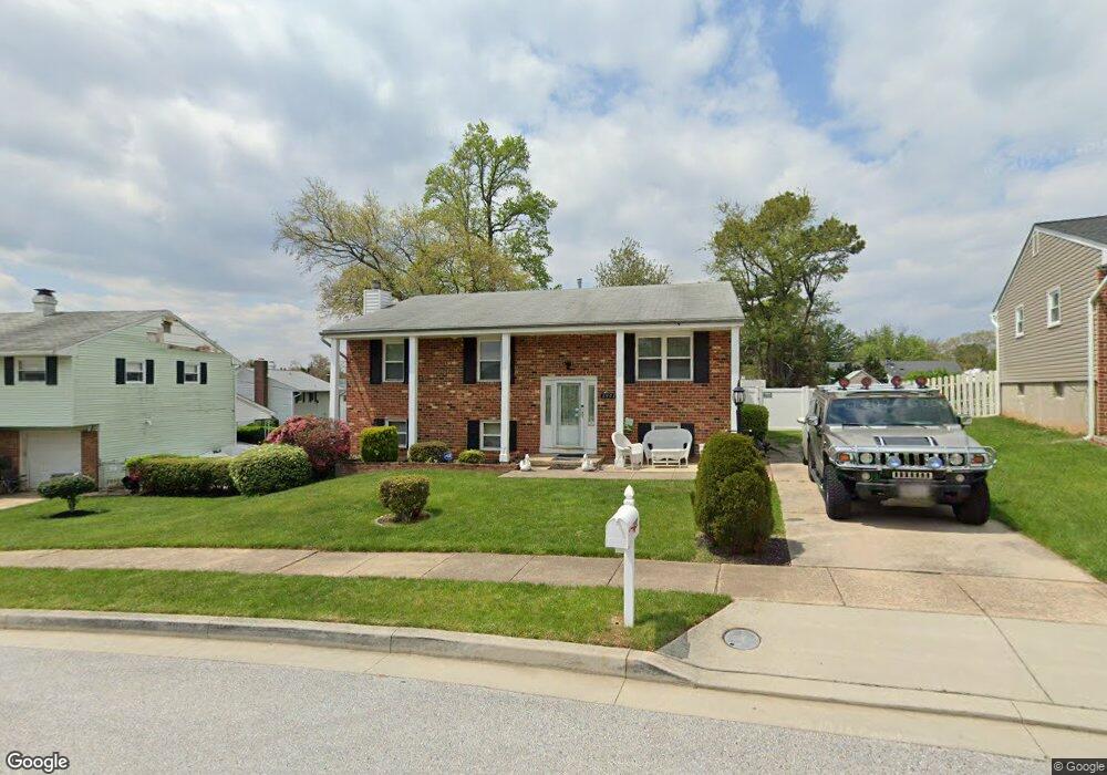
3902 Sybil Rd Randallstown, MD 21133
Estimated Value: $335,667 - $391,000
--
Bed
3
Baths
1,320
Sq Ft
$276/Sq Ft
Est. Value
About This Home
This home is located at 3902 Sybil Rd, Randallstown, MD 21133 and is currently estimated at $364,667, approximately $276 per square foot. 3902 Sybil Rd is a home located in Baltimore County with nearby schools including Winand Elementary School, Northwest Academy of Health Sciences, and Randallstown High School.
Ownership History
Date
Name
Owned For
Owner Type
Purchase Details
Closed on
May 22, 2018
Sold by
Brown Ellen R and Brown Norman H
Bought by
Brown Ellen R and Brown Norman H
Current Estimated Value
Purchase Details
Closed on
Oct 26, 2012
Sold by
Brown Ellen R and Brown Norman H
Bought by
Brown Ellen R and Brown Norman H
Home Financials for this Owner
Home Financials are based on the most recent Mortgage that was taken out on this home.
Original Mortgage
$278,737
Outstanding Balance
$198,083
Interest Rate
4%
Mortgage Type
FHA
Estimated Equity
$166,584
Purchase Details
Closed on
Jun 29, 1998
Sold by
Corbett Ellen R
Bought by
Brown Ellen R Corbett and Brown Norman H
Purchase Details
Closed on
Jul 5, 1990
Sold by
Vaysburd Alexander
Bought by
Corbett Ellen R
Create a Home Valuation Report for This Property
The Home Valuation Report is an in-depth analysis detailing your home's value as well as a comparison with similar homes in the area
Home Values in the Area
Average Home Value in this Area
Purchase History
| Date | Buyer | Sale Price | Title Company |
|---|---|---|---|
| Brown Ellen R | -- | None Available | |
| Brown Ellen R | -- | First American | |
| Brown Ellen R Corbett | -- | -- | |
| Corbett Ellen R | $114,900 | -- |
Source: Public Records
Mortgage History
| Date | Status | Borrower | Loan Amount |
|---|---|---|---|
| Open | Brown Ellen R | $278,737 |
Source: Public Records
Tax History Compared to Growth
Tax History
| Year | Tax Paid | Tax Assessment Tax Assessment Total Assessment is a certain percentage of the fair market value that is determined by local assessors to be the total taxable value of land and additions on the property. | Land | Improvement |
|---|---|---|---|---|
| 2025 | $3,779 | $316,333 | -- | -- |
| 2024 | $3,779 | $293,500 | $74,300 | $219,200 |
| 2023 | $1,845 | $276,133 | $0 | $0 |
| 2022 | $3,476 | $258,767 | $0 | $0 |
| 2021 | $3,274 | $241,400 | $56,300 | $185,100 |
| 2020 | $3,274 | $237,867 | $0 | $0 |
| 2019 | $3,136 | $234,333 | $0 | $0 |
| 2018 | $2,992 | $230,800 | $56,300 | $174,500 |
| 2017 | $2,804 | $213,100 | $0 | $0 |
| 2016 | $2,399 | $195,400 | $0 | $0 |
| 2015 | $2,399 | $177,700 | $0 | $0 |
| 2014 | $2,399 | $177,700 | $0 | $0 |
Source: Public Records
Map
Nearby Homes
- 3907 Roxanne Rd
- 8908 Meadow Heights Rd
- 8802 Falcon Ridge Dr
- 4001 Starbrook Rd
- 4105 Kiwi Ct
- 8806 Gilly Way Unit D
- 9044 Allenswood Rd
- 8541 Lucerne Rd
- 3854 Terka Cir
- 3921 Zurich Rd
- 9012 Allenswood Rd
- 3805 Terka Cir
- 3705 Allenswood Ct
- 4108 Century Towne Rd
- 20 Windy Meadow Ct
- 20 Sunrise Ct
- 28 Sunrise Ct
- 4210 Mary Ridge Dr
- 1205/99 Winands Rd
- 9112 Meadow Heights Rd