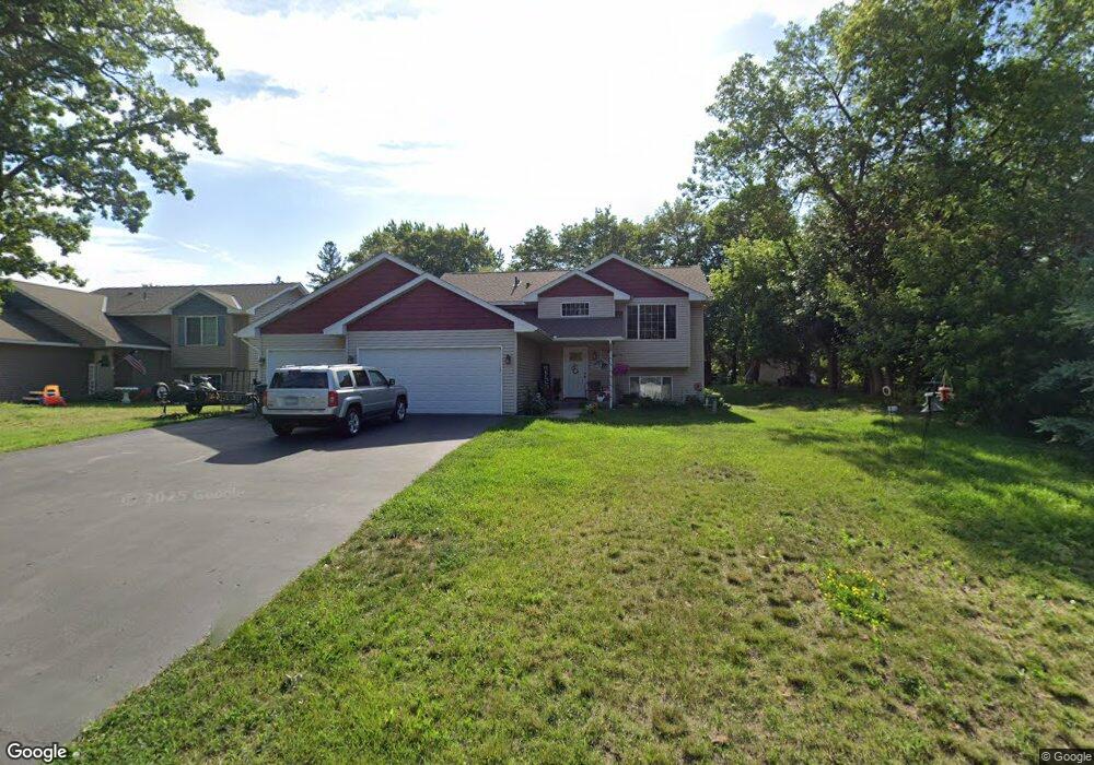
39032 Riverside Ct North Branch, MN 55056
Estimated Value: $322,000 - $342,000
2
Beds
1
Bath
1,020
Sq Ft
$322/Sq Ft
Est. Value
About This Home
This home is located at 39032 Riverside Ct, North Branch, MN 55056 and is currently estimated at $328,571, approximately $322 per square foot. 39032 Riverside Ct is a home located in Chisago County with nearby schools including North Branch Middle School, Sunrise River Elementary School, and North Branch Senior High School.
Ownership History
Date
Name
Owned For
Owner Type
Purchase Details
Closed on
Apr 26, 2017
Sold by
Donahue Joseph and Donahue Jane
Bought by
Frederick Mathew R and Frederick Kaite A
Current Estimated Value
Purchase Details
Closed on
Sep 27, 2001
Sold by
Jehlicka Travis D
Bought by
Morris Vicky L
Purchase Details
Closed on
Mar 30, 1999
Sold by
Cramblit Russell L and Cramblit Teresa A
Bought by
Jehlicka Travis D and Jehlicka Stacy L
Create a Home Valuation Report for This Property
The Home Valuation Report is an in-depth analysis detailing your home's value as well as a comparison with similar homes in the area
Home Values in the Area
Average Home Value in this Area
Purchase History
| Date | Buyer | Sale Price | Title Company |
|---|---|---|---|
| Frederick Mathew R | $194,848 | Land Title | |
| Morris Vicky L | $112,900 | -- | |
| Jehlicka Travis D | $87,900 | -- |
Source: Public Records
Tax History Compared to Growth
Tax History
| Year | Tax Paid | Tax Assessment Tax Assessment Total Assessment is a certain percentage of the fair market value that is determined by local assessors to be the total taxable value of land and additions on the property. | Land | Improvement |
|---|---|---|---|---|
| 2024 | $3,286 | $250,700 | $0 | $0 |
| 2023 | $3,286 | $272,000 | $0 | $0 |
| 2022 | $3,302 | $248,700 | $0 | $0 |
| 2021 | $2,988 | $195,300 | $0 | $0 |
| 2020 | $2,904 | $207,100 | $36,000 | $171,100 |
| 2019 | $2,386 | $0 | $0 | $0 |
| 2018 | $802 | $0 | $0 | $0 |
| 2017 | $464 | $0 | $0 | $0 |
| 2016 | $592 | $0 | $0 | $0 |
| 2015 | $406 | $0 | $0 | $0 |
| 2014 | -- | $15,300 | $0 | $0 |
Source: Public Records
Map
Nearby Homes
- 38946 7th Ave
- 36XXX Forest Blvd
- XXXXX Maple St
- 38958 Elm Ct
- 39183 Grand Ave
- 38558 Grand Ave
- XXX Ash St
- 6231 Red Fox Run
- 38470 Glacier Dr
- 38xxx Oakview Ave
- 38725 12th Ave Unit 83
- 38692 Hawthorne Ave
- 38632 Oakview Ave
- 38578 Hawthorne Ave
- TBD Saint Croix Trail
- 38280 Great Oaks Ct
- 7255 Hawthorne Ct
- 7222 Hawthorne Ct
- 7246 385th St
- 6072 Chippewa Trail
- 39016 Riverside Ct
- 39050 Riverside Ct
- 39037 Riverside Ct
- 6554 Cedar St
- 6520 Cedar St
- 39059 Riverside Ct
- 39074 Riverside Ct
- 6488 Cedar St
- 38984 5th Ave
- 39048 Forest Blvd
- 6511 Cedar St
- 39081 Riverside Ct
- 6584 Cedar St
- 39094 Riverside Ct
- 38987 6th Ave
- 6476 Cedar St
- 6553 Cedar St
- 39062 Forest Blvd
- 38975 6th Ave
- 6581 Rivercrest Dr