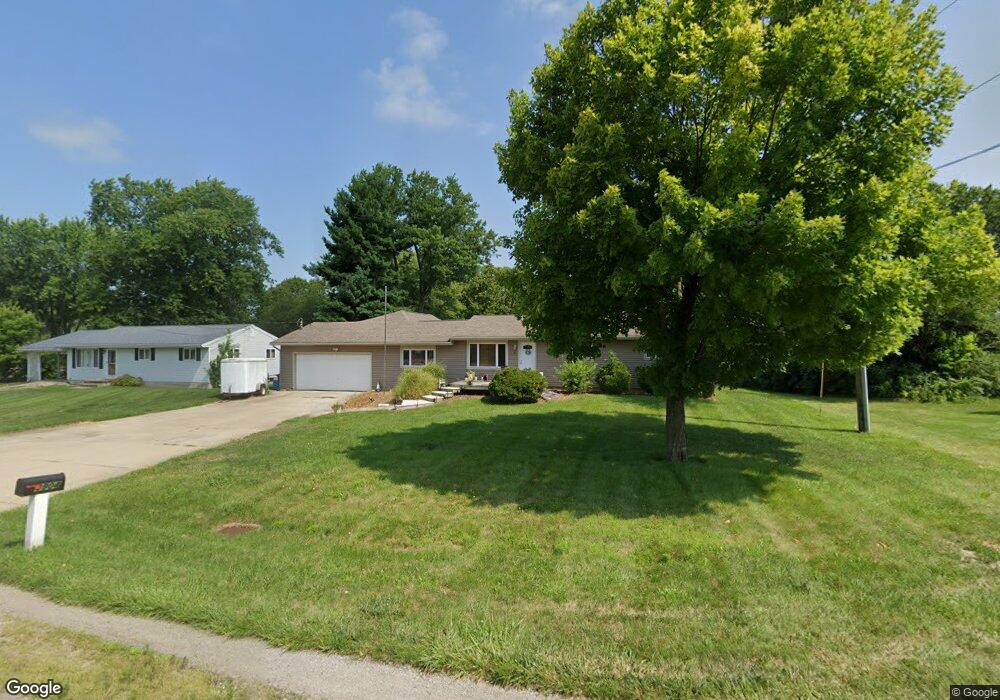
3904 State Route 122 Franklin, OH 45005
Estimated Value: $288,000 - $386,000
3
Beds
2
Baths
1,922
Sq Ft
$167/Sq Ft
Est. Value
About This Home
This home is located at 3904 State Route 122, Franklin, OH 45005 and is currently estimated at $320,821, approximately $166 per square foot. 3904 State Route 122 is a home located in Warren County with nearby schools including Franklin High School, Summit Academy Community School for Alternative Learners - Middletown, and Marshall High School.
Ownership History
Date
Name
Owned For
Owner Type
Purchase Details
Closed on
Sep 30, 2025
Sold by
Chamberlain John D
Bought by
John D Chamberlain Family Trust and Chamberlain
Current Estimated Value
Purchase Details
Closed on
Nov 20, 1985
Sold by
Mccaughey Michael A and Mccaughey Michael A
Bought by
Chamberlain and Chamberlain Cheryl A
Purchase Details
Closed on
Sep 15, 1978
Sold by
Bone Bone and Bone Carless L
Purchase Details
Closed on
Jun 14, 1978
Sold by
Home Federal Savings & Loan and Mulford Myron C
Create a Home Valuation Report for This Property
The Home Valuation Report is an in-depth analysis detailing your home's value as well as a comparison with similar homes in the area
Home Values in the Area
Average Home Value in this Area
Purchase History
We collect this data history from publicly available records. To have your information removed, we recommend requesting removal directly through your county’s website.
| Date | Buyer | Sale Price | Title Company |
|---|---|---|---|
| John D Chamberlain Family Trust | -- | None Listed On Document | |
| Chamberlain | $46,500 | -- | |
| -- | $37,800 | -- | |
| -- | $14,000 | -- |
Source: Public Records
Tax History
| Year | Tax Paid | Tax Assessment Tax Assessment Total Assessment is a certain percentage of the fair market value that is determined by local assessors to be the total taxable value of land and additions on the property. | Land | Improvement |
|---|---|---|---|---|
| 2025 | $3,467 | $78,750 | $16,330 | $62,420 |
| 2024 | $3,467 | $78,750 | $16,330 | $62,420 |
| 2023 | $3,109 | $63,577 | $13,394 | $50,183 |
| 2022 | $3,340 | $63,578 | $13,395 | $50,183 |
| 2021 | $3,264 | $63,578 | $13,395 | $50,183 |
| 2020 | $3,053 | $51,688 | $10,889 | $40,800 |
| 2019 | $2,790 | $51,688 | $10,889 | $40,800 |
| 2018 | $2,798 | $51,688 | $10,889 | $40,800 |
| 2017 | $2,645 | $44,160 | $9,454 | $34,706 |
| 2016 | $2,696 | $44,160 | $9,454 | $34,706 |
| 2015 | $2,699 | $44,160 | $9,454 | $34,706 |
| 2014 | $2,246 | $42,060 | $9,000 | $33,050 |
| 2013 | $1,909 | $50,880 | $10,890 | $39,990 |
Source: Public Records
Map
Nearby Homes
- 3412 State Route 122
- 3881 Robinson Vail Rd
- 3554 Madison Grace Way
- 3537 Mourning Dove
- 4150 Rose Marie Rd
- 3449 Madison Grace Way
- 3413 Ash Meadow Ln
- 4301 Post Rail Ln
- 3535 Noble Way
- 3415 Gadwall Ln
- 4412 Post Rail Ln
- 4595 Todd Rd
- 4689 Fisher Rd
- 3095 Canvasback Ct
- 3071 Canvasback Ct
- 3077 Canvasback Ct
- 3089 Canvasback Ct
- 3083 Canvasback Ct
- 3092 Canvasback Ct
- 3098 Canvasback Ct
- 3922 State Route 122
- 3538 Beatrice Dr
- 3576 Beatrice Dr
- 3600 Beatrice Dr
- 3539 Beatrice Dr
- 3618 Beatrice Dr
- 3575 Beatrice Dr
- 3996 State Route 122
- 3593 Beatrice Dr
- 3581 Wilson Farms Blvd
- 3577 Wilson Farms Blvd
- 3573 Wilson Farms Blvd
- 3636 Beatrice Dr
- 3585 Wilson Farms Blvd
- 3569 Wilson Farms Blvd
- 3611 Beatrice Dr
- 3565 Wilson Farms Blvd
- 3561 Wilson Farms Blvd
- 3589 Wilson Farms Blvd
- 3656 Beatrice Dr
Your Personal Tour Guide
Ask me questions while you tour the home.