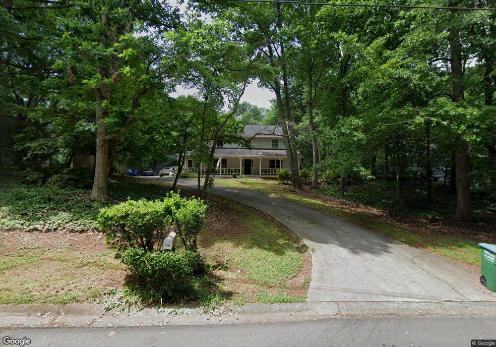
3905 Hunting Ridge Dr SW Unit 2 Lilburn, GA 30047
Estimated Value: $440,000 - $458,000
4
Beds
3
Baths
2,678
Sq Ft
$166/Sq Ft
Est. Value
About This Home
This home is located at 3905 Hunting Ridge Dr SW Unit 2, Lilburn, GA 30047 and is currently estimated at $445,803, approximately $166 per square foot. 3905 Hunting Ridge Dr SW Unit 2 is a home located in Gwinnett County with nearby schools including Head Elementary School, Five Forks Middle School, and Brookwood High School.
Ownership History
Date
Name
Owned For
Owner Type
Purchase Details
Closed on
May 31, 2000
Sold by
Allen Carolyn F
Bought by
Korn Michael J and Korn Lourdes A
Current Estimated Value
Home Financials for this Owner
Home Financials are based on the most recent Mortgage that was taken out on this home.
Original Mortgage
$163,200
Outstanding Balance
$60,997
Interest Rate
9.5%
Mortgage Type
New Conventional
Estimated Equity
$384,806
Create a Home Valuation Report for This Property
The Home Valuation Report is an in-depth analysis detailing your home's value as well as a comparison with similar homes in the area
Home Values in the Area
Average Home Value in this Area
Purchase History
| Date | Buyer | Sale Price | Title Company |
|---|---|---|---|
| Korn Michael J | $204,000 | -- |
Source: Public Records
Mortgage History
| Date | Status | Borrower | Loan Amount |
|---|---|---|---|
| Open | Korn Michael J | $163,200 |
Source: Public Records
Tax History Compared to Growth
Tax History
| Year | Tax Paid | Tax Assessment Tax Assessment Total Assessment is a certain percentage of the fair market value that is determined by local assessors to be the total taxable value of land and additions on the property. | Land | Improvement |
|---|---|---|---|---|
| 2025 | $4,743 | $174,680 | $30,000 | $144,680 |
| 2024 | $4,783 | $169,800 | $30,000 | $139,800 |
| 2023 | $4,783 | $154,160 | $35,600 | $118,560 |
| 2022 | $4,425 | $154,160 | $35,600 | $118,560 |
| 2021 | $3,743 | $118,400 | $23,200 | $95,200 |
| 2020 | $3,502 | $106,000 | $23,200 | $82,800 |
| 2019 | $3,307 | $101,240 | $20,000 | $81,240 |
| 2018 | $3,311 | $101,240 | $20,000 | $81,240 |
| 2016 | $2,999 | $85,840 | $17,600 | $68,240 |
| 2015 | $3,024 | $85,840 | $17,600 | $68,240 |
| 2014 | -- | $85,840 | $17,600 | $68,240 |
Source: Public Records
Map
Nearby Homes
- 3725 Hunting Ridge Dr SW
- 3663 Stonelake Ct SW Unit 1
- 1776 Bear Cave SW
- 3868 Buckland Dr SW
- 3728 Kelin Ct SW
- 1725 Spindle Top Ct SW
- 1640 Killian Hill Rd SW
- 1535 Pathfinder Way SW Unit 1
- 1893 Hedgestone Ct
- 1795 Elmwood Cir
- 3594 Hedgestone Ln
- 1905 Embassy Walk Ln
- 1732 Beauregard Dr SW
- 3588 Kelin Ct SW
- 4000 Embassy Way
- 4070 Runnymede Dr SW
- 1721 Bruckner Ct
- 3915 Hunting Ridge Dr SW
- 3895 Hunting Ridge Dr SW Unit 2
- 3835 Hunting Ridge Dr SW
- 3925 Hunting Ridge Dr SW Unit 2
- 3885 Hunting Ridge Dr SW
- 3845 Hunting Ridge Dr SW
- 3825 Hunting Ridge Dr SW
- 3924 Hunting Ridge Dr SW Unit 2
- 3865 Hunting Ridge Dr SW
- 3855 Hunting Ridge Dr SW
- 3904 Hunting Ridge Dr SW
- 3935 Hunting Ridge Dr SW Unit 2
- 3934 Hunting Ridge Dr SW Unit 2
- 3815 Hunting Ridge Dr SW
- 3884 Hunting Ridge Dr SW
- 3945 Hunting Ridge Dr SW Unit 2
- 3715 Hunting Ridge Dr SW
- 3944 Hunting Ridge Dr SW
- 1614 Deerpath Ct SW
- 0 Deerpath Ct SW Unit 7023693