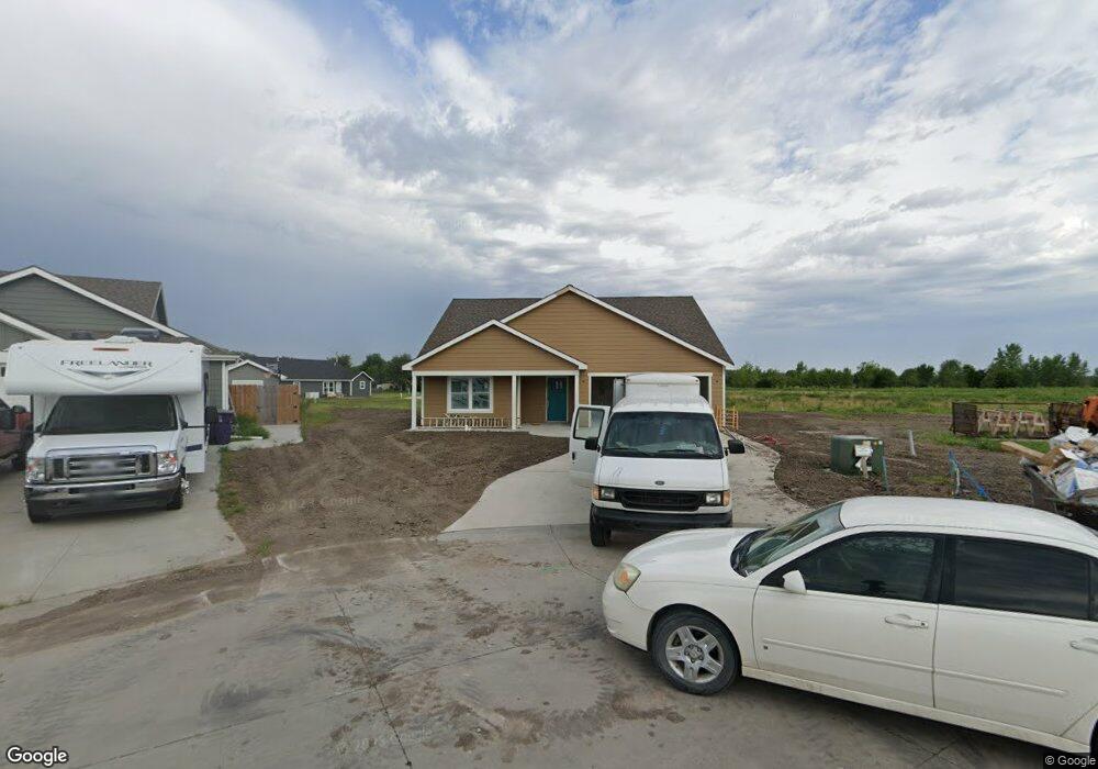
3905 Swift Ct Manhattan, KS 66502
Northview NeighborhoodEstimated Value: $301,000 - $369,000
3
Beds
2
Baths
1,689
Sq Ft
$203/Sq Ft
Est. Value
About This Home
This home is located at 3905 Swift Ct, Manhattan, KS 66502 and is currently estimated at $342,857, approximately $202 per square foot. 3905 Swift Ct is a home with nearby schools including Lee Elementary School, Dwight D. Eisenhower Middle School, and Manhattan High School.
Ownership History
Date
Name
Owned For
Owner Type
Purchase Details
Closed on
Jun 26, 2018
Sold by
Frey Property Development Corporation
Bought by
Irvine John G and Irvine Holly B
Current Estimated Value
Home Financials for this Owner
Home Financials are based on the most recent Mortgage that was taken out on this home.
Original Mortgage
$104,000
Interest Rate
4.44%
Mortgage Type
New Conventional
Purchase Details
Closed on
Apr 30, 2018
Sold by
Anders Trust Under Trust Agreement Dated
Bought by
Frey Property Development Corporation
Home Financials for this Owner
Home Financials are based on the most recent Mortgage that was taken out on this home.
Original Mortgage
$104,000
Interest Rate
4.44%
Mortgage Type
New Conventional
Create a Home Valuation Report for This Property
The Home Valuation Report is an in-depth analysis detailing your home's value as well as a comparison with similar homes in the area
Home Values in the Area
Average Home Value in this Area
Purchase History
| Date | Buyer | Sale Price | Title Company |
|---|---|---|---|
| Irvine John G | -- | -- | |
| Frey Property Development Corporation | -- | -- |
Source: Public Records
Mortgage History
| Date | Status | Borrower | Loan Amount |
|---|---|---|---|
| Previous Owner | Frey Property Development Corporation | $104,000 |
Source: Public Records
Tax History Compared to Growth
Tax History
| Year | Tax Paid | Tax Assessment Tax Assessment Total Assessment is a certain percentage of the fair market value that is determined by local assessors to be the total taxable value of land and additions on the property. | Land | Improvement |
|---|---|---|---|---|
| 2025 | $7,362 | $37,555 | $3,437 | $34,118 |
| 2024 | $7,362 | $35,879 | $3,433 | $32,446 |
| 2023 | $2,308 | $1,667 | $1,667 | $0 |
| 2022 | $2,183 | $806 | $806 | $0 |
| 2021 | $94 | $583 | $583 | $0 |
| 2020 | $91 | $583 | $583 | $0 |
| 2019 | $94 | $598 | $598 | $0 |
| 2018 | $91 | $613 | $613 | $0 |
| 2017 | $87 | $598 | $598 | $0 |
| 2016 | $85 | $594 | $594 | $0 |
| 2014 | -- | $0 | $0 | $0 |
Source: Public Records
Map
Nearby Homes
- 1001 Waxwing Dr
- 2814 Nelson's Landing
- 704 Goodrich Dr
- 3002 Brookville Dr
- 2710 Buttonwood Dr
- 2808 Brookpark Dr
- 2610 Buttonwood Dr
- 917 Mission Ave
- 2728 Buttonwood Dr
- 2730 Buttonwood Dr
- 701 Mission Ave
- 2604 Blueline Cir
- 517 Brookmont Dr
- 515 Brookmont Dr
- 425 Brookhaven Dr
- 2504 Church Cir
- 2407 Buttonwood Dr
- 2413 Charolais Ln
- 00000 Tuttle Creek Blvd
- 2208 Green Ave