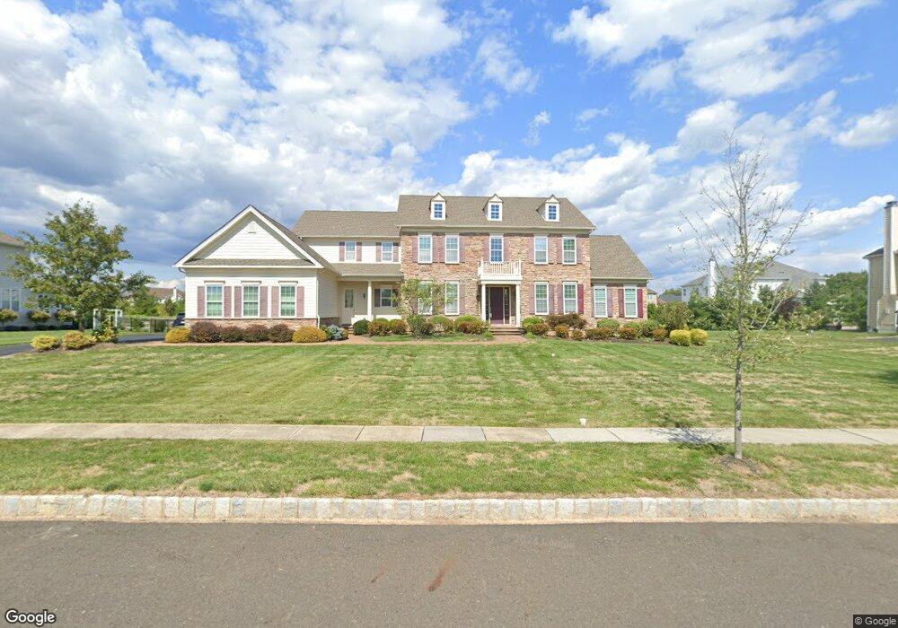
3906 Hillcrest Dr Furlong, PA 18925
Estimated Value: $1,516,000 - $1,736,546
4
Beds
5
Baths
5,251
Sq Ft
$308/Sq Ft
Est. Value
About This Home
This home is located at 3906 Hillcrest Dr, Furlong, PA 18925 and is currently estimated at $1,619,849, approximately $308 per square foot. 3906 Hillcrest Dr is a home with nearby schools including Bridge Valley Elementary School, Holicong Middle School, and Central Bucks High School - East.
Ownership History
Date
Name
Owned For
Owner Type
Purchase Details
Closed on
Oct 3, 2014
Sold by
Toll Pa Xi Lp
Bought by
Joseph James and James Laiju
Current Estimated Value
Home Financials for this Owner
Home Financials are based on the most recent Mortgage that was taken out on this home.
Original Mortgage
$417,000
Outstanding Balance
$231,743
Interest Rate
4.11%
Mortgage Type
New Conventional
Estimated Equity
$1,388,106
Create a Home Valuation Report for This Property
The Home Valuation Report is an in-depth analysis detailing your home's value as well as a comparison with similar homes in the area
Home Values in the Area
Average Home Value in this Area
Purchase History
| Date | Buyer | Sale Price | Title Company |
|---|---|---|---|
| Joseph James | $1,007,031 | None Available |
Source: Public Records
Mortgage History
| Date | Status | Borrower | Loan Amount |
|---|---|---|---|
| Open | Joseph James | $417,000 |
Source: Public Records
Tax History Compared to Growth
Tax History
| Year | Tax Paid | Tax Assessment Tax Assessment Total Assessment is a certain percentage of the fair market value that is determined by local assessors to be the total taxable value of land and additions on the property. | Land | Improvement |
|---|---|---|---|---|
| 2025 | $15,195 | $93,330 | $11,540 | $81,790 |
| 2024 | $15,195 | $93,330 | $11,540 | $81,790 |
| 2023 | $14,680 | $93,330 | $11,540 | $81,790 |
| 2022 | $14,504 | $93,330 | $11,540 | $81,790 |
| 2021 | $14,331 | $93,330 | $11,540 | $81,790 |
| 2020 | $14,331 | $93,330 | $11,540 | $81,790 |
| 2019 | $14,237 | $93,330 | $11,540 | $81,790 |
| 2018 | $14,237 | $93,330 | $11,540 | $81,790 |
| 2017 | $14,121 | $93,330 | $11,540 | $81,790 |
| 2016 | $14,261 | $93,330 | $11,540 | $81,790 |
| 2015 | -- | $93,330 | $11,540 | $81,790 |
| 2014 | -- | $9,240 | $9,240 | $0 |
Source: Public Records
Map
Nearby Homes
- 941 Penns Park
- 1221 Creek Rd
- 925 Park Ave
- 158 Grouse Cir
- 214 Dove Ct
- 183 Spring Meadow Cir
- 4697 Smith Rd
- 191 Cardinal Ct S
- 147 Raven Ct
- 148 Raven Ct
- 377 Spring Meadow Cir
- 495 Goldenrod Crossing W
- 529 Honeysuckle Ct
- 92 Acorn Ct E
- 561 Spring Meadow Cir
- 1341 Durham Rd
- 40 Hallowell Dr
- 4549 Lower Mountain Rd
- 2145 2nd St
- 4981 New Rd
- 3902 Hillcrest Dr
- 3910 Hillcrest Dr
- 3926 Hillcrest Dr
- 874 Green Meadow Dr
- 808 Green Meadow Dr
- 818 Smith Rd
- 802 Green Meadow Dr
- 864 Green Meadow Dr
- 3921 Hillcrest Dr
- 3917 Hillcrest Dr
- 818 Green Meadow Dr
- 862 Green Meadow Dr
- 3931 Hillcrest Dr
- 842 Smith Rd
- 842 Green Meadow Dr
- 3935 Hillcrest Dr
- 811 Green Meadow Dr
- 805 Green Meadow Dr
- 809 Smith Rd
- 805 Smith Rd