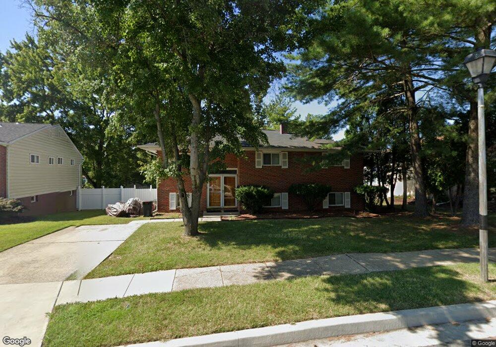
3908 Bryony Rd Randallstown, MD 21133
Estimated Value: $317,000 - $398,000
--
Bed
3
Baths
1,212
Sq Ft
$293/Sq Ft
Est. Value
About This Home
This home is located at 3908 Bryony Rd, Randallstown, MD 21133 and is currently estimated at $355,420, approximately $293 per square foot. 3908 Bryony Rd is a home located in Baltimore County with nearby schools including Randallstown Elementary School, Deer Park Middle Magnet School, and Randallstown High School.
Ownership History
Date
Name
Owned For
Owner Type
Purchase Details
Closed on
Aug 27, 2001
Sold by
Wilson James W
Bought by
Beauford Todd T
Current Estimated Value
Purchase Details
Closed on
Nov 28, 1994
Sold by
Shochat Jonathan
Bought by
Wilson James
Home Financials for this Owner
Home Financials are based on the most recent Mortgage that was taken out on this home.
Original Mortgage
$107,800
Interest Rate
8.91%
Create a Home Valuation Report for This Property
The Home Valuation Report is an in-depth analysis detailing your home's value as well as a comparison with similar homes in the area
Home Values in the Area
Average Home Value in this Area
Purchase History
| Date | Buyer | Sale Price | Title Company |
|---|---|---|---|
| Beauford Todd T | $114,000 | -- | |
| Wilson James | $113,500 | -- |
Source: Public Records
Mortgage History
| Date | Status | Borrower | Loan Amount |
|---|---|---|---|
| Previous Owner | Wilson James | $107,800 |
Source: Public Records
Tax History Compared to Growth
Tax History
| Year | Tax Paid | Tax Assessment Tax Assessment Total Assessment is a certain percentage of the fair market value that is determined by local assessors to be the total taxable value of land and additions on the property. | Land | Improvement |
|---|---|---|---|---|
| 2025 | $4,930 | $265,967 | -- | -- |
| 2024 | $4,930 | $243,100 | $74,300 | $168,800 |
| 2023 | $2,327 | $232,700 | $0 | $0 |
| 2022 | $4,629 | $222,300 | $0 | $0 |
| 2021 | $3,072 | $211,900 | $56,300 | $155,600 |
| 2020 | $3,072 | $208,833 | $0 | $0 |
| 2019 | $2,723 | $205,767 | $0 | $0 |
| 2018 | $2,741 | $202,700 | $56,300 | $146,400 |
| 2017 | $2,529 | $189,500 | $0 | $0 |
| 2016 | $2,210 | $176,300 | $0 | $0 |
| 2015 | $2,210 | $163,100 | $0 | $0 |
| 2014 | $2,210 | $163,100 | $0 | $0 |
Source: Public Records
Map
Nearby Homes
- 9044 Allenswood Rd
- 3854 Terka Cir
- 3805 Terka Cir
- 8908 Meadow Heights Rd
- 9012 Allenswood Rd
- 3907 Roxanne Rd
- 3705 Allenswood Ct
- 20 Sunrise Ct
- 3816 Cassandra Rd
- 28 Sunrise Ct
- 9112 Meadow Heights Rd
- 1205/99 Winands Rd
- 8806 Gilly Way Unit D
- 9202 Samoset Rd
- 8802 Falcon Ridge Dr
- 4105 Kiwi Ct
- 4135 Brookside Oaks
- 9208A Liberty Rd
- 3506 Bayer Ave
- 9210 Liberty Rd
- 3906 Bryony Rd
- 3910 Bryony Rd
- 5 Calgary Ct
- 3912 Bryony Rd
- 7 Calgary Ct
- 3904 Bryony Rd
- 3907 Bryony Rd
- 3914 Bryony Rd
- 3909 Bryony Rd
- 3 Calgary Ct
- 3902 Bryony Rd
- 9040 Meadow Heights Rd
- 3905 Bryony Rd
- 3911 Bryony Rd
- 9 Calgary Ct
- 9042 Meadow Heights Rd
- 9038 Meadow Heights Rd
- 3916 Bryony Rd
- 3913 Bryony Rd
- 3903 Bryony Rd