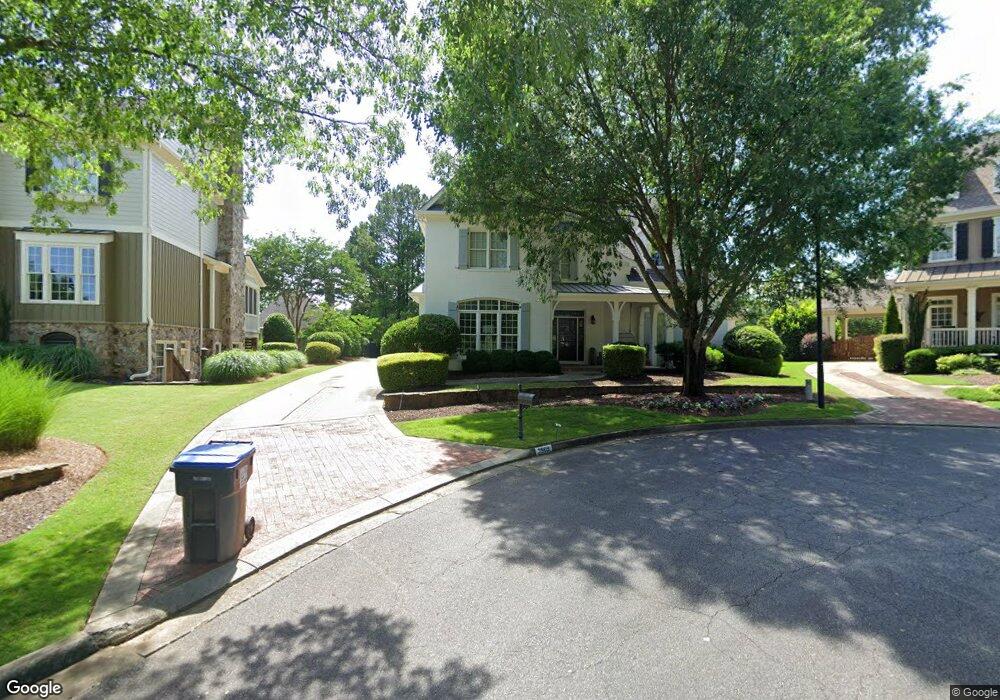
3909 Hazelhurst Dr Marietta, GA 30066
Sandy Plains NeighborhoodEstimated Value: $1,319,410 - $1,628,000
5
Beds
7
Baths
5,632
Sq Ft
$260/Sq Ft
Est. Value
About This Home
This home is located at 3909 Hazelhurst Dr, Marietta, GA 30066 and is currently estimated at $1,466,103, approximately $260 per square foot. 3909 Hazelhurst Dr is a home located in Cobb County with nearby schools including Rocky Mount Elementary School, Simpson Middle School, and Lassiter High School.
Ownership History
Date
Name
Owned For
Owner Type
Purchase Details
Closed on
Feb 25, 2003
Sold by
Carlson Builders Inc
Bought by
Vonhoffmann Christopher K
Current Estimated Value
Home Financials for this Owner
Home Financials are based on the most recent Mortgage that was taken out on this home.
Original Mortgage
$600,000
Outstanding Balance
$246,258
Interest Rate
5.38%
Mortgage Type
New Conventional
Estimated Equity
$1,219,845
Create a Home Valuation Report for This Property
The Home Valuation Report is an in-depth analysis detailing your home's value as well as a comparison with similar homes in the area
Home Values in the Area
Average Home Value in this Area
Purchase History
| Date | Buyer | Sale Price | Title Company |
|---|---|---|---|
| Vonhoffmann Christopher K | $750,000 | -- |
Source: Public Records
Mortgage History
| Date | Status | Borrower | Loan Amount |
|---|---|---|---|
| Open | Vonhoffmann Christopher K | $600,000 |
Source: Public Records
Tax History Compared to Growth
Tax History
| Year | Tax Paid | Tax Assessment Tax Assessment Total Assessment is a certain percentage of the fair market value that is determined by local assessors to be the total taxable value of land and additions on the property. | Land | Improvement |
|---|---|---|---|---|
| 2025 | $3,602 | $526,744 | $100,000 | $426,744 |
| 2024 | $11,971 | $466,596 | $100,000 | $366,596 |
| 2023 | $9,721 | $387,840 | $88,000 | $299,840 |
| 2022 | $10,339 | $387,840 | $88,000 | $299,840 |
| 2021 | $8,773 | $316,288 | $84,000 | $232,288 |
| 2020 | $8,773 | $316,288 | $84,000 | $232,288 |
| 2019 | $8,840 | $319,372 | $84,000 | $235,372 |
| 2018 | $8,840 | $319,372 | $84,000 | $235,372 |
| 2017 | $8,089 | $302,368 | $60,000 | $242,368 |
| 2016 | $8,095 | $302,368 | $60,000 | $242,368 |
| 2015 | $8,281 | $302,368 | $60,000 | $242,368 |
| 2014 | $6,646 | $232,532 | $0 | $0 |
Source: Public Records
Map
Nearby Homes
- 2696 S Arbor Dr
- 3901 Hazelhurst Dr
- 2578 Middle Coray Cir
- 4259 Arbor Club Dr
- 2713 Arbor Summit
- 3798 Upland Dr
- 4050 Idlewilde Meadows Dr NE
- 2402 Woodbridge Dr
- 4464 Windsor Oaks Dr
- 3505 Bonaire Ct
- 3130 Maley Ct
- 2610 Chadwick Rd
- 3851 Trickum Rd NE
- 2603 Chadwick Rd
- 3147 Swallow Dr NE
- 3043 Sawyer Trace NE
- 2855 Lamer Trace
- 2477 Bobbie Dr
- 2124 Lassiter Field Dr NE
- 3907 Hazelhurst Dr
- 3911 Hazelhurst Dr
- 3905 Hazelhurst Dr
- 3912 Hazelhurst Dr
- 2737 Pete Shaw Rd
- 0 Hazelhurst Dr NE Unit 7054377
- 0 Hazelhurst Dr NE Unit 8824975
- 0 Hazelhurst Dr NE Unit 8748083
- 0 Hazelhurst Dr NE Unit 8618721
- 0 Hazelhurst Dr NE Unit 8344569
- 0 Hazelhurst Dr NE Unit 7632434
- 0 Hazelhurst Dr NE Unit 7301545
- 2751 Hazelhurst Ct
- 2690 S Arbor Dr Unit 2
- 2692 S Arbor Dr Unit 2
- 2688 S Arbor Dr
- 2694 S Arbor Dr Unit 2
- 3906 Hazelhurst Dr
- 3904 Hazelhurst Dr
- 2753 Hazelhurst Ct