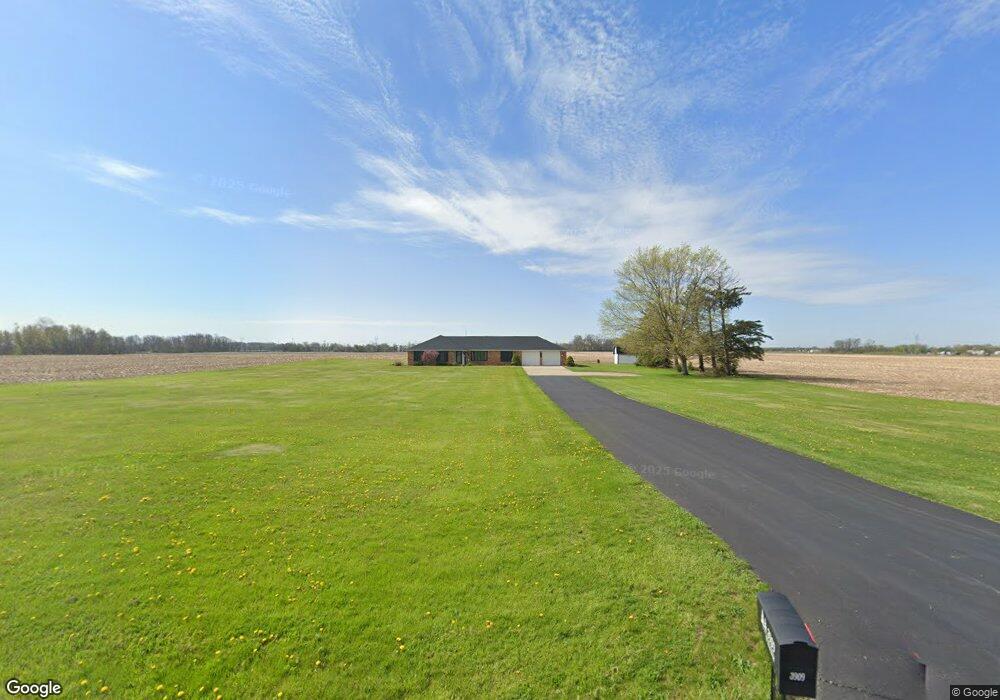
3909 W 53rd St Anderson, IN 46011
Estimated Value: $222,000 - $268,000
3
Beds
3
Baths
1,712
Sq Ft
$147/Sq Ft
Est. Value
About This Home
This home is located at 3909 W 53rd St, Anderson, IN 46011 and is currently estimated at $252,489, approximately $147 per square foot. 3909 W 53rd St is a home located in Madison County with nearby schools including Anderson Elementary School, Highland Middle School, and Anderson High School.
Ownership History
Date
Name
Owned For
Owner Type
Purchase Details
Closed on
Aug 18, 2023
Sold by
5B Farms Trust
Bought by
Cabiness Buddy E and Cabiness Hilary E
Current Estimated Value
Home Financials for this Owner
Home Financials are based on the most recent Mortgage that was taken out on this home.
Original Mortgage
$148,500
Outstanding Balance
$145,116
Interest Rate
6.81%
Mortgage Type
New Conventional
Estimated Equity
$107,373
Purchase Details
Closed on
Jan 27, 2023
Sold by
Conrad Don L and Conrad Linda I
Bought by
5B Farms Trust
Create a Home Valuation Report for This Property
The Home Valuation Report is an in-depth analysis detailing your home's value as well as a comparison with similar homes in the area
Home Values in the Area
Average Home Value in this Area
Purchase History
| Date | Buyer | Sale Price | Title Company |
|---|---|---|---|
| Cabiness Buddy E | -- | None Listed On Document | |
| 5B Farms Trust | -- | -- |
Source: Public Records
Mortgage History
| Date | Status | Borrower | Loan Amount |
|---|---|---|---|
| Open | Cabiness Buddy E | $148,500 |
Source: Public Records
Tax History Compared to Growth
Tax History
| Year | Tax Paid | Tax Assessment Tax Assessment Total Assessment is a certain percentage of the fair market value that is determined by local assessors to be the total taxable value of land and additions on the property. | Land | Improvement |
|---|---|---|---|---|
| 2024 | $3,353 | $150,900 | $16,900 | $134,000 |
| 2023 | $1,481 | $132,000 | $16,000 | $116,000 |
| 2022 | $1,615 | $142,300 | $15,400 | $126,900 |
| 2021 | $1,488 | $130,700 | $15,300 | $115,400 |
| 2020 | $1,418 | $124,600 | $14,500 | $110,100 |
| 2019 | $1,420 | $124,700 | $14,500 | $110,200 |
| 2018 | $1,322 | $114,500 | $14,500 | $100,000 |
| 2017 | $1,246 | $121,000 | $14,500 | $106,500 |
| 2016 | $1,246 | $121,000 | $14,500 | $106,500 |
| 2014 | $1,329 | $127,500 | $13,600 | $113,900 |
| 2013 | $1,329 | $127,500 | $13,600 | $113,900 |
Source: Public Records
Map
Nearby Homes
- 3640 W 67th St
- 5330 Dr Martin Luther King jr Blvd
- 4609 Doctor Martin Luther King Junior Blvd
- 2628 W 39th St
- 3905 Doctor Martin Luther King Junior Blvd
- 308 Bay Ridge Dr
- 421 Enchanted Dr
- 3504 W 25th St
- 5668 W 250 S
- 5260 S State Road 67
- 0 Oak Ct Unit LotWP001 24609107
- 0 Oak Ct Unit MBR22059682
- 1247 Flint Ct
- 6216 Rocky Rd
- 6201 Arrowhead Dr
- 2121 Euclid Dr
- 2015 Rosewood Dr
- 2401 W 27th St
- 1015 Pebble Ct
- 2006 Costello Dr