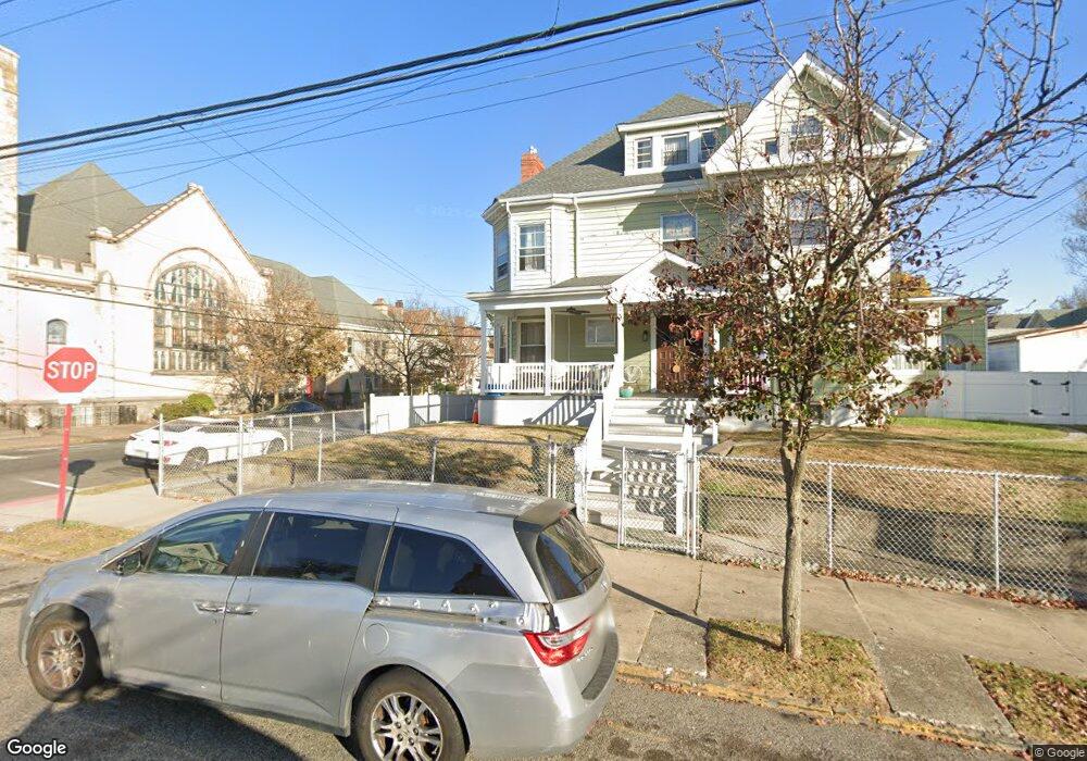
391 15th Ave Unit 395 Paterson, NJ 07504
Eastside NeighborhoodEstimated Value: $526,000 - $783,000
--
Bed
--
Bath
4,176
Sq Ft
$158/Sq Ft
Est. Value
About This Home
This home is located at 391 15th Ave Unit 395, Paterson, NJ 07504 and is currently estimated at $659,572, approximately $157 per square foot. 391 15th Ave Unit 395 is a home located in Passaic County with nearby schools including Edward W. Kilpatrick School of Discovery, Dale Avenue Elementary School, and Paterson School 6.
Ownership History
Date
Name
Owned For
Owner Type
Purchase Details
Closed on
Mar 30, 2016
Sold by
Ball Jaime and Ball Julio
Bought by
Acosta Orlando and Perez Carmen K
Current Estimated Value
Home Financials for this Owner
Home Financials are based on the most recent Mortgage that was taken out on this home.
Original Mortgage
$370,624
Interest Rate
3.42%
Mortgage Type
FHA
Create a Home Valuation Report for This Property
The Home Valuation Report is an in-depth analysis detailing your home's value as well as a comparison with similar homes in the area
Home Values in the Area
Average Home Value in this Area
Purchase History
| Date | Buyer | Sale Price | Title Company |
|---|---|---|---|
| Acosta Orlando | $275,000 | First American Title Ins Co |
Source: Public Records
Mortgage History
| Date | Status | Borrower | Loan Amount |
|---|---|---|---|
| Previous Owner | Acosta Orlando | $370,624 |
Source: Public Records
Tax History Compared to Growth
Tax History
| Year | Tax Paid | Tax Assessment Tax Assessment Total Assessment is a certain percentage of the fair market value that is determined by local assessors to be the total taxable value of land and additions on the property. | Land | Improvement |
|---|---|---|---|---|
| 2025 | $18,240 | $358,000 | $73,000 | $285,000 |
| 2024 | $17,553 | $358,000 | $73,000 | $285,000 |
| 2022 | $16,618 | $358,000 | $73,000 | $285,000 |
| 2021 | $16,024 | $358,000 | $73,000 | $285,000 |
| 2020 | $14,947 | $358,000 | $73,000 | $285,000 |
| 2019 | $14,481 | $350,300 | $72,000 | $278,300 |
| 2018 | $14,938 | $345,300 | $71,400 | $273,900 |
| 2017 | $14,256 | $342,700 | $71,000 | $271,700 |
| 2016 | $15,325 | $353,200 | $66,000 | $287,200 |
| 2015 | $14,509 | $353,200 | $66,000 | $287,200 |
| 2014 | $12,412 | $428,000 | $171,000 | $257,000 |
Source: Public Records
Map
Nearby Homes
- 361 15th Ave
- 645 E 26th St
- 444-446 15th Ave
- 444 15th Ave Unit 446
- 324 E 30th St Unit 326
- 440 Park Ave
- 712 E 27th St
- 366-368 Park Ave
- 693 E 28th St Unit 695
- 724 E 27th St
- 475 Park Ave
- 676 E 24th St
- 178-180 17th Ave
- 277 E 32nd St Unit 279
- 599 E 25th St
- 670-672 E 23rd St
- 777 E 26th St
- 282-284 17th Ave
- 442 E 30th St
- 523 Park Ave
- 391-395 15th Ave
- 397 15th Ave Unit 401
- 643 E 27th St
- 396 15th Ave
- 641 E 27th St Unit 643
- 641-643 E 27th St
- 402 15th Ave
- 403 15th Ave Unit 405
- 392 15th Ave Unit 394
- 404 15th Ave Unit 406
- 639 E 27th St
- 620 E 28th St
- 404-406 15th Ave
- 386 15th Ave
- 640 E 27th St
- 635 E 27th St
- 380 15th Ave Unit 382
- 377 15th Ave
- 377 15th Ave Unit 3
- 633 E 27th St