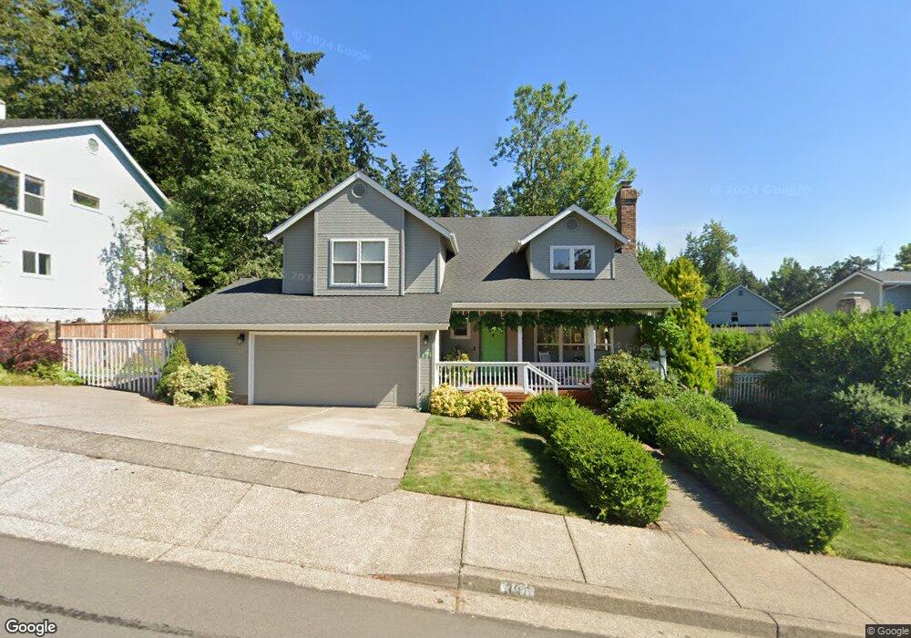
391 Dellwood Dr Eugene, OR 97405
Crest Drive NeighborhoodEstimated Value: $566,000 - $598,000
3
Beds
3
Baths
1,791
Sq Ft
$323/Sq Ft
Est. Value
About This Home
This home is located at 391 Dellwood Dr, Eugene, OR 97405 and is currently estimated at $579,259, approximately $323 per square foot. 391 Dellwood Dr is a home located in Lane County with nearby schools including Edgewood Community Elementary School, Spencer Butte Middle School, and South Eugene High School.
Ownership History
Date
Name
Owned For
Owner Type
Purchase Details
Closed on
Feb 6, 2013
Sold by
Thomas Robert James and Thomas Jean Ellen
Bought by
Thomas Robert James and Thomas Jean Ellen
Current Estimated Value
Purchase Details
Closed on
Nov 12, 2010
Sold by
Thomas Robert James and Thomas Jean Ellen
Bought by
Thomas Robert James and Thomas Jean Ellen
Home Financials for this Owner
Home Financials are based on the most recent Mortgage that was taken out on this home.
Original Mortgage
$72,200
Interest Rate
4.23%
Mortgage Type
New Conventional
Create a Home Valuation Report for This Property
The Home Valuation Report is an in-depth analysis detailing your home's value as well as a comparison with similar homes in the area
Home Values in the Area
Average Home Value in this Area
Purchase History
| Date | Buyer | Sale Price | Title Company |
|---|---|---|---|
| Thomas Robert James | -- | None Available | |
| Thomas Robert James | -- | First American Title |
Source: Public Records
Mortgage History
| Date | Status | Borrower | Loan Amount |
|---|---|---|---|
| Closed | Thomas Robert James | $72,200 |
Source: Public Records
Tax History
| Year | Tax Paid | Tax Assessment Tax Assessment Total Assessment is a certain percentage of the fair market value that is determined by local assessors to be the total taxable value of land and additions on the property. | Land | Improvement |
|---|---|---|---|---|
| 2025 | $7,847 | $402,721 | -- | -- |
| 2024 | $7,749 | $390,992 | -- | -- |
| 2023 | $7,749 | $379,604 | $0 | $0 |
| 2022 | $7,259 | $368,548 | $0 | $0 |
| 2021 | $6,702 | $357,814 | $0 | $0 |
| 2020 | $6,540 | $347,393 | $0 | $0 |
| 2019 | $6,365 | $337,275 | $0 | $0 |
| 2018 | $5,960 | $317,915 | $0 | $0 |
| 2017 | $5,547 | $317,915 | $0 | $0 |
| 2016 | $5,344 | $308,655 | $0 | $0 |
| 2015 | $5,204 | $299,665 | $0 | $0 |
| 2014 | $5,136 | $290,937 | $0 | $0 |
Source: Public Records
Map
Nearby Homes
- 357 W 37th Ave
- 3593 Lawrence St
- 275 W 37th Ave
- 3854 Monroe St
- 806 Sundance St
- 605 Fulvue Dr
- 0 Hidden Meadows
- 4103 Brae Burn Dr
- 1 Storey Blvd
- 2 Storey Blvd
- 365 Brae Burn Dr
- 0 Pine View Ct Unit 758820410
- 170 E 40th Ave
- 4020 Pearl St
- 3160 Whitten Dr
- 275 E 39th Ave
- 17 Westbrook Way
- 21 Westbrook Way
- 3087 Whitbeck Blvd
- 36 Westbrook Way
- 389 Dellwood Dr
- 393 Dellwood Dr
- 3734 Lawrence St
- 392 Dellwood Dr
- 390 Dellwood Dr
- 387 Dellwood Dr
- 405 Dellwood Dr
- 388 Dellwood Dr
- 386 Dellwood Dr
- 415 Dellwood Dr
- 396 Dellwood Dr
- 3711 Lawrence St
- 381 Dellwood Dr
- 398 Dellwood Dr
- 382 Dellwood Dr
- 475 Dellwood Dr
- 423 Dellwood Dr
- 382 W 37th Ave
- 0 W 37th Ave
- 3841 Monroe St
Your Personal Tour Guide
Ask me questions while you tour the home.