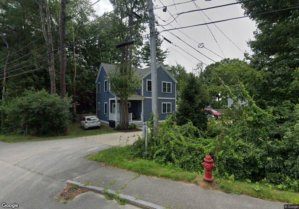
391 Dover Point Rd Unit 1 Dover, NH 03820
Dover Point NeighborhoodEstimated Value: $952,862 - $1,025,000
3
Beds
3
Baths
2,128
Sq Ft
$471/Sq Ft
Est. Value
About This Home
This home is located at 391 Dover Point Rd Unit 1, Dover, NH 03820 and is currently estimated at $1,003,216, approximately $471 per square foot. 391 Dover Point Rd Unit 1 is a home located in Strafford County with nearby schools including Garrison School, Dover Middle School, and Dover Senior High School.
Ownership History
Date
Name
Owned For
Owner Type
Purchase Details
Closed on
Mar 22, 2018
Sold by
Kerr-Richenburg Margaret
Bought by
M Kerr Richenburg Ret
Current Estimated Value
Purchase Details
Closed on
Jun 30, 2017
Sold by
Coakley Ronald C and Coakley Bianca A
Bought by
Karr-Richenburg Margaret
Purchase Details
Closed on
Feb 24, 2012
Sold by
Coakley Roanld C and Coakley Bianca A
Bought by
Bianca A Coakley Ret and Coakley Ronald C
Purchase Details
Closed on
Jun 17, 1996
Sold by
Wood Est Lawrence J
Bought by
Coakley Ronald C and Coakley Bianca A
Home Financials for this Owner
Home Financials are based on the most recent Mortgage that was taken out on this home.
Original Mortgage
$180,000
Interest Rate
7.97%
Create a Home Valuation Report for This Property
The Home Valuation Report is an in-depth analysis detailing your home's value as well as a comparison with similar homes in the area
Home Values in the Area
Average Home Value in this Area
Purchase History
| Date | Buyer | Sale Price | Title Company |
|---|---|---|---|
| M Kerr Richenburg Ret | -- | -- | |
| Karr-Richenburg Margaret | $577,000 | -- | |
| Bianca A Coakley Ret | -- | -- | |
| Coakley Ronald C | $225,000 | -- |
Source: Public Records
Mortgage History
| Date | Status | Borrower | Loan Amount |
|---|---|---|---|
| Previous Owner | Coakley Ronald C | $180,000 |
Source: Public Records
Tax History Compared to Growth
Tax History
| Year | Tax Paid | Tax Assessment Tax Assessment Total Assessment is a certain percentage of the fair market value that is determined by local assessors to be the total taxable value of land and additions on the property. | Land | Improvement |
|---|---|---|---|---|
| 2024 | $19,260 | $1,060,000 | $644,000 | $416,000 |
| 2023 | $17,376 | $929,200 | $561,000 | $368,200 |
| 2022 | $16,543 | $833,800 | $502,000 | $331,800 |
| 2021 | $16,025 | $738,500 | $450,000 | $288,500 |
| 2020 | $15,715 | $632,400 | $381,000 | $251,400 |
| 2019 | $15,371 | $610,200 | $364,000 | $246,200 |
| 2018 | $14,501 | $581,900 | $342,000 | $239,900 |
| 2017 | $14,221 | $549,700 | $317,000 | $232,700 |
| 2016 | $13,721 | $521,900 | $313,400 | $208,500 |
| 2015 | $13,350 | $501,700 | $298,000 | $203,700 |
| 2014 | $13,049 | $501,700 | $298,000 | $203,700 |
| 2011 | $12,221 | $486,500 | $298,000 | $188,500 |
Source: Public Records
Map
Nearby Homes
- 0 Cote Dr
- 27 Wentworth Terrace
- 18 Little Bay Dr
- 33 Little Bay Dr
- SLIP 15 Little Bay Marina
- 41 Clearwater Dr
- Slip B18 Little Bay
- 71 Shipwright Way
- 245 Piscataqua Rd
- 10 Shipwright Way
- 708 River Rd Unit 2
- 708 River Rd Unit 3
- 4 Shore Ln
- 263 Durham Point Rd
- 25 Fosters Dr
- 0 Franks Fort Island Unit 1631886
- 18 Governor Hill Rd
- 1708 State Rd
- 956 Main St
- 850 Main St
- 391 Dover Point Rd Unit 2
- 391 Dover Point Rd Unit B
- 393 Dover Point Rd
- 61 Boston Harbor Rd
- 55 Boston Harbor Rd
- 57 Boston Harbor Rd
- 53 Boston Harbor Rd
- 395 Dover Point Rd
- 49 Boston Harbor Rd
- 39 Boston Harbor Rd
- 397 Dover Point Rd
- 45 Boston Harbor Rd
- 43 Boston Harbor Rd
- 41 Boston Harbor Rd
- 401 Dover Point Rd
- 403 Dover Point Rd
- 35 Boston Harbor Rd
- 33A Boston Harbor Rd
- 33 Boston Harbor Rd
- 33 Boston Harbor Rd