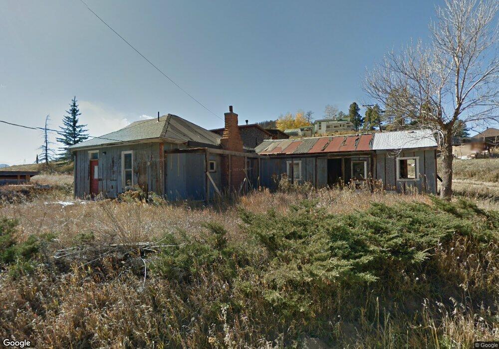
391 Grove St Boulder, CO 80302
Gold Hill NeighborhoodEstimated Value: $404,298 - $625,000
3
Beds
2
Baths
1,136
Sq Ft
$479/Sq Ft
Est. Value
About This Home
This home is located at 391 Grove St, Boulder, CO 80302 and is currently estimated at $544,575, approximately $479 per square foot. 391 Grove St is a home located in Boulder County with nearby schools including Gold Hill Elementary School, Casey Middle School, and Boulder High School.
Ownership History
Date
Name
Owned For
Owner Type
Purchase Details
Closed on
Jan 14, 2005
Sold by
Walter Darlene
Bought by
Walter Robert Dale
Current Estimated Value
Purchase Details
Closed on
Sep 23, 1998
Sold by
Walter Darlene
Bought by
Walter Robert Dale
Purchase Details
Closed on
Nov 29, 1985
Bought by
Walter Robert Dale
Purchase Details
Closed on
Apr 20, 1977
Bought by
Walter Robert Dale
Create a Home Valuation Report for This Property
The Home Valuation Report is an in-depth analysis detailing your home's value as well as a comparison with similar homes in the area
Home Values in the Area
Average Home Value in this Area
Purchase History
| Date | Buyer | Sale Price | Title Company |
|---|---|---|---|
| Walter Robert Dale | -- | -- | |
| Walter Robert Dale | -- | -- | |
| Walter Robert Dale | $32,900 | -- | |
| Walter Robert Dale | $27,000 | -- |
Source: Public Records
Tax History Compared to Growth
Tax History
| Year | Tax Paid | Tax Assessment Tax Assessment Total Assessment is a certain percentage of the fair market value that is determined by local assessors to be the total taxable value of land and additions on the property. | Land | Improvement |
|---|---|---|---|---|
| 2025 | $1,573 | $19,587 | $1,631 | $17,956 |
| 2024 | $1,573 | $19,587 | $1,631 | $17,956 |
| 2023 | $1,546 | $18,016 | $1,930 | $19,772 |
| 2022 | $1,624 | $17,591 | $1,307 | $16,284 |
| 2021 | $1,427 | $18,096 | $1,344 | $16,752 |
| 2020 | $1,202 | $15,065 | $3,003 | $12,062 |
| 2019 | $1,182 | $15,065 | $3,003 | $12,062 |
| 2018 | $862 | $10,814 | $3,024 | $7,790 |
| 2017 | $835 | $11,956 | $3,343 | $8,613 |
| 2016 | $804 | $10,085 | $2,706 | $7,379 |
| 2015 | $758 | $8,589 | $3,184 | $5,405 |
| 2014 | $587 | $7,560 | $2,801 | $4,759 |
Source: Public Records
Map
Nearby Homes
- 501 Main St
- 855 Main St
- 360 Boulder St
- 1050 Pine St
- 783 Dixon Rd
- 98 Rim Rd
- 89 Gold Trail
- 0 Gold Trail
- 61 Rim Rd
- 280 Rim Rd
- 00 County Rd 89 Unit 237
- 718 Emerson Gulch Rd
- 300 Shining Star Trail
- 300 Shining Star Trail Unit A
- 8493 Lefthand Canyon Dr
- 6801 Sunshine Canyon Dr
- 6055 Fourmile Canyon Dr
- 7893 Fourmile Canyon Dr
- 6553 Sunshine Canyon Dr
- 6415 Sunshine Canyon Dr