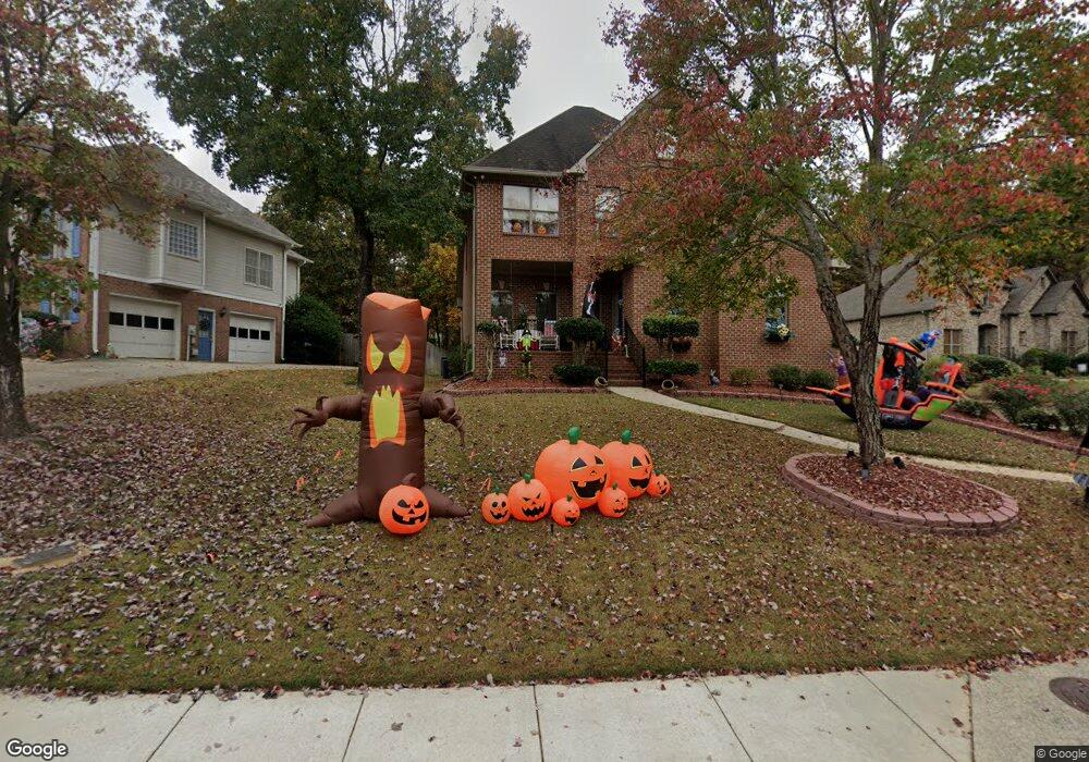
391 Lane Park Trail Maylene, AL 35114
Estimated Value: $400,000 - $431,000
--
Bed
--
Bath
2,403
Sq Ft
$173/Sq Ft
Est. Value
About This Home
This home is located at 391 Lane Park Trail, Maylene, AL 35114 and is currently estimated at $415,598, approximately $172 per square foot. 391 Lane Park Trail is a home located in Shelby County with nearby schools including Thompson Intermediate School, Thompson Middle School, and Thompson High School.
Ownership History
Date
Name
Owned For
Owner Type
Purchase Details
Closed on
Jun 20, 2006
Sold by
Massie Louis V and Massie Sharon B
Bought by
Burbank Chris R and Burbank Darla H
Current Estimated Value
Home Financials for this Owner
Home Financials are based on the most recent Mortgage that was taken out on this home.
Original Mortgage
$239,875
Outstanding Balance
$140,869
Interest Rate
6.55%
Mortgage Type
Unknown
Estimated Equity
$274,729
Purchase Details
Closed on
Aug 26, 2004
Sold by
Mayhall Builders Inc
Bought by
Burbank Christopher R and Burbank Daria H
Home Financials for this Owner
Home Financials are based on the most recent Mortgage that was taken out on this home.
Original Mortgage
$182,400
Interest Rate
5.97%
Mortgage Type
Unknown
Create a Home Valuation Report for This Property
The Home Valuation Report is an in-depth analysis detailing your home's value as well as a comparison with similar homes in the area
Home Values in the Area
Average Home Value in this Area
Purchase History
| Date | Buyer | Sale Price | Title Company |
|---|---|---|---|
| Burbank Chris R | $252,500 | None Available | |
| Burbank Christopher R | $228,000 | -- |
Source: Public Records
Mortgage History
| Date | Status | Borrower | Loan Amount |
|---|---|---|---|
| Open | Burbank Chris R | $239,875 | |
| Closed | Burbank Christopher R | $182,400 | |
| Closed | Burbank Christopher R | $34,200 |
Source: Public Records
Tax History Compared to Growth
Tax History
| Year | Tax Paid | Tax Assessment Tax Assessment Total Assessment is a certain percentage of the fair market value that is determined by local assessors to be the total taxable value of land and additions on the property. | Land | Improvement |
|---|---|---|---|---|
| 2024 | $1,999 | $37,020 | $0 | $0 |
| 2023 | $1,902 | $35,980 | $0 | $0 |
| 2022 | $1,615 | $30,660 | $0 | $0 |
| 2021 | $1,492 | $28,380 | $0 | $0 |
| 2020 | $1,473 | $28,040 | $0 | $0 |
| 2019 | $1,455 | $27,700 | $0 | $0 |
| 2017 | $1,327 | $25,340 | $0 | $0 |
| 2015 | $1,277 | $24,400 | $0 | $0 |
| 2014 | $1,256 | $24,020 | $0 | $0 |
Source: Public Records
Map
Nearby Homes
- 207 Grande View Pkwy
- 1217 Grande View Ln
- 1215 Grande View Ln Unit 820
- 111 Grande View Cir
- 117 Big Oak Dr
- 1210 Grande View Ln Unit 804
- 1208 Grande View Ln Unit 803
- 61 Maylene Dr
- 213 Grande View Cir Unit 637
- 10141 Highway 17 Unit 20
- 1064 Grande View Pass Unit RESIDENTIAL LOT / 91
- 1724 Butler Rd
- 1077 Grande View Pass
- 1161 Butler Rd
- 119 Carriage Dr
- 104 Sunflower Place
- 104 Kentwood Trail Cir
- 316 Willow Glen Ct
- 424 Acer Trail
- 189 Sweetbay Dr
- 383 Lane Park Trail
- 397 Lane Park Trail
- 377 Lane Park Trail
- 244 Lane Park Cir
- 241 Lane Park Cir
- 241 Lane Park Cir
- 401 Lane Park Trail
- 371 Lane Park Trail
- 392 Lane Park Trail
- 384 Lane Park Trail
- 396 Lane Park Trail
- 388 Lane Park Trail
- 404 Lane Park Trail
- 384 Lane Park Trail
- 380 Lane Park Trail
- 365 Lane Park Trail
- 240 Lane Park Cir
- 237 Lane Park Cir
- 400 Lane Park Trail
- 376 Lane Park Trail
