Estimated Value: $404,300 - $459,000
3
Beds
3
Baths
2,398
Sq Ft
$181/Sq Ft
Est. Value
About This Home
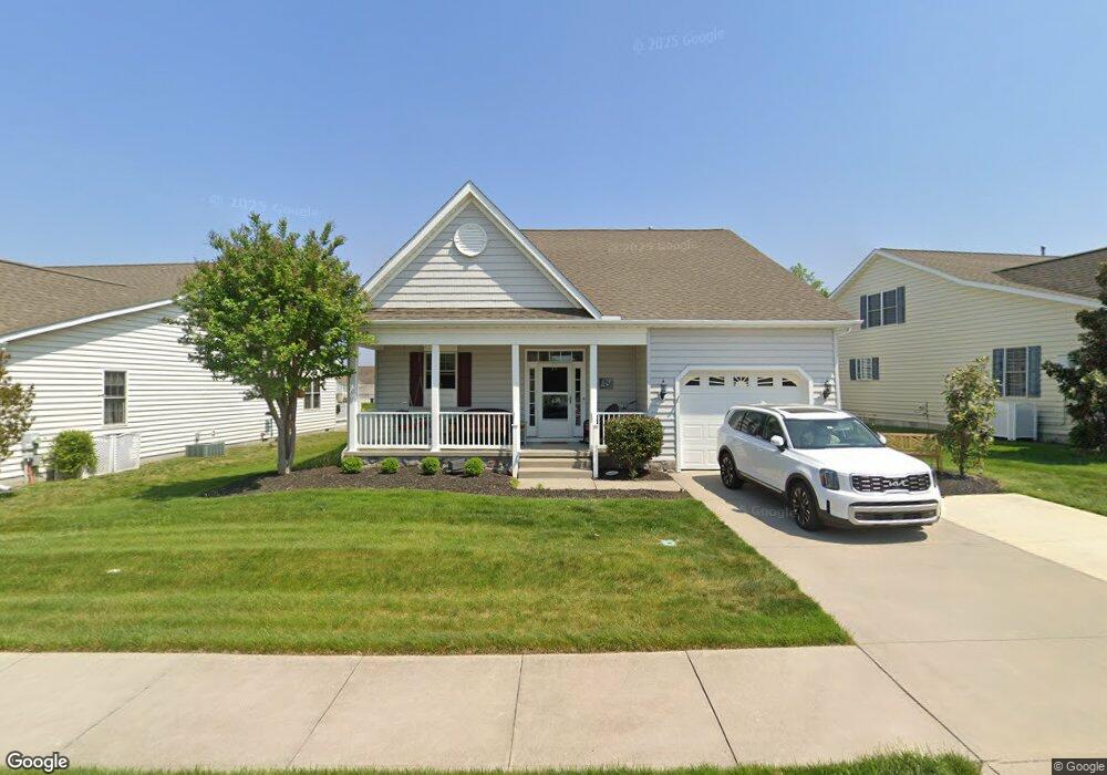
This home is located at 391 N Red Haven Ln Unit LOT119, Dover, DE 19901 and is currently estimated at $433,825, approximately $180 per square foot. 391 N Red Haven Ln Unit LOT119 is a home located in Kent County with nearby schools including Nellie Hughes Stokes Elementary School, Fred Fifer Middle School, and Caesar Rodney High School.
Ownership History
Date
Name
Owned For
Owner Type
Purchase Details
Closed on
Aug 15, 2008
Sold by
Harrington Development Co Llc
Bought by
Houck Douglas L and Houck Margaret A
Current Estimated Value
Home Financials for this Owner
Home Financials are based on the most recent Mortgage that was taken out on this home.
Original Mortgage
$80,000
Outstanding Balance
$52,686
Interest Rate
6.4%
Mortgage Type
Purchase Money Mortgage
Estimated Equity
$381,139
Create a Home Valuation Report for This Property
The Home Valuation Report is an in-depth analysis detailing your home's value as well as a comparison with similar homes in the area
Home Values in the Area
Average Home Value in this Area
Purchase History
| Date | Buyer | Sale Price | Title Company |
|---|---|---|---|
| Houck Douglas L | $297,669 | None Available |
Source: Public Records
Mortgage History
| Date | Status | Borrower | Loan Amount |
|---|---|---|---|
| Open | Houck Douglas L | $80,000 |
Source: Public Records
Tax History Compared to Growth
Tax History
| Year | Tax Paid | Tax Assessment Tax Assessment Total Assessment is a certain percentage of the fair market value that is determined by local assessors to be the total taxable value of land and additions on the property. | Land | Improvement |
|---|---|---|---|---|
| 2025 | $1,549 | $408,500 | $72,700 | $335,800 |
| 2024 | $1,549 | $404,100 | $72,700 | $331,400 |
| 2023 | $1,213 | $49,600 | $3,500 | $46,100 |
| 2022 | $1,134 | $49,600 | $3,500 | $46,100 |
| 2021 | $1,190 | $49,600 | $3,500 | $46,100 |
| 2020 | $1,150 | $49,600 | $3,500 | $46,100 |
| 2019 | $1,102 | $49,600 | $3,500 | $46,100 |
| 2018 | $1,068 | $49,600 | $3,500 | $46,100 |
| 2017 | $1,014 | $49,600 | $0 | $0 |
| 2016 | $967 | $49,600 | $0 | $0 |
| 2015 | $882 | $49,600 | $0 | $0 |
| 2014 | $877 | $49,600 | $0 | $0 |
Source: Public Records
Map
Nearby Homes
- 45 Harcrest Ct
- 21 Starfire Ct
- 133 Candor Ln
- 3182 Upper King Rd
- 1022 Fawn Haven Walk
- 98 Walnut Shade Rd
- 104 Lake Front Dr
- 1224 Barney Jenkins Rd
- 850 Brookfield Dr
- 1731 Upper King Rd
- 870 Brookfield Dr
- 21 Crowberry Dr
- Aster Plan at Brookfield
- Linden Plan at Brookfield
- Beech Plan at Brookfield
- Garrett Plan at Brookfield
- Sycamore Plan at Brookfield
- Red Maple Plan at Brookfield
- 78 Cove Rd
- Lot 22 Bee Brookfield Dr
- 391 N Red Haven Ln
- 407 N Red Haven Ln
- 86 N Red Haven Ln
- 381 N Red Haven Ln
- 419 N Red Haven Ln
- 369 N Red Haven Ln
- 382 N Red Haven Ln
- 357 N Red Haven Ln
- 392 N Red Haven Ln
- 370 N Red Haven Ln
- 404 N Red Haven Ln
- 412 N Red Haven Ln
- 358 N Red Haven Ln
- 65 Fuji Ct
- 345 N Red Haven Ln
- 57 Fuji Ct
- 348 N Red Haven Ln
- 47 Fuji Ct
- 333 N Red Haven Ln
- 336 N Red Haven Ln