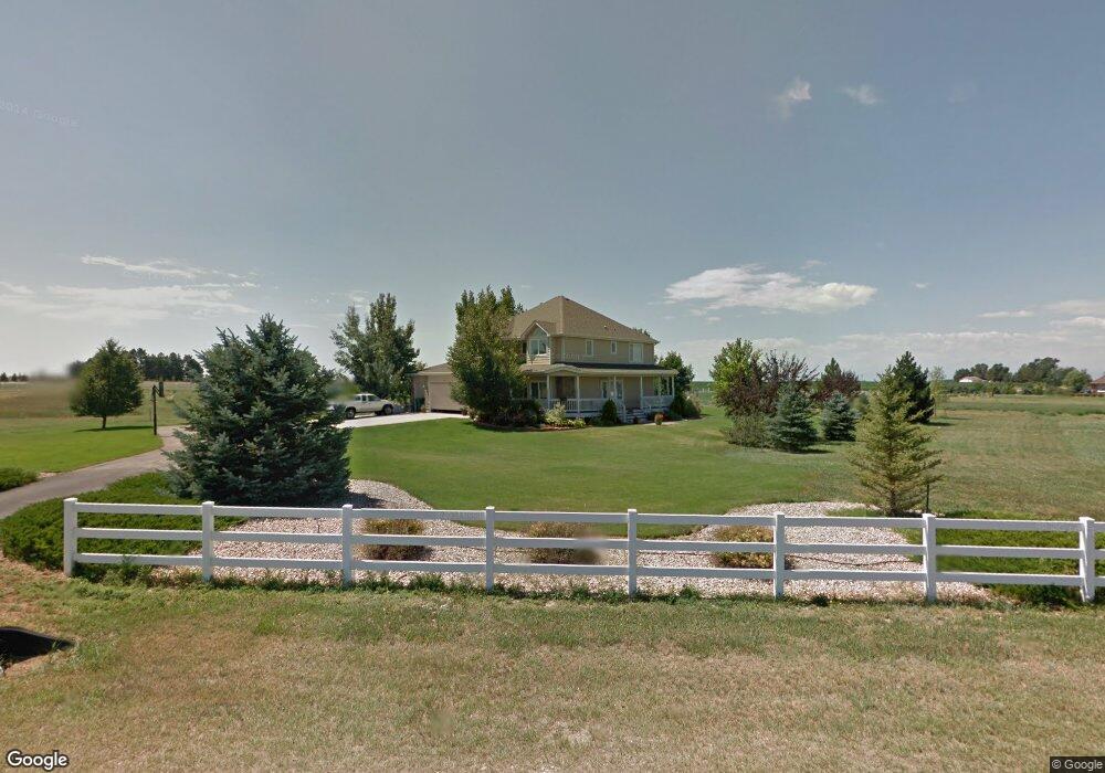
39118 Longs Peak Ct Severance, CO 80610
Estimated Value: $1,176,945 - $1,378,000
3
Beds
4
Baths
2,710
Sq Ft
$472/Sq Ft
Est. Value
About This Home
This home is located at 39118 Longs Peak Ct, Severance, CO 80610 and is currently estimated at $1,279,648, approximately $472 per square foot. 39118 Longs Peak Ct is a home located in Weld County with nearby schools including Range View Elementary School, Severance Middle School, and Lopez Continuation High School.
Ownership History
Date
Name
Owned For
Owner Type
Purchase Details
Closed on
May 31, 2001
Sold by
The Land Exchange Inc
Bought by
Barstow Marvin A and Kness Rick J
Current Estimated Value
Home Financials for this Owner
Home Financials are based on the most recent Mortgage that was taken out on this home.
Original Mortgage
$356,000
Interest Rate
8%
Purchase Details
Closed on
May 25, 2001
Sold by
Barstow Marvin A and Kness Rick J
Bought by
Crownhart Christopher A and Crownhart Amy M
Home Financials for this Owner
Home Financials are based on the most recent Mortgage that was taken out on this home.
Original Mortgage
$356,000
Interest Rate
8%
Purchase Details
Closed on
Jan 4, 2000
Sold by
Hh Group Inc
Bought by
The Land Exchange Inc
Home Financials for this Owner
Home Financials are based on the most recent Mortgage that was taken out on this home.
Original Mortgage
$333,720
Interest Rate
7.76%
Create a Home Valuation Report for This Property
The Home Valuation Report is an in-depth analysis detailing your home's value as well as a comparison with similar homes in the area
Home Values in the Area
Average Home Value in this Area
Purchase History
| Date | Buyer | Sale Price | Title Company |
|---|---|---|---|
| Barstow Marvin A | -- | -- | |
| Crownhart Christopher A | $459,900 | -- | |
| The Land Exchange Inc | $120,000 | -- |
Source: Public Records
Mortgage History
| Date | Status | Borrower | Loan Amount |
|---|---|---|---|
| Previous Owner | Barstow Marvin A | $356,000 | |
| Previous Owner | Crownhart Christopher A | $356,900 | |
| Previous Owner | The Land Exchange Inc | $333,720 | |
| Closed | The Land Exchange Inc | $15,000 |
Source: Public Records
Tax History Compared to Growth
Tax History
| Year | Tax Paid | Tax Assessment Tax Assessment Total Assessment is a certain percentage of the fair market value that is determined by local assessors to be the total taxable value of land and additions on the property. | Land | Improvement |
|---|---|---|---|---|
| 2025 | $5,008 | $69,420 | $18,110 | $51,310 |
| 2024 | $5,008 | $69,420 | $18,110 | $51,310 |
| 2023 | $4,601 | $56,160 | $18,320 | $37,840 |
| 2022 | $4,755 | $48,480 | $13,870 | $34,610 |
| 2021 | $4,435 | $49,870 | $14,260 | $35,610 |
| 2020 | $3,743 | $42,900 | $11,440 | $31,460 |
| 2019 | $3,710 | $42,900 | $11,440 | $31,460 |
| 2018 | $3,654 | $40,010 | $10,660 | $29,350 |
| 2017 | $3,866 | $40,010 | $10,660 | $29,350 |
| 2016 | $3,756 | $39,260 | $12,340 | $26,920 |
| 2015 | $3,496 | $39,260 | $12,340 | $26,920 |
| 2014 | $2,902 | $30,570 | $9,910 | $20,660 |
Source: Public Records
Map
Nearby Homes
- 39230 Longs Peak Ct
- 39828 Hilltop Cir
- 39884 Ridgecrest Ct
- 13258 County Road 84
- 2657 Cutter Dr
- 2651 Cutter Dr
- 2652 Cutter Dr
- 0 4th Ave
- 1432 Red Fox Cir
- 1303 Park Ridge Dr
- 2660 Cutter Dr
- 2648 Cutter Dr
- 1587 Lake Point Way
- 2664 Cutter Dr
- 2668 Cutter Dr
- 2550 Branding Iron Dr
- 326 Central Ave
- 320 Central Ave
- 2030 Trail Ridge Cir
- 1110 Green Ridge Dr
- 39236 Longs Peak Ct
- 39112 Rangeview Dr
- 39231 Rangeview Dr
- 39127 Rangeview Dr
- 39342 Rangeview Dr
- 39006 Rangeview Dr
- 11570 County Road 80
- 39219 Parkland Ct
- 39337 Rangeview Dr
- 39351 Hilltop Cir
- 11586 County Road 80
- 39235 Parkland Ct
- 39348 Rangeview Dr
- 39000 Rangeview Dr
- 24 Rangeview Dr
- 39003 Parkland Ct
- 11770 County Road 80
- 39367 Ridge Park Dr
- 39350 Hilltop Cir
- 39454 Rangeview Dr