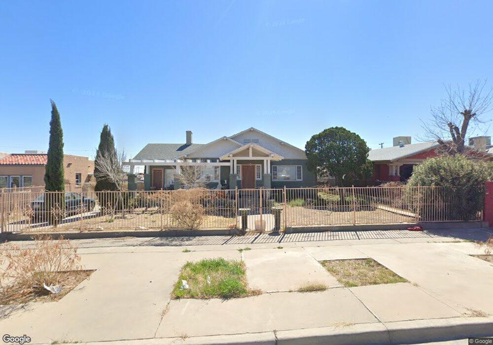
3914 Fort Blvd El Paso, TX 79930
Grandview NeighborhoodEstimated Value: $228,000 - $322,084
3
Beds
2
Baths
2,277
Sq Ft
$121/Sq Ft
Est. Value
About This Home
This home is located at 3914 Fort Blvd, El Paso, TX 79930 and is currently estimated at $274,771, approximately $120 per square foot. 3914 Fort Blvd is a home located in El Paso County with nearby schools including Rusk Elementary School, Middle School-5 NW Middle, and Austin High School.
Ownership History
Date
Name
Owned For
Owner Type
Purchase Details
Closed on
Dec 6, 2011
Sold by
Nehring Bruce W
Bought by
Deutsche Bank National Trust Company
Current Estimated Value
Purchase Details
Closed on
Apr 5, 2005
Sold by
Delgado Robert R and Lopez Mary Lily Delgado
Bought by
Nehring Bruce W
Home Financials for this Owner
Home Financials are based on the most recent Mortgage that was taken out on this home.
Original Mortgage
$72,750
Interest Rate
5.78%
Mortgage Type
Purchase Money Mortgage
Create a Home Valuation Report for This Property
The Home Valuation Report is an in-depth analysis detailing your home's value as well as a comparison with similar homes in the area
Home Values in the Area
Average Home Value in this Area
Purchase History
| Date | Buyer | Sale Price | Title Company |
|---|---|---|---|
| Deutsche Bank National Trust Company | $72,750 | None Available | |
| Nehring Bruce W | -- | -- |
Source: Public Records
Mortgage History
| Date | Status | Borrower | Loan Amount |
|---|---|---|---|
| Previous Owner | Nehring Bruce W | $72,750 | |
| Closed | Nehring Bruce W | $24,250 |
Source: Public Records
Tax History Compared to Growth
Tax History
| Year | Tax Paid | Tax Assessment Tax Assessment Total Assessment is a certain percentage of the fair market value that is determined by local assessors to be the total taxable value of land and additions on the property. | Land | Improvement |
|---|---|---|---|---|
| 2025 | $2,152 | $191,017 | -- | -- |
| 2024 | $2,152 | $173,652 | -- | -- |
| 2023 | $2,152 | $157,865 | $0 | $0 |
| 2022 | $4,248 | $143,514 | $0 | $0 |
| 2021 | $4,074 | $133,902 | $17,336 | $116,566 |
| 2020 | $3,645 | $118,606 | $15,829 | $102,777 |
| 2018 | $3,288 | $111,091 | $15,829 | $95,262 |
| 2017 | $2,939 | $104,358 | $15,829 | $88,529 |
| 2016 | $3,226 | $114,533 | $15,829 | $98,704 |
| 2015 | $2,423 | $114,533 | $15,829 | $98,704 |
| 2014 | $2,423 | $113,395 | $15,829 | $97,566 |
Source: Public Records
Map
Nearby Homes
- 3921 Nations Ave
- 3827 Idalia Ave
- 3806 Mountain Ave
- 3831 Mountain Ave
- 3901 Mckinley Ave
- 3606 Morehead Ave
- 3704 Mckinley Ave
- 3921 Mobile Ave
- 3510 Porter Ave
- 3905 Nashville Ave
- 3905 Monroe Ave
- 3427 Hamilton Ave
- 3524 Mobile Ave
- 2518 Partello St
- 3817 Frankfort Ave
- 3327 Mobile Ave
- 3413 Monroe Ave
- 3215 Mobile Ave
- 3906 Taylor Ave
- 3125 Hamilton Ave
- 3908 Fort Blvd
- 3918 Fort Blvd
- 3906 Fort Blvd
- 3922 Fort Blvd
- 3900 Fort Blvd
- 3915 Porter Ave
- 3909 Porter Ave
- 3919 Porter Ave
- 3905 Porter Ave
- 3923 Porter Ave
- 3901 Porter Ave
- 3927 Porter Ave
- 3909 Fort Blvd
- 3915 Fort Blvd
- 0 Dyer and Deer
- 0 Dyer and Pheasant Unit 395266
- 0 Dyer and Pheasant
- 0 Dyer and Railroad
- 0 Dyer St
- 0 Dyer St Unit 503189