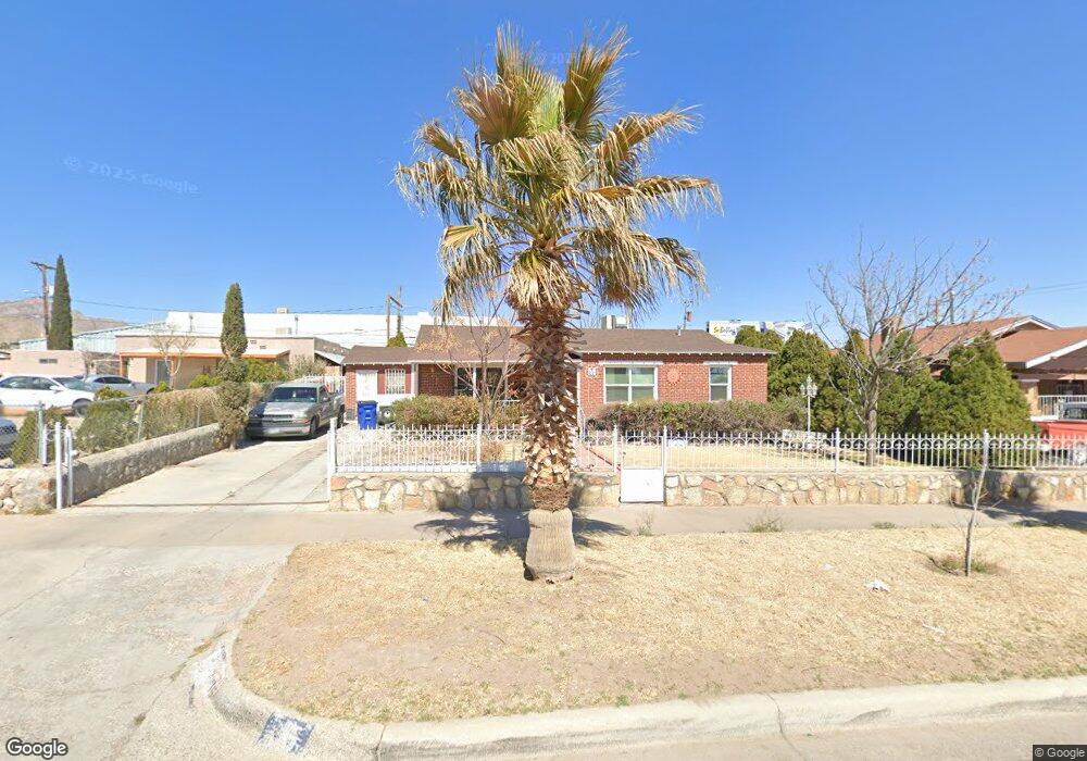
3915 Fort Blvd El Paso, TX 79930
Central NeighborhoodEstimated Value: $186,000 - $256,000
--
Bed
1
Bath
1,408
Sq Ft
$148/Sq Ft
Est. Value
About This Home
This home is located at 3915 Fort Blvd, El Paso, TX 79930 and is currently estimated at $208,980, approximately $148 per square foot. 3915 Fort Blvd is a home located in El Paso County with nearby schools including Rusk Elementary School, Middle School-5 NW Middle, and Austin High School.
Ownership History
Date
Name
Owned For
Owner Type
Purchase Details
Closed on
Apr 11, 2023
Sold by
Mancha Alejandro
Bought by
Mancha Alejandro and Mancha Gabriela
Current Estimated Value
Purchase Details
Closed on
Apr 13, 2022
Sold by
Alejandro Mancha
Bought by
Mancha Alejandro
Purchase Details
Closed on
Apr 15, 2002
Sold by
Mancha Alejandro
Bought by
Mancha Alejandro and Mancha Gabriela
Home Financials for this Owner
Home Financials are based on the most recent Mortgage that was taken out on this home.
Original Mortgage
$43,972
Interest Rate
7.09%
Mortgage Type
FHA
Create a Home Valuation Report for This Property
The Home Valuation Report is an in-depth analysis detailing your home's value as well as a comparison with similar homes in the area
Home Values in the Area
Average Home Value in this Area
Purchase History
| Date | Buyer | Sale Price | Title Company |
|---|---|---|---|
| Mancha Alejandro | -- | None Listed On Document | |
| Mancha Alejandro | -- | None Listed On Document | |
| Mancha Alejandro | -- | -- |
Source: Public Records
Mortgage History
| Date | Status | Borrower | Loan Amount |
|---|---|---|---|
| Previous Owner | Mancha Alejandro | $43,972 |
Source: Public Records
Tax History Compared to Growth
Tax History
| Year | Tax Paid | Tax Assessment Tax Assessment Total Assessment is a certain percentage of the fair market value that is determined by local assessors to be the total taxable value of land and additions on the property. | Land | Improvement |
|---|---|---|---|---|
| 2025 | $2,583 | $157,779 | -- | -- |
| 2024 | $2,583 | $143,435 | -- | -- |
| 2023 | $2,583 | $130,395 | $18,257 | $112,138 |
| 2022 | $3,108 | $104,999 | $0 | $0 |
| 2021 | $2,980 | $98,799 | $18,257 | $80,542 |
| 2020 | $2,667 | $86,776 | $16,670 | $70,106 |
| 2018 | $2,417 | $81,648 | $16,670 | $64,978 |
| 2017 | $2,227 | $79,048 | $16,670 | $62,378 |
| 2016 | $2,429 | $86,218 | $16,670 | $69,548 |
| 2015 | $2,242 | $86,218 | $16,670 | $69,548 |
| 2014 | $2,242 | $90,827 | $16,670 | $74,157 |
Source: Public Records
Map
Nearby Homes
- 3827 Idalia Ave
- 3921 Nations Ave
- 3806 Mountain Ave
- 3831 Mountain Ave
- 3921 Mobile Ave
- 3901 Mckinley Ave
- 3606 Morehead Ave
- 3704 Mckinley Ave
- 3905 Nashville Ave
- 3510 Porter Ave
- 3427 Hamilton Ave
- 2518 Partello St
- 3524 Mobile Ave
- 3905 Monroe Ave
- 3817 Frankfort Ave
- 3327 Mobile Ave
- 3413 Monroe Ave
- 4504 Nashville Ave
- 3215 Mobile Ave
- 3625 Richmond Ave
- 3925 Fort Blvd
- 3911 Fort Blvd
- 3909 Fort Blvd
- 3301 Dyer St
- 3907 Fort Blvd
- 0 Dyer and Deer
- 0 Dyer and Pheasant Unit 395266
- 0 Dyer and Pheasant
- 0 Dyer and Railroad
- 0 Dyer St
- 0 Dyer St Unit 503189
- 3901 Fort Blvd
- 3918 Fort Blvd
- 3922 Fort Blvd
- 3914 Fort Blvd
- 3908 Fort Blvd
- 3906 Fort Blvd
- 4001 Fort Blvd
- 3900 Fort Blvd
- 3831 Fort Blvd