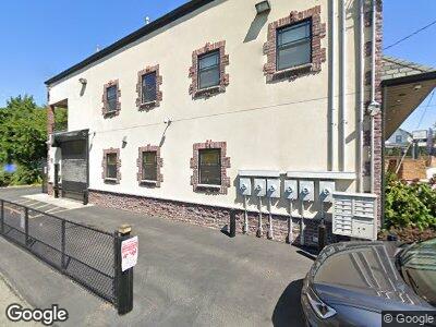
3917 Amboy Rd Unit Right Staten Island, NY 10308
Great Kills NeighborhoodEstimated Value: $1,138,395
--
Bed
--
Bath
6,438
Sq Ft
$177/Sq Ft
Est. Value
About This Home
This home is located at 3917 Amboy Rd Unit Right, Staten Island, NY 10308 and is currently estimated at $1,138,395, approximately $176 per square foot. 3917 Amboy Rd Unit Right is a home located in Richmond County with nearby schools including P.S. 8 Shirlee Solomon, Myra S. Barnes Intermediate School 24, and New Dorp High School.
Ownership History
Date
Name
Owned For
Owner Type
Purchase Details
Closed on
May 9, 2003
Sold by
Lenza Daniel
Bought by
Atreyu Realty Corp
Current Estimated Value
Home Financials for this Owner
Home Financials are based on the most recent Mortgage that was taken out on this home.
Original Mortgage
$374,000
Outstanding Balance
$174,055
Interest Rate
5.83%
Mortgage Type
Commercial
Estimated Equity
$936,960
Purchase Details
Closed on
Dec 5, 2001
Sold by
Battista Joseph and Molinari Ralph J
Bought by
Lenza Daniel
Home Financials for this Owner
Home Financials are based on the most recent Mortgage that was taken out on this home.
Original Mortgage
$195,000
Interest Rate
6.85%
Mortgage Type
Commercial
Create a Home Valuation Report for This Property
The Home Valuation Report is an in-depth analysis detailing your home's value as well as a comparison with similar homes in the area
Home Values in the Area
Average Home Value in this Area
Purchase History
| Date | Buyer | Sale Price | Title Company |
|---|---|---|---|
| Atreyu Realty Corp | $499,000 | First American Title Ins Co | |
| Lenza Daniel | $395,000 | Washington Title Insurance C |
Source: Public Records
Mortgage History
| Date | Status | Borrower | Loan Amount |
|---|---|---|---|
| Open | Atreyu Realty Corp | $374,000 | |
| Previous Owner | Lenza Daniel | $195,000 |
Source: Public Records
Tax History Compared to Growth
Tax History
| Year | Tax Paid | Tax Assessment Tax Assessment Total Assessment is a certain percentage of the fair market value that is determined by local assessors to be the total taxable value of land and additions on the property. | Land | Improvement |
|---|---|---|---|---|
| 2024 | $40,429 | $387,900 | $85,950 | $301,950 |
| 2023 | $41,325 | $388,170 | $85,950 | $302,220 |
| 2022 | $37,425 | $374,400 | $85,950 | $288,450 |
| 2021 | $28,854 | $322,650 | $85,950 | $236,700 |
| 2020 | $34,835 | $422,550 | $85,950 | $336,600 |
| 2019 | $31,349 | $420,300 | $85,950 | $334,350 |
| 2018 | $25,374 | $418,950 | $85,950 | $333,000 |
| 2017 | $21,530 | $369,900 | $85,950 | $283,950 |
| 2016 | $20,044 | $364,050 | $81,450 | $282,600 |
| 2015 | $15,927 | $353,700 | $81,450 | $272,250 |
| 2014 | $15,927 | $314,550 | $81,450 | $233,100 |
Source: Public Records
Map
Nearby Homes
- 27 Brower Ct
- 3871 Amboy Rd Unit 105
- 92 Giffords Ln
- 2 Oak Ct
- 68 Margaret St
- 81 Exeter St
- 0 Dent Rd
- 3747 Amboy Rd Unit 1A
- 3747 Amboy Rd Unit 6b
- 50 Pleasant St Unit 2
- 265 Dewey Ave
- 142 Great Kills Rd Unit A
- 171 Dewey Ave
- 34 Stern Ct
- 254 Katan Ave Unit B
- 14 Colon Ave
- 153 Shafter Ave
- 16 Fieldway Ave
- 0 Seely Ln
- 65 Highland Rd
- 3917 Amboy Rd Unit Right
- 3917 Amboy Rd Unit Mid
- 3917 Amboy Rd
- 3915 Amboy Rd Unit GROUND LEV
- 3921 Amboy Rd
- 3911 Amboy Rd Unit E
- 3911 Amboy Rd Unit A
- 3911 Amboy Rd Unit 2
- 3911 Amboy Rd Unit 3
- 3911 Amboy Rd Unit B
- 3911 Amboy Rd Unit D
- 3911 Amboy Rd Unit C
- 3925 Amboy Rd Unit 1
- 3925 Amboy Rd
- 3927 Amboy Rd
- 5,11,17, Osprey Ct
- 3929 Amboy Rd
- 3912 Amboy Rd Unit Rear
- 3912 Amboy Rd
- 3895 Amboy Rd