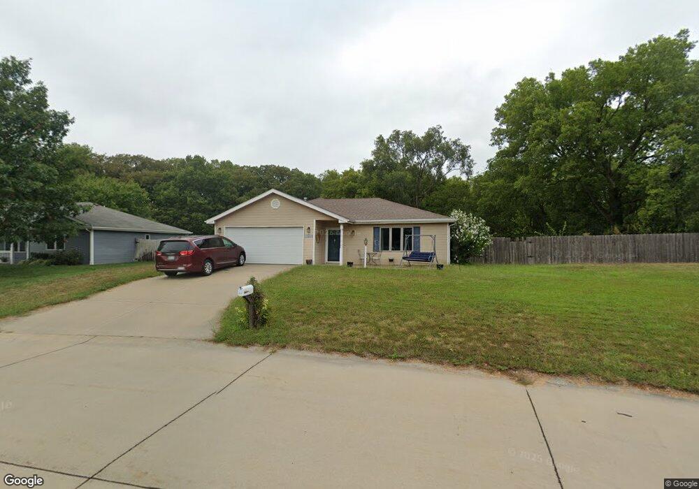
3917 Foxridge Dr Manhattan, KS 66502
Estimated Value: $278,037 - $354,000
3
Beds
2
Baths
1,617
Sq Ft
$190/Sq Ft
Est. Value
About This Home
This home is located at 3917 Foxridge Dr, Manhattan, KS 66502 and is currently estimated at $307,259, approximately $190 per square foot. 3917 Foxridge Dr is a home located in Pottawatomie County with nearby schools including Woodrow Wilson Elementary School, Dwight D. Eisenhower Middle School, and Manhattan High School.
Ownership History
Date
Name
Owned For
Owner Type
Purchase Details
Closed on
Jun 9, 2005
Sold by
Eilbert Ryan H and Eilert Brennan L
Bought by
Bainter David D and Bainter Melinda
Current Estimated Value
Home Financials for this Owner
Home Financials are based on the most recent Mortgage that was taken out on this home.
Original Mortgage
$115,000
Outstanding Balance
$60,114
Interest Rate
5.78%
Mortgage Type
New Conventional
Estimated Equity
$247,145
Create a Home Valuation Report for This Property
The Home Valuation Report is an in-depth analysis detailing your home's value as well as a comparison with similar homes in the area
Purchase History
| Date | Buyer | Sale Price | Title Company |
|---|---|---|---|
| Bainter David D | -- | None Available |
Source: Public Records
Mortgage History
| Date | Status | Borrower | Loan Amount |
|---|---|---|---|
| Open | Bainter David D | $115,000 |
Source: Public Records
Tax History
| Year | Tax Paid | Tax Assessment Tax Assessment Total Assessment is a certain percentage of the fair market value that is determined by local assessors to be the total taxable value of land and additions on the property. | Land | Improvement |
|---|---|---|---|---|
| 2025 | $2,339 | $25,573 | $3,870 | $21,703 |
| 2024 | $23 | $24,889 | $3,928 | $20,961 |
| 2023 | $2,439 | $24,452 | $3,867 | $20,585 |
| 2022 | $2,200 | $21,563 | $3,800 | $17,763 |
| 2021 | $2,200 | $20,863 | $3,662 | $17,201 |
| 2020 | $2,200 | $20,738 | $3,662 | $17,076 |
| 2019 | $2,261 | $21,119 | $3,524 | $17,595 |
| 2018 | $2,166 | $20,724 | $3,226 | $17,498 |
| 2017 | $2,098 | $20,528 | $2,957 | $17,571 |
| 2016 | $1,995 | $19,815 | $2,694 | $17,121 |
| 2015 | -- | $18,972 | $2,954 | $16,018 |
| 2014 | -- | $18,228 | $3,258 | $14,970 |
Source: Public Records
Map
Nearby Homes
- 6004 Tumbleweed Terrace
- 4014 Coachman Rd
- 9109 Emily Cir
- 8739 William Dr
- 8606 William Dr
- 8900 Butterfly Ln
- 8862 Elderberry Run
- 9245 Cara's Way
- 8886 Elderberry Run
- 8550 William Dr
- 4541 Periwinkle Dr
- 4660 Raven Creek Dr
- 8405 Chrissy Landing
- 4642 Pierce Dr
- 8754 S Kelliann Way
- 8781 S Kelliann Way
- 4852 Nature Ave
- 4860 Nature Ave
- 4884 Nature Ave
- 4881 Nature Ave
- 3911 Foxridge Dr
- 3911 Fox Ridge Dr
- 3923 Forrest Ln
- 3916 Foxridge Dr
- 3916 Fox Ridge Dr
- 3903 Foxridge Dr
- 3903 Fox Ridge Dr
- 3910 Foxridge Dr
- 3929 Forrest Ln
- 3986 Fox Ridge Dr
- 3986 Foxridge Dr
- 3904 Fox Ridge Dr
- 3895 Foxridge Dr
- 3904 Foxridge Dr
- 8712 Eagles Landing Dr
- 3935 Forrest Ln
- 3996 Foxridge Dr
- 8716 Eagles Landing Dr
- 8716 Eagle's Landing Dr
- 8708 Eagles Landing Dr
Your Personal Tour Guide
Ask me questions while you tour the home.