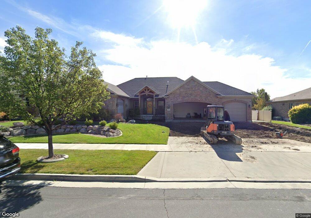
392 Azure Cir Draper, UT 84020
Estimated Value: $997,000 - $1,136,973
5
Beds
4
Baths
4,218
Sq Ft
$252/Sq Ft
Est. Value
About This Home
This home is located at 392 Azure Cir, Draper, UT 84020 and is currently estimated at $1,062,743, approximately $251 per square foot. 392 Azure Cir is a home located in Salt Lake County with nearby schools including Corner Canyon High School, Draper Park Middle School, and Channing Hall.
Ownership History
Date
Name
Owned For
Owner Type
Purchase Details
Closed on
Dec 19, 2018
Sold by
Day Michael H and Day Devi M
Bought by
Ono Aya and Allen Kenric
Current Estimated Value
Home Financials for this Owner
Home Financials are based on the most recent Mortgage that was taken out on this home.
Original Mortgage
$544,000
Outstanding Balance
$480,232
Interest Rate
4.9%
Mortgage Type
New Conventional
Estimated Equity
$582,511
Purchase Details
Closed on
Feb 20, 2013
Sold by
Day Michael H and Day Devi M
Bought by
Day Michaerl H and Day Devin M
Home Financials for this Owner
Home Financials are based on the most recent Mortgage that was taken out on this home.
Original Mortgage
$349,900
Interest Rate
2.61%
Mortgage Type
New Conventional
Purchase Details
Closed on
Dec 13, 2010
Sold by
Day Michael H
Bought by
Day Michael H and Day Devi M
Home Financials for this Owner
Home Financials are based on the most recent Mortgage that was taken out on this home.
Original Mortgage
$363,000
Interest Rate
4.21%
Mortgage Type
New Conventional
Create a Home Valuation Report for This Property
The Home Valuation Report is an in-depth analysis detailing your home's value as well as a comparison with similar homes in the area
Home Values in the Area
Average Home Value in this Area
Purchase History
| Date | Buyer | Sale Price | Title Company |
|---|---|---|---|
| Ono Aya | -- | Provo Land Title Co | |
| Day Michaerl H | -- | Pinnacle Title Co | |
| Day Michael H | -- | Accommodation | |
| Day Michael H | -- | Title West |
Source: Public Records
Mortgage History
| Date | Status | Borrower | Loan Amount |
|---|---|---|---|
| Open | Ono Aya | $544,000 | |
| Previous Owner | Day Michaerl H | $349,900 | |
| Previous Owner | Day Michael H | $363,000 |
Source: Public Records
Tax History Compared to Growth
Tax History
| Year | Tax Paid | Tax Assessment Tax Assessment Total Assessment is a certain percentage of the fair market value that is determined by local assessors to be the total taxable value of land and additions on the property. | Land | Improvement |
|---|---|---|---|---|
| 2025 | $4,956 | $984,100 | $283,300 | $700,800 |
| 2024 | $4,956 | $946,700 | $272,800 | $673,900 |
| 2023 | $4,882 | $925,700 | $254,500 | $671,200 |
| 2022 | $5,148 | $942,800 | $249,500 | $693,300 |
| 2021 | $4,461 | $698,000 | $235,100 | $462,900 |
| 2020 | $4,346 | $644,600 | $206,300 | $438,300 |
| 2019 | $4,033 | $584,500 | $206,300 | $378,200 |
| 2018 | $3,850 | $570,200 | $194,400 | $375,800 |
| 2017 | $3,866 | $548,600 | $185,000 | $363,600 |
| 2016 | $3,781 | $521,300 | $177,700 | $343,600 |
| 2015 | $3,557 | $454,200 | $181,200 | $273,000 |
| 2014 | $3,318 | $413,800 | $167,000 | $246,800 |
Source: Public Records
Map
Nearby Homes
- 13080 S Crystal Spring Dr
- 13181 S Woodridge Oak Dr
- 13128 S Day Meadow Dr
- 13448 Saddle Ridge Dr
- 194 Bridgepark Cir
- 587 Corner Canyon Dr
- 479 Fox Farm Place
- 480 E Foxstone Cove
- 296 E Ireland Ln Unit 101
- 847 E Willow Springs Ln
- 283 E Concord Farm Ln Unit 2
- 13554 Bella Monte Dr Unit 113
- 633 E Vandalay Ln
- 261 E Concord Farm Ln Unit 6
- 284 E Concord Farm Ln Unit 8
- 13528 S Venicia Way Unit 11
- 1263 E 13400 S
- 13720 S 300 E
- 12959 S Fort St
- 902 E 12650 S
- 392 E Azure Cir
- 404 E Azure Cir
- 404 Azure Cir
- 376 Azure Cir
- 393 Azure Cir
- 422 E Crystal Meadow Ln
- 422 Crystal Meadow Ln
- 387 Midlake Dr
- 387 E Midlake Dr
- 362 Azure Cir
- 362 E Azure Cir
- 401 Midlake Dr
- 401 E Midlake Dr
- 371 E Midlake Dr
- 371 Midlake Dr
- 373 Azure Cir
- 363 Azure Cir
- 13086 Crystal Meadow Ln
- 13086 S Crystal Meadow Ln
- 13097 Crystal Meadow Ln