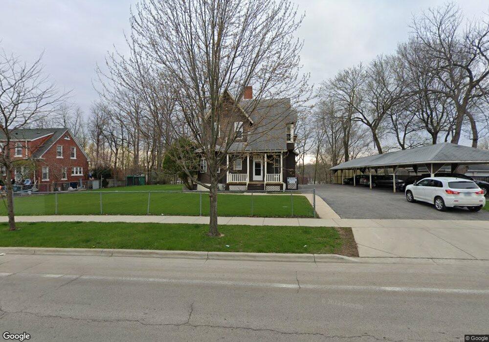
392 Raymond St Elgin, IL 60120
Elgin National Watch Historic District NeighborhoodEstimated Value: $382,000 - $481,630
9
Beds
6
Baths
--
Sq Ft
25,700
Sq Ft Lot
About This Home
This home is located at 392 Raymond St, Elgin, IL 60120 and is currently estimated at $424,408. 392 Raymond St is a home located in Kane County with nearby schools including Channing Memorial Elementary School, Kenyon Woods Middle School, and South Elgin High School.
Ownership History
Date
Name
Owned For
Owner Type
Purchase Details
Closed on
Jan 15, 2021
Sold by
Merwin Crow Loving Trust and Merwin Crow
Bought by
Trust Number 466 and First State Bank
Current Estimated Value
Home Financials for this Owner
Home Financials are based on the most recent Mortgage that was taken out on this home.
Original Mortgage
$350,000
Interest Rate
2.7%
Mortgage Type
New Conventional
Purchase Details
Closed on
Dec 6, 2014
Sold by
Crow Merwin R
Bought by
The Merwin R Crow Loving Trust
Purchase Details
Closed on
Jun 27, 2013
Sold by
Meado Michael
Bought by
Crow Merwin R
Create a Home Valuation Report for This Property
The Home Valuation Report is an in-depth analysis detailing your home's value as well as a comparison with similar homes in the area
Home Values in the Area
Average Home Value in this Area
Purchase History
| Date | Buyer | Sale Price | Title Company |
|---|---|---|---|
| Trust Number 466 | -- | Wheatland Title | |
| The Merwin R Crow Loving Trust | -- | None Available | |
| Crow Merwin R | $200,000 | First American Title |
Source: Public Records
Mortgage History
| Date | Status | Borrower | Loan Amount |
|---|---|---|---|
| Previous Owner | Trust Number 466 | $350,000 |
Source: Public Records
Tax History
| Year | Tax Paid | Tax Assessment Tax Assessment Total Assessment is a certain percentage of the fair market value that is determined by local assessors to be the total taxable value of land and additions on the property. | Land | Improvement |
|---|---|---|---|---|
| 2024 | $10,340 | $129,204 | $15,911 | $113,293 |
| 2023 | $9,950 | $116,726 | $14,374 | $102,352 |
| 2022 | $9,229 | $106,434 | $13,107 | $93,327 |
| 2021 | $8,878 | $99,508 | $12,254 | $87,254 |
| 2020 | $8,664 | $94,995 | $11,698 | $83,297 |
| 2019 | $8,451 | $90,489 | $11,143 | $79,346 |
| 2018 | $8,428 | $85,246 | $10,497 | $74,749 |
| 2017 | $8,725 | $84,829 | $10,445 | $74,384 |
| 2016 | $8,393 | $78,698 | $9,690 | $69,008 |
| 2015 | -- | $72,134 | $8,882 | $63,252 |
| 2014 | -- | $71,243 | $8,772 | $62,471 |
| 2013 | -- | $73,122 | $9,003 | $64,119 |
Source: Public Records
Map
Nearby Homes
- 262 Bartlett Place
- 518 Raymond St
- 408 Bowen Ct
- 286 Villa St
- 483 Barrett St
- 277 Gifford Place
- 133 Oak St
- 631 Bent St
- 462 Ashland Ave
- 7 National St Unit 7
- 3 National St Unit 3
- 162 Festival Ct
- 689 Bent St
- 211 Prairie St
- 58 S Geneva St
- 408 E Chicago St
- 331 Orange St
- 96 S Crystal St
- 131 N Gifford St
- 711 Bluff City Blvd
- 400 Raymond St
- 384 Raymond St
- 265 Bartlett Place
- 404 Raymond St
- 263 Bartlett Place
- 269 Bartlett Place
- 391 Wellington Ave
- 391 Wellington Ave Unit 1
- 393 Wellington Ave
- 393 Wellington Ave Unit 1
- 393 Wellington Ave Unit 2
- 387 Wellington Ave
- 378 Raymond St
- 259 Bartlett Place
- 408 Raymond St
- 393 Raymond St Unit 395
- 387 Raymond St Unit 389
- 255 Bartlett Place
- 412 Raymond St
- 383 Raymond St
Your Personal Tour Guide
Ask me questions while you tour the home.