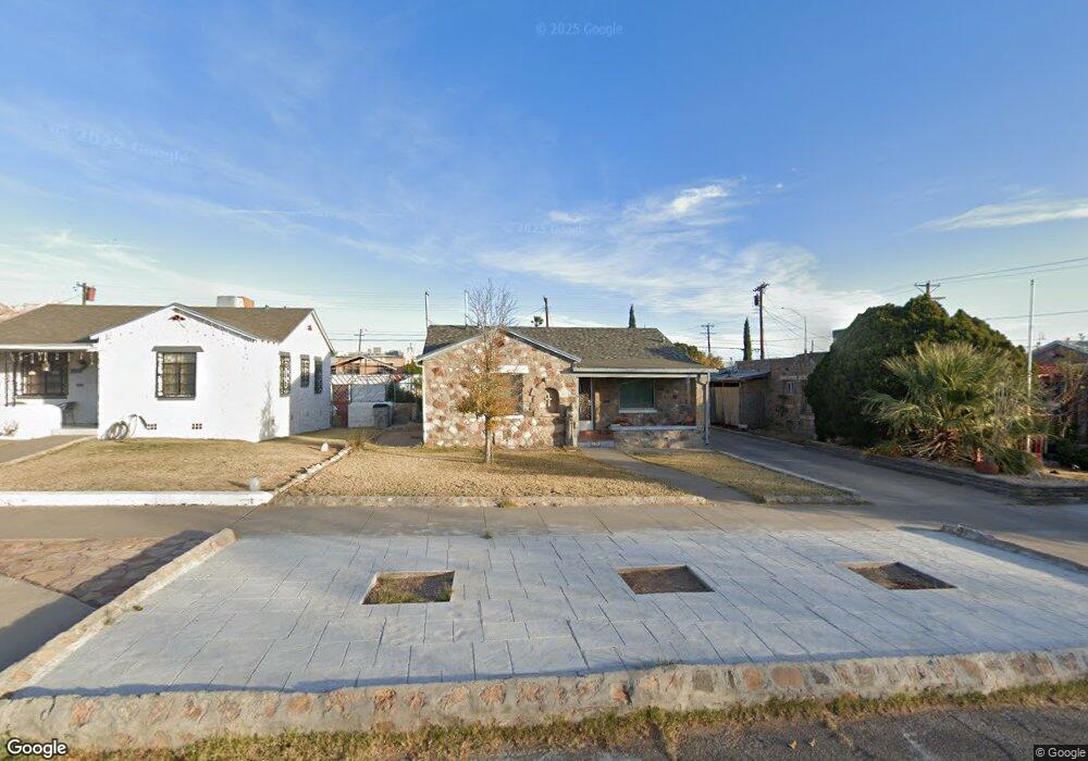
3923 Porter Ave El Paso, TX 79930
Grandview NeighborhoodEstimated Value: $156,000 - $214,000
--
Bed
1
Bath
1,000
Sq Ft
$176/Sq Ft
Est. Value
About This Home
This home is located at 3923 Porter Ave, El Paso, TX 79930 and is currently estimated at $175,507, approximately $175 per square foot. 3923 Porter Ave is a home located in El Paso County with nearby schools including Rusk Elementary School, Middle School-5 NW Middle, and Austin High School.
Ownership History
Date
Name
Owned For
Owner Type
Purchase Details
Closed on
Jan 30, 2006
Sold by
Romo Paul
Bought by
Jurado Leticia C
Current Estimated Value
Home Financials for this Owner
Home Financials are based on the most recent Mortgage that was taken out on this home.
Original Mortgage
$53,900
Outstanding Balance
$30,254
Interest Rate
6.15%
Mortgage Type
Fannie Mae Freddie Mac
Estimated Equity
$145,253
Purchase Details
Closed on
Sep 16, 2005
Sold by
Cook Betty P
Bought by
Romo Paul and Nebram Enterprizes
Home Financials for this Owner
Home Financials are based on the most recent Mortgage that was taken out on this home.
Original Mortgage
$35,000
Interest Rate
5.73%
Mortgage Type
Purchase Money Mortgage
Create a Home Valuation Report for This Property
The Home Valuation Report is an in-depth analysis detailing your home's value as well as a comparison with similar homes in the area
Home Values in the Area
Average Home Value in this Area
Purchase History
| Date | Buyer | Sale Price | Title Company |
|---|---|---|---|
| Jurado Leticia C | -- | None Available | |
| Romo Paul | -- | -- |
Source: Public Records
Mortgage History
| Date | Status | Borrower | Loan Amount |
|---|---|---|---|
| Open | Jurado Leticia C | $53,900 | |
| Previous Owner | Romo Paul | $35,000 |
Source: Public Records
Tax History Compared to Growth
Tax History
| Year | Tax Paid | Tax Assessment Tax Assessment Total Assessment is a certain percentage of the fair market value that is determined by local assessors to be the total taxable value of land and additions on the property. | Land | Improvement |
|---|---|---|---|---|
| 2025 | $1,298 | $129,029 | -- | -- |
| 2024 | $1,298 | $117,299 | -- | -- |
| 2023 | $1,222 | $106,635 | $0 | $0 |
| 2022 | $2,870 | $96,941 | $0 | $0 |
| 2021 | $2,752 | $97,142 | $15,180 | $81,962 |
| 2020 | $2,462 | $80,116 | $13,860 | $66,256 |
| 2018 | $2,211 | $74,713 | $13,860 | $60,853 |
| 2017 | $2,101 | $74,591 | $13,860 | $60,731 |
| 2016 | $2,298 | $81,572 | $13,860 | $67,712 |
| 2015 | $2,032 | $81,572 | $13,860 | $67,712 |
| 2014 | $2,032 | $83,154 | $13,860 | $69,294 |
Source: Public Records
Map
Nearby Homes
- 3827 Idalia Ave
- 3921 Mobile Ave
- 3921 Nations Ave
- 3905 Nashville Ave
- 3806 Mountain Ave
- 3831 Mountain Ave
- 3606 Morehead Ave
- 3901 Mckinley Ave
- 3510 Porter Ave
- 3704 Mckinley Ave
- 2518 Partello St
- 3817 Frankfort Ave
- 3427 Hamilton Ave
- 3524 Mobile Ave
- 3905 Monroe Ave
- 3327 Mobile Ave
- 4504 Nashville Ave
- 3625 Richmond Ave
- 3215 Mobile Ave
- 3125 Hamilton Ave
- 3927 Porter Ave
- 3919 Porter Ave
- 3931 Porter Ave
- 3915 Porter Ave
- 3922 Fort Blvd
- 3909 Porter Ave
- 3918 Fort Blvd
- 3914 Fort Blvd
- 3922 Porter Ave
- 3926 Porter Ave
- 3918 Porter Ave
- 3905 Porter Ave
- 3113 Dyer St
- 3914 Porter Ave
- 3908 Fort Blvd
- 3910 Porter Ave
- 3901 Porter Ave
- 3906 Fort Blvd
- 3906 Porter Ave
- 0 Dyer and Deer