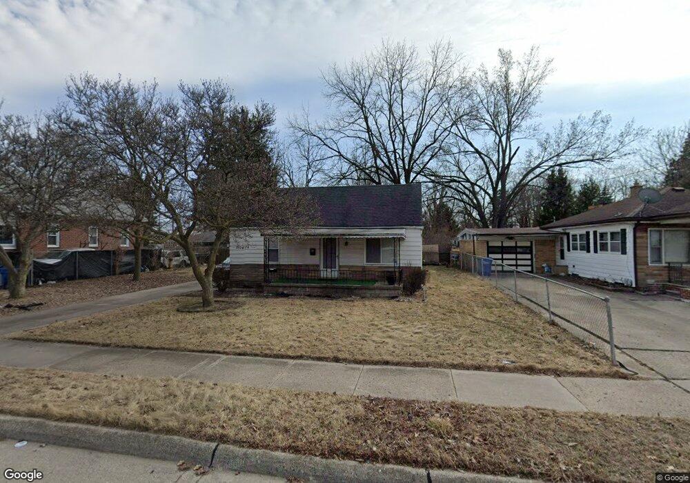
3924 Berkshire Ave Warren, MI 48091
Southwest Warren NeighborhoodEstimated Value: $125,623 - $187,000
--
Bed
2
Baths
1,027
Sq Ft
$145/Sq Ft
Est. Value
About This Home
This home is located at 3924 Berkshire Ave, Warren, MI 48091 and is currently estimated at $149,156, approximately $145 per square foot. 3924 Berkshire Ave is a home located in Macomb County with nearby schools including Schofield Elementary School, Mound Park Elementary School, and Westview Elementary School.
Ownership History
Date
Name
Owned For
Owner Type
Purchase Details
Closed on
Feb 3, 2023
Sold by
Mcnabb Laura
Bought by
Berkshire Group Home Llc
Current Estimated Value
Purchase Details
Closed on
Apr 28, 2017
Sold by
Berkshire Group Home Llc
Bought by
Schoen Michael
Home Financials for this Owner
Home Financials are based on the most recent Mortgage that was taken out on this home.
Original Mortgage
$66,000
Interest Rate
4.1%
Mortgage Type
New Conventional
Purchase Details
Closed on
Jul 5, 2007
Sold by
Schoen Michael
Bought by
Berkshire Group Home Llc
Create a Home Valuation Report for This Property
The Home Valuation Report is an in-depth analysis detailing your home's value as well as a comparison with similar homes in the area
Home Values in the Area
Average Home Value in this Area
Purchase History
| Date | Buyer | Sale Price | Title Company |
|---|---|---|---|
| Berkshire Group Home Llc | -- | -- | |
| Schoen Michael | -- | None Available | |
| Berkshire Group Home Llc | -- | None Available |
Source: Public Records
Mortgage History
| Date | Status | Borrower | Loan Amount |
|---|---|---|---|
| Previous Owner | Schoen Michael | $66,000 |
Source: Public Records
Tax History Compared to Growth
Tax History
| Year | Tax Paid | Tax Assessment Tax Assessment Total Assessment is a certain percentage of the fair market value that is determined by local assessors to be the total taxable value of land and additions on the property. | Land | Improvement |
|---|---|---|---|---|
| 2025 | $1,762 | $59,540 | $0 | $0 |
| 2024 | $1,726 | $51,090 | $0 | $0 |
| 2023 | $1,640 | $38,960 | $0 | $0 |
| 2022 | $1,552 | $32,490 | $0 | $0 |
| 2021 | $1,592 | $30,800 | $0 | $0 |
| 2020 | $1,530 | $27,730 | $0 | $0 |
| 2019 | $1,462 | $24,960 | $0 | $0 |
| 2018 | $31 | $20,930 | $0 | $0 |
| 2017 | $1,391 | $20,530 | $4,810 | $15,720 |
| 2016 | $1,365 | $20,530 | $0 | $0 |
| 2015 | -- | $19,210 | $0 | $0 |
| 2013 | $1,193 | $16,610 | $0 | $0 |
Source: Public Records
Map
Nearby Homes
- 3900 Berkshire Ave
- 3641 Berkshire Ave
- 21299 Sunset Ave
- 3925 Toepfer Rd
- 20731 Bartholomaei Ave
- 3167 Berkshire Ave
- 3850 Jarvis Ave
- 20499 Yonka St
- 20499 Binder St
- 20491 Klinger St
- 21870 Le Fever Ave
- 20246 Binder St
- 23420 Harned St Unit 1
- 20270 Dean Ave
- 23421 Harned St Unit 4
- 23429 Harned St Unit 5
- 23485 Harned St Unit 10
- 20201 Yonka St
- 20209 Revere St
- 22321 Logue Ave
- 3954 Berkshire Ave
- 3840 Berkshire Ave
- 3787 Wasmund Ave
- 3765 Wasmund Ave
- 3741 Wasmund Ave
- 3973 Berkshire Ave
- 3806 Berkshire Ave
- 3927 Berkshire Ave
- 3957 Berkshire Ave
- 3869 Berkshire Ave
- 3729 Wasmund Ave
- 3784 Berkshire Ave
- 3807 Berkshire Ave
- 3849 Berkshire Ave
- 21351 Ryan Rd
- 3693 Wasmund Ave
- 3760 Berkshire Ave
- 21381 Ryan Rd
- 3800 Wasmund Ave
- 3776 Wasmund Ave