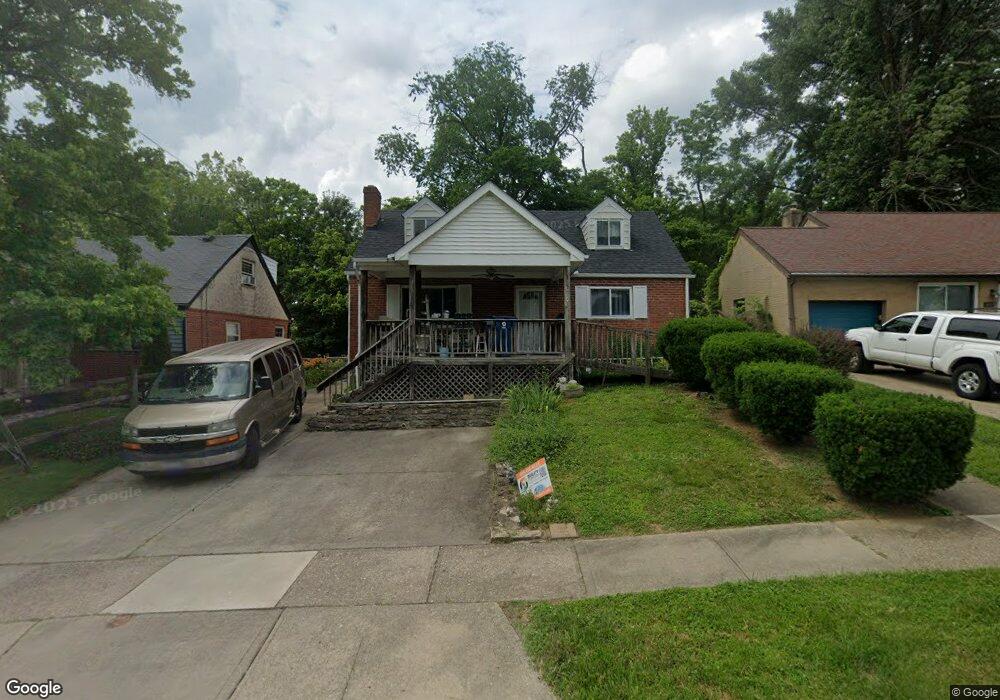
3926 Trebor Dr Cincinnati, OH 45236
Estimated Value: $274,624 - $345,000
4
Beds
1
Bath
1,450
Sq Ft
$212/Sq Ft
Est. Value
About This Home
This home is located at 3926 Trebor Dr, Cincinnati, OH 45236 and is currently estimated at $307,906, approximately $212 per square foot. 3926 Trebor Dr is a home located in Hamilton County with nearby schools including Amity Elementary School, Deer Park Jr/Sr High School, and Ohr Torah Cincinnati.
Ownership History
Date
Name
Owned For
Owner Type
Purchase Details
Closed on
Mar 2, 2002
Sold by
Richard Schottner John and Richard Ruth H
Bought by
Bell James Anthony and Bell Mary Ruth
Current Estimated Value
Purchase Details
Closed on
Dec 2, 1994
Sold by
Schottner John Richard and Schottner Ruth H
Bought by
Bell James A and Bell Mary Ruth
Create a Home Valuation Report for This Property
The Home Valuation Report is an in-depth analysis detailing your home's value as well as a comparison with similar homes in the area
Home Values in the Area
Average Home Value in this Area
Purchase History
| Date | Buyer | Sale Price | Title Company |
|---|---|---|---|
| Bell James Anthony | $70,000 | -- | |
| Bell James A | $70,000 | -- |
Source: Public Records
Tax History
| Year | Tax Paid | Tax Assessment Tax Assessment Total Assessment is a certain percentage of the fair market value that is determined by local assessors to be the total taxable value of land and additions on the property. | Land | Improvement |
|---|---|---|---|---|
| 2025 | $3,569 | $67,841 | $12,586 | $55,255 |
| 2023 | $3,207 | $67,841 | $12,586 | $55,255 |
| 2022 | $2,711 | $46,960 | $10,994 | $35,966 |
| 2021 | $2,643 | $46,960 | $10,994 | $35,966 |
| 2020 | $2,420 | $46,960 | $10,994 | $35,966 |
| 2019 | $2,397 | $41,192 | $9,643 | $31,549 |
| 2018 | $2,288 | $41,192 | $9,643 | $31,549 |
| 2017 | $2,158 | $41,192 | $9,643 | $31,549 |
| 2016 | $2,420 | $44,748 | $9,947 | $34,801 |
| 2015 | $2,252 | $44,748 | $9,947 | $34,801 |
| 2014 | $2,182 | $43,593 | $9,947 | $33,646 |
| 2013 | $2,201 | $43,498 | $10,150 | $33,348 |
Source: Public Records
Map
Nearby Homes
- 8608 Dundalk Ct
- 8494 Wexford Ave
- 4053 Belfast Ave
- 4041 Larchview Dr
- 4104 Estermarie Dr
- 4068 Glenbar Ct
- 8390 Wexford Ave
- 8622 Plainfield Ln
- 4152 Larchview Dr
- 8468 Plainfield Rd
- 3647 Guam Ct
- 4304 Kugler Mill Rd
- 4208 Linden Ave
- 8801 Tudor Ct
- 7905 Plainfield Rd
- 7837 Moss Ct
- 4453 Beryl Ave
- 8459 Vorhees Ln
- 4305 Myrtle Ave
- 4120 Hoffman Ave
- 3932 Trebor Dr
- 3920 Trebor Dr
- 3940 Trebor Dr
- 3912 Trebor Dr
- 3946 Trebor Dr
- 3931 Trebor Dr
- 3925 Trebor Dr
- 3939 Trebor Dr
- 3906 Trebor Dr
- 3945 Trebor Dr
- 3952 Trebor Dr
- 3900 Trebor Dr
- 3909 Trebor Dr
- 3917 Trebor Dr
- 8631 Dundalk Ct
- 3960 Trebor Dr
- 3901 Trebor Dr
- 8625 Dundalk Ct
- 8656 Antrim Ct
- 3966 Trebor Dr
Your Personal Tour Guide
Ask me questions while you tour the home.