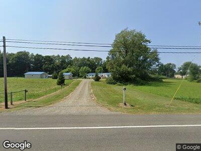
3927 Route 430 Rd Sherman, NY 14781
Sherman Township NeighborhoodEstimated Value: $199,249 - $232,000
5
Beds
2
Baths
2,052
Sq Ft
$102/Sq Ft
Est. Value
About This Home
This home is located at 3927 Route 430 Rd, Sherman, NY 14781 and is currently estimated at $210,062, approximately $102 per square foot. 3927 Route 430 Rd is a home with nearby schools including Sherman Elementary School, Sherman High School, and Clear View School.
Ownership History
Date
Name
Owned For
Owner Type
Purchase Details
Closed on
Jan 10, 2025
Sold by
Detweiler Melvin B
Bought by
Calhoun Jared A
Current Estimated Value
Home Financials for this Owner
Home Financials are based on the most recent Mortgage that was taken out on this home.
Original Mortgage
$190,000
Outstanding Balance
$189,678
Interest Rate
6.85%
Mortgage Type
New Conventional
Estimated Equity
$20,384
Create a Home Valuation Report for This Property
The Home Valuation Report is an in-depth analysis detailing your home's value as well as a comparison with similar homes in the area
Home Values in the Area
Average Home Value in this Area
Purchase History
| Date | Buyer | Sale Price | Title Company |
|---|---|---|---|
| Calhoun Jared A | $200,000 | None Listed On Document |
Source: Public Records
Mortgage History
| Date | Status | Borrower | Loan Amount |
|---|---|---|---|
| Open | Calhoun Jared A | $190,000 | |
| Closed | Calhoun Jared A | $190,000 | |
| Previous Owner | Cupp Larry L | $120,421 |
Source: Public Records
Tax History Compared to Growth
Tax History
| Year | Tax Paid | Tax Assessment Tax Assessment Total Assessment is a certain percentage of the fair market value that is determined by local assessors to be the total taxable value of land and additions on the property. | Land | Improvement |
|---|---|---|---|---|
| 2024 | $3,491 | $141,000 | $29,400 | $111,600 |
| 2023 | $3,491 | $141,000 | $29,400 | $111,600 |
| 2022 | $2,830 | $102,300 | $24,000 | $78,300 |
| 2021 | $2,619 | $90,000 | $24,000 | $66,000 |
| 2020 | $2,646 | $90,000 | $24,000 | $66,000 |
| 2019 | -- | $90,000 | $24,000 | $66,000 |
| 2018 | $2,216 | $90,000 | $24,000 | $66,000 |
| 2017 | $2,242 | $90,000 | $24,000 | $66,000 |
| 2016 | $3,323 | $90,000 | $24,000 | $66,000 |
| 2015 | -- | $90,000 | $20,800 | $69,200 |
| 2014 | -- | $90,000 | $20,800 | $69,200 |
Source: Public Records
Map
Nearby Homes
- 132 Miller St
- 148 E Main St
- 118 Miller St
- 154 Kipp St
- 0 New York 76
- 0 New York 430
- 4999 New York 76
- 14 Mandolin Ridge
- 57 Mandolin Ridge
- 56 Mandolin Ridge
- 45 Mandolin Ridge
- 44 Mandolin Ridge
- 43 Mandolin Ridge
- 42 Mandolin Ridge
- 41 Mandolin Ridge
- 39 Mandolin Ridge
- 38 Mandolin Ridge
- 35 Mandolin Ridge
- 34 Mandolin Ridge
- 33 Mandolin Ridge