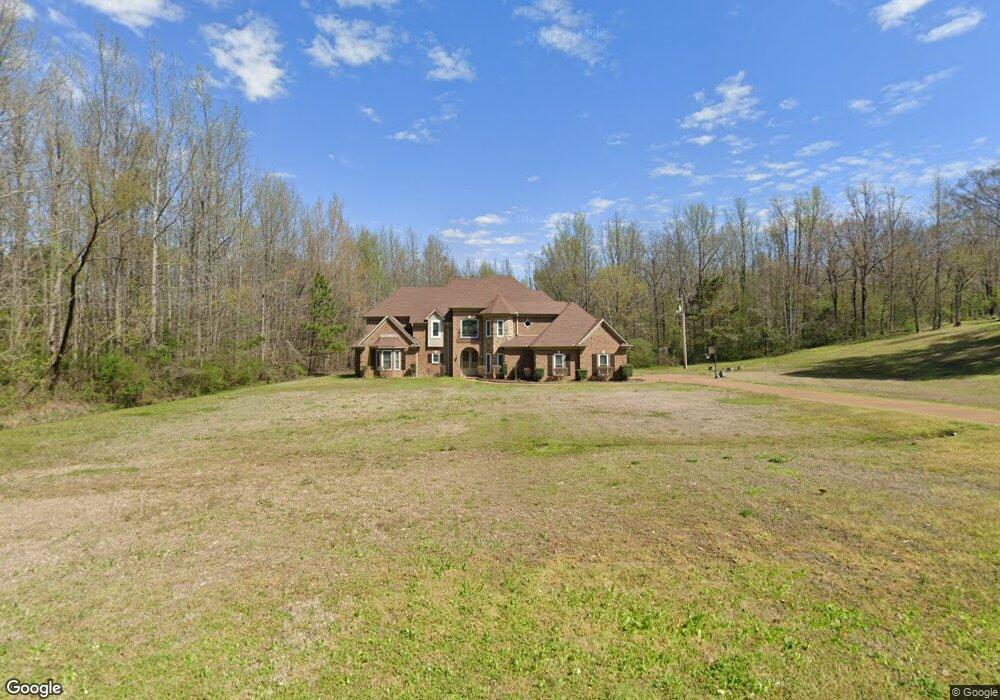
3928 Dean Rd Nesbit, MS 38651
Estimated Value: $423,885 - $544,000
3
Beds
--
Bath
3,360
Sq Ft
$139/Sq Ft
Est. Value
About This Home
This home is located at 3928 Dean Rd, Nesbit, MS 38651 and is currently estimated at $465,471, approximately $138 per square foot. 3928 Dean Rd is a home located in DeSoto County with nearby schools including Horn Lake Elementary School, Horn Lake Intermediate School, and Horn Lake Middle School.
Ownership History
Date
Name
Owned For
Owner Type
Purchase Details
Closed on
Mar 31, 2008
Sold by
Bullard Kenneth and Bullard Latonya
Bought by
Bullard Kenneth and Bullard Latonya
Current Estimated Value
Home Financials for this Owner
Home Financials are based on the most recent Mortgage that was taken out on this home.
Original Mortgage
$283,000
Interest Rate
5.68%
Mortgage Type
Stand Alone Refi Refinance Of Original Loan
Create a Home Valuation Report for This Property
The Home Valuation Report is an in-depth analysis detailing your home's value as well as a comparison with similar homes in the area
Home Values in the Area
Average Home Value in this Area
Purchase History
| Date | Buyer | Sale Price | Title Company |
|---|---|---|---|
| Bullard Kenneth | -- | None Available |
Source: Public Records
Mortgage History
| Date | Status | Borrower | Loan Amount |
|---|---|---|---|
| Closed | Bullard Kenneth | $283,000 |
Source: Public Records
Tax History
| Year | Tax Paid | Tax Assessment Tax Assessment Total Assessment is a certain percentage of the fair market value that is determined by local assessors to be the total taxable value of land and additions on the property. | Land | Improvement |
|---|---|---|---|---|
| 2025 | $2,189 | $29,814 | $3,300 | $26,514 |
| 2024 | $1,884 | $21,628 | $3,300 | $18,328 |
| 2023 | $1,884 | $21,628 | $0 | $0 |
| 2022 | $1,884 | $21,628 | $3,300 | $18,328 |
| 2021 | $1,884 | $21,628 | $3,300 | $18,328 |
| 2020 | $1,734 | $20,139 | $3,300 | $16,839 |
| 2019 | $1,734 | $20,139 | $3,300 | $16,839 |
| 2017 | $1,713 | $36,292 | $19,796 | $16,496 |
| 2016 | $1,713 | $19,796 | $3,300 | $16,496 |
| 2015 | $2,013 | $36,292 | $19,796 | $16,496 |
| 2014 | $1,693 | $19,796 | $0 | $0 |
| 2013 | $1,746 | $19,796 | $0 | $0 |
Source: Public Records
Map
Nearby Homes
- 00 Dean Rd
- 0000 Dean Rd
- 3399 Dean Cove N
- 31 Deerwood Crossing Dr
- 41 Deerwood Crossing Dr
- 34 Deerwood Crossing Dr
- 32 Deerwood Crossing Dr
- 42 Deerwood Crossing Dr
- 665 N Fogg Rd
- 33 Deerwood Crossing Dr
- 43 Deerwood Crossing Dr
- 36 Deerwood Dr
- 44 Deerwood Crossing Dr
- 38 Deerwood Dr
- 40 Deerwood Dr
- 37 Deerwood Dr
- 39 Deerwood Dr
- 6 Fogg Rd S
- 0 Fogg Rd S Unit 4098913
- 5404 Hazelwood Dr
Your Personal Tour Guide
Ask me questions while you tour the home.