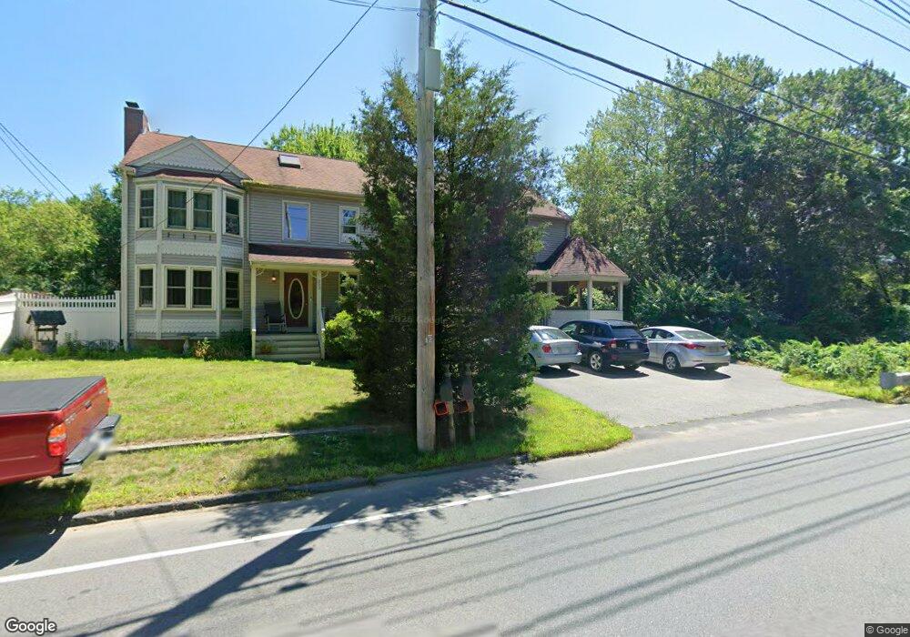
393 Richardson Ave Attleboro, MA 02703
Estimated Value: $642,000 - $898,000
4
Beds
4
Baths
2,985
Sq Ft
$265/Sq Ft
Est. Value
About This Home
This home is located at 393 Richardson Ave, Attleboro, MA 02703 and is currently estimated at $791,032, approximately $265 per square foot. 393 Richardson Ave is a home located in Bristol County with nearby schools including Thomas E. Willett School, Cyril K. Brennan Middle School, and Attleboro High School.
Ownership History
Date
Name
Owned For
Owner Type
Purchase Details
Closed on
May 27, 1997
Sold by
Cedar Ride Dev Inc
Bought by
Edgar Michael L and Edgar Karen L
Current Estimated Value
Create a Home Valuation Report for This Property
The Home Valuation Report is an in-depth analysis detailing your home's value as well as a comparison with similar homes in the area
Home Values in the Area
Average Home Value in this Area
Purchase History
| Date | Buyer | Sale Price | Title Company |
|---|---|---|---|
| Edgar Michael L | $171,900 | -- |
Source: Public Records
Mortgage History
| Date | Status | Borrower | Loan Amount |
|---|---|---|---|
| Open | Edgar Michael L | $47,000 | |
| Open | Edgar Michael L | $237,000 | |
| Closed | Edgar Michael L | $78,000 | |
| Closed | Edgar Michael L | $161,500 |
Source: Public Records
Tax History Compared to Growth
Tax History
| Year | Tax Paid | Tax Assessment Tax Assessment Total Assessment is a certain percentage of the fair market value that is determined by local assessors to be the total taxable value of land and additions on the property. | Land | Improvement |
|---|---|---|---|---|
| 2025 | $8,048 | $641,300 | $162,700 | $478,600 |
| 2024 | $7,826 | $614,800 | $162,700 | $452,100 |
| 2023 | $7,100 | $518,600 | $149,500 | $369,100 |
| 2022 | $6,781 | $469,300 | $143,300 | $326,000 |
| 2021 | $6,768 | $457,300 | $138,500 | $318,800 |
| 2020 | $6,497 | $446,200 | $134,900 | $311,300 |
| 2019 | $6,344 | $448,000 | $132,700 | $315,300 |
| 2018 | $6,118 | $412,800 | $129,300 | $283,500 |
| 2017 | $6,014 | $413,300 | $129,300 | $284,000 |
| 2016 | $5,932 | $400,300 | $128,000 | $272,300 |
| 2015 | $5,755 | $391,200 | $128,000 | $263,200 |
| 2014 | $5,673 | $382,000 | $121,900 | $260,100 |
Source: Public Records
Map
Nearby Homes
- 6 Cedar Creek Dr
- 4 Village Way Unit F
- 451R Gilbert St
- 17 Karen St
- 122 N Worcester St
- 933 Pleasant St
- 9 Larson Farm Dr
- 97 N Worcester St
- 6 Colts Way
- 37 Oakleaf Dr
- 180 Pike Ave
- 2 Top Flight Dr Unit B
- 378 Old Colony Rd
- 13 Crowe Farm Ln
- 2 Oak St Unit 2D
- 2 Oak St Unit 2A
- 2 Oak St Unit 2C
- 2 Oak St Unit 2B
- 21 Shady Ln
- 293 Pike Ave
- 452 Richardson Ave
- 460 Richardson Ave
- 385 Richardson Ave
- 18 Plain St
- 444 Richardson Ave
- 436 Richardson Ave
- 12 Plain St
- 24 Plain St
- 377 Richardson Ave
- 6 Plain St
- 428 Richardson Ave
- 17 Plain St
- 30 Plain St
- 11 Plain St
- 19 Frontier Dr
- 369 Richardson Ave
- 29 Frontier Dr
- 8 Frontier Dr
- 31 Frontier Dr
- 404 Richardson Ave