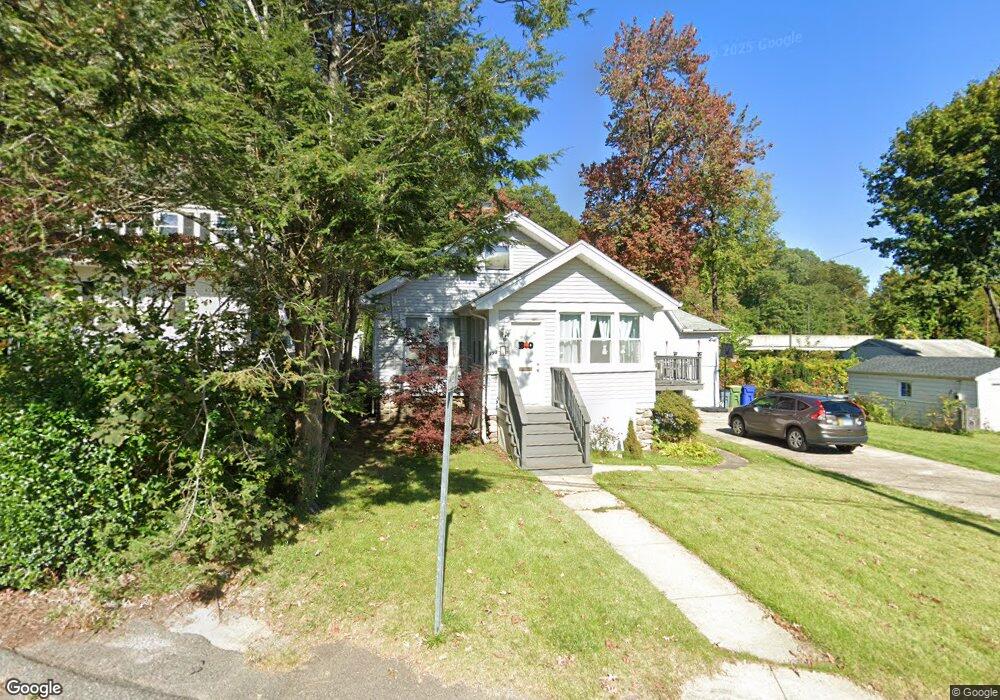
393 Robinwood Rd Waterbury, CT 06708
Bunker Hill NeighborhoodEstimated Value: $222,000 - $260,206
2
Beds
1
Bath
988
Sq Ft
$245/Sq Ft
Est. Value
About This Home
This home is located at 393 Robinwood Rd, Waterbury, CT 06708 and is currently estimated at $242,552, approximately $245 per square foot. 393 Robinwood Rd is a home located in New Haven County with nearby schools including Driggs School, West Side Middle School, and John F. Kennedy High School.
Ownership History
Date
Name
Owned For
Owner Type
Purchase Details
Closed on
May 25, 2001
Sold by
Frenchs Mill Assoc 1
Bought by
Mcduff Amy M
Current Estimated Value
Home Financials for this Owner
Home Financials are based on the most recent Mortgage that was taken out on this home.
Original Mortgage
$70,000
Interest Rate
7.05%
Mortgage Type
Purchase Money Mortgage
Purchase Details
Closed on
Jun 26, 1998
Sold by
Shugrue Raymond J
Bought by
Noll Wilbur T
Create a Home Valuation Report for This Property
The Home Valuation Report is an in-depth analysis detailing your home's value as well as a comparison with similar homes in the area
Home Values in the Area
Average Home Value in this Area
Purchase History
| Date | Buyer | Sale Price | Title Company |
|---|---|---|---|
| Mcduff Amy M | $72,000 | -- | |
| Noll Wilbur T | $63,000 | -- |
Source: Public Records
Mortgage History
| Date | Status | Borrower | Loan Amount |
|---|---|---|---|
| Open | Noll Wilbur T | $50,000 | |
| Closed | Noll Wilbur T | $30,000 | |
| Closed | Noll Wilbur T | $18,546 | |
| Closed | Noll Wilbur T | $70,000 |
Source: Public Records
Tax History Compared to Growth
Tax History
| Year | Tax Paid | Tax Assessment Tax Assessment Total Assessment is a certain percentage of the fair market value that is determined by local assessors to be the total taxable value of land and additions on the property. | Land | Improvement |
|---|---|---|---|---|
| 2025 | $4,298 | $95,550 | $24,080 | $71,470 |
| 2024 | $4,724 | $95,550 | $24,080 | $71,470 |
| 2023 | $5,178 | $95,550 | $24,080 | $71,470 |
| 2022 | $3,484 | $57,870 | $24,090 | $33,780 |
| 2021 | $3,484 | $57,870 | $24,090 | $33,780 |
| 2020 | $3,419 | $56,780 | $24,090 | $32,690 |
| 2019 | $3,419 | $56,780 | $24,090 | $32,690 |
| 2018 | $3,419 | $56,780 | $24,090 | $32,690 |
| 2017 | $3,542 | $58,820 | $24,090 | $34,730 |
| 2016 | $3,542 | $58,820 | $24,090 | $34,730 |
| 2015 | $3,425 | $58,820 | $24,090 | $34,730 |
| 2014 | $3,425 | $58,820 | $24,090 | $34,730 |
Source: Public Records
Map
Nearby Homes
- 284 Robbins St
- 0004 Westwood Ave
- 332 Robbins St
- 23 Shirley St Unit 5
- 310 Parklawn Dr
- 38 Shirley St Unit 5
- 108 Highland Ave
- 37 Robinwood Rd
- 112 Delaware Ave
- 91 Parklawn Dr
- 151 Highland Ave
- 61 Revere St
- 91 Devonwood Dr
- 44 Bunker Hill Ave
- 96 Fairview St
- 00 Gaylord Glen
- 28 Gaylord Glen
- 28 Gilbert St
- 37 Johnson St
- 50 Chestnut Ave
- 387 Robinwood Rd
- 407 Robinwood Rd
- 413 Robinwood Rd
- 369 Robinwood Rd
- 357 Robinwood Rd
- 167 Robbins St
- 352 Robinwood Rd
- 53 Myrtle Ave
- 161 Robbins St
- 193 Robbins St
- 347 Robinwood Rd
- 334 Robinwood Rd
- 83 Midwood Ave
- 49 Myrtle Ave
- 155 Robbins St Unit 10
- 155 Robbins St Unit 6
- 155 Robbins St Unit 12
- 155 Robbins St Unit 11
- 155 Robbins St Unit 2
- 155 Robbins St